Glacier National Park posted this on their social media today:
Watch out! We're getting some work done in Two Medicine this summer, so access to the North Shore Trail is a little different. There is a re-route that crosses the creek to access both the North Shore Trail and the trail toward Old Man Lake and Pitamakin Pass. If you want to stay dry, stick to the South Shore Trail and destinations accessible from there. Stay safe and please respect the construction closure.
This construction project includes replacement of the full water distribution system in the Two Medicine developed area and campground. To facilitate construction, Two Medicine Road will be closed at the Running Eagle Falls Trailhead beginning September 8, 2026.
Last fall, Two Medicine Road was closed as part of a large, multi-year project which includes full rehabilitation of the Two Medicine Road from the MT-49 intersection all the way to the Two Medicine parking lot. The work includes ditch re-establishment, road repair, parking lot construction, replacement of entrance station buildings, and paving. This road work is scheduled to resume this fall and be completed in late 2027, but may continue into 2028.
Glacier National Park preserves more than a million acres of some of the most spectacular scenery on Earth. With more than 740 miles of trails meandering throughout this vast park, how will you find and choose the most scenic and rewarding hikes?
Exploring Glacier National Park takes all the guesswork out by focusing on the most amazing hikes, and provides you with handpicked recommendations that will allow you to make the most of your trip to Glacier:
It's not clear how long they will offer this discount, but it's usually only for a limited time.
This is a great opportunity to learn about the rich history of the world's greatest outdoor activity! You can also impress your friends with your knowledge of hiking the next time you're on the trail with them!
Back on May 3rd, Anthony Pollio, a 33-year-old Florida man, died while hiking the Mount Brown Lookout trail in Glacier National Park. An Interagency Grizzly Bear Committee Board of Review has recently released their report, in which they concluded:
Mr. Pollio, while hiking alone, surprised an adult male grizzly bear on the Mt. Brown Lookout trail. He was most likely descending the trail in darkness. Darkness and deadfall on the trail would have prevented the bear and Mr. Pollio from seeing each other until they were very close. During the initial assault, Mr. Pollio managed to discharge his bear spray, but it is unknown if and where the spray contacted the bear. Mr. Pollio tumbled down slope, probably while the bear continued its attack, for 93 ft. We surmise that the bear broke off the attack at that time allowing Mr. Pollio to climb upslope approximately 18 ft at which point the bear re-engaged and killed Mr. Pollio with crushing bites to the head. The attack was likely brief and intense and not prolonged. There was no consumption or caching of the victim by the bear. There was no evidence that Mr. Pollio was fighting back. After the attack, the bear left the area. Mr. Pollio appears to have been the victim of a defensive attack by a surprised grizzly bear.
A Billings, Montana man was impaled by a trekking pole on Granite Peak last week. The freak accident occurred roughly 2 miles below the summit. After assesing his injuries, David Cifaldi, a nurse, determined that he could walk back to the trailhead on his own power. That trip covered nearly 10 miles and took roughly six and a half hours to complete.
KCENNews in Texas provided a full report on the story. Warning: some of the images may be a little disturbing:
Grand Teton National Park posted this on their social media today:
Volunteer Stewardship Day at Delta Lake: July 25, 2026
Access Fund and Teton Climbers' Coalition are hosting a volunteer stewardship day at Delta Lake in Grand Teton National Park, and they're looking for helping hands! Grand Teton National Park Foundation is proud to be supporting the trail stabilization near Delta Lake, and we're excited to see this work come to life with the help of volunteers like you.
Join in for a day of trail work and conservation in the shadow of the Tetons. Whether you're a climber, hiker, or just love this park, it's a great way to give back to the landscape we all share.
📅 Date: Saturday, July 25, 2026
📍 Meet: 8:00 AM at the Park's Trail Shop, 200 Pine Marten Dr, Moose, WY 83012 (shuttle to Lupine Meadows Trailhead from there)
🕒 Wrap-up: ~3:00 PM
No park pass? No problem—volunteers receive free park admission for the day. Email stewardship@accessfund.org to coordinate details.
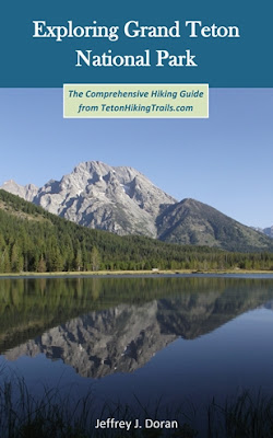
Rising more than 7000 feet above Jackson Hole, the majestic mountains of Grand Teton National Park provide one of the most dramatic landscapes in the world. With more than 240 miles of trails meandering throughout this park, how will you find and choose the most scenic and rewarding hikes?
Exploring Grand Teton National Park takes all the guesswork out by focusing on the most amazing hikes, and provides you with handpicked recommendations that will allow you to make the most of your trip to Grand Teton:
In 1894, the Mazamas held their inaugural meeting atop Mt. Hood, the highest peak in Oregon. To become a charter member of the prospective club, hikers were required to attend this meeting.
On June 12, 1894, organizers published an advertisement in the Morning Oregonian announcing the forthcoming meeting, which was to include a “typical mountain banquet.” On July 17th, more than 300 people responded to the advertisement by arriving at one of two staging areas along the flanks of the 11,249-foot mountain. Two days later, a total of 193 climbers (155 men and 38 women) reached the snow-capped summit, of which 105 would become charter members. Before descending the peak, the newly minted organization released three homing pigeons with notes announcing to friends in Portland that the club had been successfully established.
Today, the Mazamas are one of the largest hiking and mountaineering clubs in America.
Here’s a photo of prospective members climbing the Cooper Spur on Mt. Hood to take part in the inaugural meeting atop the mountain:
Virtually no one went hiking before the 19th century. What occurred that inspired ordinary people to take a walk through the woods for pleasure?Ramble On: A History of Hiking explores the rich history of hiking, and how it evolved into one of the most popular pastimes in the world.
Glacier National Park will begin work in late July to plug the historic Butte Oil Well at Kintla Lake. The well, which predates the establishment of the park, was selected for plugging after monitoring detected leaking gases. Work is expected to continue for several weeks and be completed in fall 2026.
The project will temporarily affect trail and camping access in the Kintla Lake area. The Kintla Lake Wilderness Campground is expected to be closed during helicopter operations and active construction, beginning July 27 and continuing through late August. Visitors should check Recreation.gov for current availability before planning overnight trips in the area.
The Kintla-Boulder Pass Trail along Kintla Lake will close intermittently during four days of helicopter operations. Initial flights are scheduled for July 27 and 28 between approximately 8 a.m. and 6 p.m. Two additional days of helicopter operations will occur near the end of the project to remove equipment and materials that cannot be transported by boat. Those dates will be announced when available.
The frontcountry campground at Kintla Lake will be open for first-come, first-served camping during construction.
Visitors should also expect increased construction traffic along the Inside North Fork Road between Polebridge and Kintla Lake. Construction equipment and activities may temporarily affect views and natural sounds around the lake.
The project is being completed through the National Park Service’s Abandoned Mineral Lands program, which addresses historic mining sites and oil and gas well established before lands became part of the National Park System.
For information about the project and history of the Butte Oil Well, visit the park’s story map.
Glacier National Park preserves more than a million acres of some of the most spectacular scenery on Earth. With more than 740 miles of trails meandering throughout this vast park, how will you find and choose the most scenic and rewarding hikes?
Exploring Glacier National Park takes all the guesswork out by focusing on the most amazing hikes, and provides you with handpicked recommendations that will allow you to make the most of your trip to Glacier:
Grand Teton National Park will temporarily close a section of Moose-Wilson Road on Tuesday, July 21, and Wednesday, July 22, from 7 a.m. to 7 p.m. to allow crews to safely complete a critical phase of ongoing road construction.
The closure will be in effect between Murie Ranch Road and the Laurance S. Rockefeller Preserve (LSRP) entrance to both vehicles and cyclists. The road will reopen to traffic each evening from 7 p.m. to 7 a.m.
Since Moose-Wilson Road reopened to through traffic on June 19, visitors have experienced extended delays through the construction zone and near the LSRP entrance. Flagging operations, combined with high visitation and limited parking at the LSRP, have resulted in significant congestion for visitors traveling through the corridor.
The temporary closure will provide construction crews with a dedicated work window to install road base material safely and efficiently without vehicle traffic. Completing this work now will allow the contractor to advance construction north of the LSRP entrance more quickly and resume pilot-car operations that better accommodate access to the LSRP and along the Moose-Wilson Road.
During the closure:
* The closure will extend from Murie Ranch Road to the LSRP entrance.
* LSRP will be open and accessible from the south only during closure hours.
* Murie Ranch and destinations north of the closure will not be accessible from the Granite Canyon Entrance Station or Teton Village/Wilson via Moose-Wilson Road during closure hours.
* Visitors traveling between Moose and Wilson should use U.S. Highway 26/89/191 and Wyoming Highway 22 as an alternate route.
* The road will reopen nightly from 7 p.m. until 7 a.m.
Construction on Moose-Wilson Road remains on schedule. Following the two-day closure, the park expects to resume traffic control with flaggers while continuing improvements to the roadway. Visitors should continue to expect delays of up to 45 minutes or longer through Labor Day and should follow directions from construction personnel.
For current construction updates, maps, and trip-planning information, visit the park's road construction webpage.
Rising more than 7000 feet above Jackson Hole, the majestic mountains of Grand Teton National Park provide one of the most dramatic landscapes in the world. With more than 240 miles of trails meandering throughout this park, how will you find and choose the most scenic and rewarding hikes?
Exploring Grand Teton National Park takes all the guesswork out by focusing on the most amazing hikes, and provides you with handpicked recommendations that will allow you to make the most of your trip to Grand Teton:
As we’ve already seen in this four-part series, Cincinnati has had its share of famous concerts. Unfortunately, it’s also hosted several infamous concerts. As the 1970s progressed, rock fans seemingly became rowdier, more aggressive, and possibly even more inebriated, while concert venue management practices became sloppy and lax. As we shall see, there were two major incidents during this period that would shock the world.
The Ohio River Music Festival (August 3, 1975)
Held at the University of Cincinnati’s football stadium, the Ohio River Music Festival drew an estimated crowd of 35,000 to 50,000 fans, while another 18,000 reportedly lingered outside, many who conspired to breach the perimeter. Just months after releasing their breakthrough album, Toys in the Attic, Aerosmith was announced as the headliner for the festival. Though their fans loved them, Cincinnati Enquirer music critic, Cliff Radel, described them afterwards as “an inordinately mediocre band.” Ouch! A young promising act known as Styx opened the festival at 10 a.m. that morning. Among the other bands to hit the stage that day were Blue Oyster Cult, Foghat, The Outlaws, and Black Oak Arkansas. At that time, this one-day festival was the largest rock concert in Cincinnati history. To help with security, concert promoters hired twenty black belt karate experts from Chicago. While city and university police patrolled the perimeter of the venue to keep gatecrashers out, the black belts were used to keep paying concertgoers away from the stage. The University of Cincinnati’s student paper, The News Record, relayed an incident that resulted from this decision:
One six-foot “gorilla” dressed in a black karate gee corralled a concertgoer trying to climb over the fence, pulled him down by his hair, and then gave him several drop kicks in the face for good measure — just so he wouldn’t get the idea again. Watching the episode from the stage, the lead singer of Nitty Gritty Dirt Band approached the black belt during a break and said, “You know pal, you’re one bona fide ass-hole.”
Throughout the day, there were several incidents where gatecrashers attempted to storm the inner and outer perimeters. In 1979, Illinois State University ran an article about one of the hired martial artists for the festival. He’s quoted in the extended piece, stating:
The kids stormed the building, scaled the walls. We couldn't stop them, so we had to go inside and evict the ones who'd gotten in… During the day, the crowd took complete control of the stadium—all the entrances and exits. We pulled all our guys out of there and barely managed to secure the front stage and backstage areas… It was like Custer's Last Stand.
The next day, the Cincinnati Enquirer reported that dozens of fans were treated at local emergency rooms, while many others required first aid for cuts from broken glass bottles hurled by unruly fans. There were at least 12 arrests, many of them for disorderly conduct, while several police officers were reportedly assaulted. At least one fan died of a drug overdose. Afterwards, The News Recorddeclared the festival to be “a genuine drug and violence bonanza.” Though it was billed as the “1st” Ohio River Music Festival, a second festival never materialized.
Led Zeppelin (April 19/20, 1977)
Led Zeppelin played two nights in Cincinnati during what ended up being their final tour of North America. Both concerts sold out, and attracted more than 36,000 fans over the course of two evenings. Unfortunately, the concerts spawned mayhem, and are considered to be one of the worst incidents in Zeppelin’s history. Trouble started well before the band even hit the stage. When tickets for the two Cincinnati Riverfront Coliseum shows went on sale at the Ticketron in Shillito’s in Lexington, KY, a near riot broke out in the old department store when fans rushed the counter. This was a mere warm-up for Zeppelin’s first show, when nearly a thousand fans attempted to crash the gates. As you might expect, a riot ensued, with fans smashing the glass entrance doors and windows that surrounded the perimeter of the arena. Afterwards, the Lexington newspaper described the scene as “a pitched battle between Cincinnati police and rock and bottle throwing non-ticket holders.” Obviously, there were multiple injuries reported, including a fan from Dayton who plunged 20 feet onto a concrete ramp while attempting to scale a wall. The Detroit Free Press also reported: “In Cincinnati last week, a fan was pushed from the third level of the outdoor Riverfront Stadium into traffic below and was killed.” However, I couldn’t confirm this incident in any of the Cincinnati press clippings I found. There were also several reports of a police motorcycle being thrown off the elevated concourse onto the street below. At least 70, possibly as many as 100 fans, depending on the reporting, were arrested during the melee.
Even more frightening for concertgoers was the crush of humanity as the crowd surged towards the limited number of open doors. At that time, concerts at Riverfront Coliseum were festival seating, meaning that seats were on a first-come first-serve basis. If you wanted a great seat to watch your favorite band, you had to arrive early and wait in line. After the doors opened, you were then competing with fans rushing through the other entrances. So, basically, it was every fan for themselves once inside the arena. The events that unfolded that night should’ve been a major warning shot to Riverfront Coliseum, concert promoters, and city officials; however, it was ignored or tolerated by all, the consequences of which would result in one of the most tragic incidents in rock history two years later.
The Beverly Hills Supper Club fire (May 28, 1977)
Just across the Ohio River, in Southgate, Kentucky, was the renowned Beverly Hills Supper Club, a popular gambling, entertainment, and dinner theatre venue. The historic nightclub opened in 1937, and had attracted a myriad of superstars over the years, including Milton Berle, Pearl Bailey, Louis Armstrong, Mel Torme, Jimmy Durante, Marilyn Monroe, Tony Bennett, Steve Lawrence, Liberace, Jerry Lee Lewis, Al Green, Frankie Valli, Jerry Lewis, Dean Martin and Frank Sinatra. Well before he became a headliner at “The Showplace of the Nation,” Steubenville, Ohio native Dean Martin worked at the club as a blackjack dealer.
On Memorial Day weekend in 1977, singer and actor John Davidson was scheduled to perform to a packed house. With other events and dinner parties taking place, it’s estimated that up to 3000 people were in the club that night – double the fire code limit based on the number of exits in the building. The Cabaret Room, where Davidson was to perform, was considered safe for roughly 600 patrons; however, estimates of 900 to 1300 people were reported to be in attendance that evening, with many seated in the aisles. Shortly before 9:00 PM that night, smoke was detected in the Zebra Room. Almost immediately, an 18-year-old busboy named Walter Bailey walked onto the stage while a comedy duo was performing (Davidson’s warm-up act), and calmly told the crowd that a fire was detected on the opposite side of the building. Roughly a third of the audience instantly got up and left the building. However, another third thought he was part of the comedy act, and remained seated. Unfortunately, the fire spread rapidly, and many of those patrons became trapped in the sprawling complex. By midnight, the roof of the building had collapsed. The inferno ended up claiming the lives of 165 people, including John Davidson's music director. More than 200 people were also injured. At that time, it was the third deadliest nightclub fire in world history. It now ranks seventh. It’s also recognized as Kentucky’s worst disaster since the Civil War.
Faulty aluminum wiring was cited as the cause of the fire. However, more recent evidence and testimony suggests that the mob may have purposely burned the club down, and then Kentucky officials purportedly engaged in a cover-up. Almost a decade later, the families of the victims received a $49 million settlement in the first class-action, mass tort lawsuit in U.S. history. The fire and the lawsuit resulted in a nationwide movement to improve fire codes and enforcement. You can read how the layout of the convoluted complex acted as a force multiplier that night.
To his credit, John Davidson helped patrons get out of the building. Afterwards, he apparently suffered greatly from PTSD, and for years was purportedly afraid to perform in closed venues. Forty years later, he gave a rare interview about that night. Here’s a short documentary about the fire from the Cincinnati Enquirer:
The Who (December 3, 1979)
December 3, 1979 is a day that will live in infamy for many Cincinnatians, at least for those in “my generation.” Widely known in the region as “THE Who concert,” the iconic British rock band played to a sold-out crowd of 18,348 that night. Because of festival seating, a standard practice for many arenas at that time, fans began arriving at Riverfront Coliseum more than seven hours before the doors were opened. As show time approached, fans began pressing forward to get closer to the doors. There are multiple reports of forward surges in the crowd, what some described as waves where people were crushed, and some even being knocked to the ground. The situation was exacerbated when a limited number of doors were opened – for whatever reason. Around that same time, the Coliseum speakers began blasting the film trailer for Quadrophenia (there are also reports that this may have been a final soundcheck). Regardless, fans outside of the arena thought the concert had begun, thus resulting in what has been described as a stampede.
Fifteen-year-old concertgoer, Suzanne Sudrack, told the AP that night: “You could see people getting hurt. People were flailing elbows and smashing noses. You could see people going down.”
Seventeen-year-old Michael Jordan stated: “I was in the middle. It was crazy. You had to fight to save your life.”
Fred Wittenbaum, a then 14-year-old student from Finneytown High School, later told Fox19: “A lot of people got pushed, and then they got pushed through some of the doors - through the glass, which alleviated the pressure. It was terrible.”
The crush of fans killed 11 concertgoers that evening. Though they were trampled by fellow fans, they actually died of asphyxiation. Three of those eleven concertgoers attended Finneytown High School, the youngest of which was 15. There were numerous other injuries as well.
On schedule that evening, The Who hit the stage completely unaware of what had happened on the plaza. Though Cincinnati fire officials wanted to cancel the show, longtime Who manager Bill Curbishley convinced them to allow the concert to continue and avoid a likely riot. Cincinnati Mayor Ken Blackwell agreed. Later, Curbishley told Rolling Stone Magazine that:
The band didn’t see it. I saw it when I went up on the plaza level, with the medics, so I saw just how catastrophic it was… There were so many people there unconscious, and on the floor, and injured. I knew straight away that there’d be people dead. It was almost like a bomb had exploded.
Unexpectedly, roughly seven months ago, 26 minutes of film footage from the concert was uploaded to YouTube, apparently by a fan who used a Super 8 Film camera to record various segments of the show. Other than a very short clip from a local TV station, this appears to be the only published footage from the concert. Interestingly, there’s a clip (at roughly the 5:30 mark) of Pete Townshend pleading with the crowd to take a step back away from the stage. About a minute before this, you see Roger Daltrey speaking with someone behind the amps. Daltrey then walks over to Townshend and obviously relays the conversation he just had. My guess is that fire marshals may have expressed concern about a repeat of what had happened outside.
At that time, “THE Who concert” was the deadliest tragedy in rock concert history, and still ranks as the worst non-fire, non-terror-related catastrophe. Less than a month afterwards, Cincinnati City Council imposed a ban on festival seating for the next 25 years. Arenas across the country followed suit by adopting assigned seating and various other crowd management policies. As you would probably expect, the victims' families sued the band, concert promoter, and the city in a class action lawsuit.
For the families, friends, city, and the band, healing was a slow process. The Who felt that fingers were pointed squarely at them. As time passed, it looked like they would never return to the Queen City. However, more than 30 years later, the band finally made a connection after several Finneytown High School graduates established the P.E.M. Memorial Scholarship Fund to commemorate the lives of the three students who died that night. Since its founding in 2010, scholarships have been awarded each year to three Finneytown seniors who plan to pursue the arts or music in college. Roughly two years after its creation, The Who became involved with the program. Then in 2018, for the first time since 1979, Roger Daltrey returned to Cincinnati to meet the families of the victims and the founders of the fund:
A year later, on the 40th anniversary of the disaster, local TV station WCPO aired an outstanding documentary about the tragedy and its aftermath. The Who: The Night That Changed Rock featured interviews with survivors and family members, as well as the first extended sit-down interviews with Roger Daltrey, Pete Townshend and Bill Curbishley. If you want to gain a better understanding of what happened that night, I highly recommend this special:
Three years later, on May 15, 2022, The Who finally returned to Cincinnati for their first concert since the disaster. The band couldn’t have handled this momentous event any better. As you would probably expect, the concert became a tribute to those who died almost 43 years earlier. The families of nine victims killed in 1979 were in attendance, and were seated in the front rows. Near the end of the concert, during a soft piano prelude to “Love, Reign O’er Me,” a massive video screen on the side of the stage showed black-and-white photos of the 11 fans who perished. Safe Passage, a local rock band that’s comprised of two 1979 Finneytown High School graduates, both of whom attended the 1979 concert, were the warm-up act. After playing three original tunes, they closed their set with a cover of Pink Floyd’s “Wish You Were Here.” Additionally, The Who’s performance of their final song, “Baba O’Riley,” contained an orchestral arrangement that featured 10 students from Finneytown High School’s music program. Afterwards, The Who donated their entire share of the proceeds from the concert to the P.E.M. Memorial Scholarship Fund, which totaled more than a half-million dollars.
After “THE Who concert” tragedy, and the subsequent ban on festival seating, many of the biggest touring bands simply avoided Cincinnati. In general, many big name acts refused to play arenas that had banned festival seating because they enjoyed, or fed off the energy generated by their most rabid fans in front of the stage. Perhaps this is at least partially why smaller venues like Sudsy Malone's, Annie’s, and especially Bogart’s, thrived during the 1980s. They were able to fill a demand for live concerts by booking emerging acts. Though a few major acts continued to play at Riverfront Coliseum, it was the opening of Riverbend Music Center in 1984 that initiated the process of bringing big name artists back to the city. By 2004, Cincinnati was the only city among the top 50 concert markets that still banned festival seating. Likely sensing they were missing out on significant revenue streams, Cincinnati City Council lifted the ban in August of that year.
Closing Time:
Cincinnati’s standing on the world’s stage isn’t defined by a single event, a single genre, or even a distinctive sound, but rather by the totality of its long and rich sonic heritage. For more than a hundred years, the Queen City has been a destination for top artists in nearly every musical genre. Numerous groundbreaking songs across multiple genres have been recorded here. Most importantly, Cincinnati has been at the forefront of several emerging styles over the years, including bluegrass, doo-wop, rock & roll, soul and funk. The city has also played important roles in helping to shape country, blues, and R&B. Though not mentioned in this blog series, the Queen City is also home to the world-renowned Cincinnati Symphony Orchestra, the 5th oldest orchestra in the US; the Cincinnati Opera, the 2nd oldest opera company in the US; and the May Festival, which is the longest-running choral festival in the Western Hemisphere. In summary, it’s the broad diversity of genres, institutions, legendary venues, and historical events over the last 150 years that I believe cements Cincinnati’s legacy as one of America’s great music towns.
Though it’s probably been a long time coming, Cincinnati is finally embracing its rich musical heritage. In addition to dozens of historical markers and outdoor murals that celebrate this legacy, the city opened the Black Music Walk of Fame in 2023, which is the only outdoor augmented reality attraction in America. In 2017, Xavier University launched a digital exhibit dedicated to King Records, while PBS has recently produced an acclaimed documentary about the iconic label. This worthy and proud legacy is finally being shared with the rest of the nation.
What are the chances that one of the most beloved movies of all time is artistically linked to one of the greatest rock albums ever recorded?
For the uninitiated, the “Dark Side of the Rainbow” theory asserts that Pink Floyd purposely synchronized The Dark Side of the Moon to The Wizard of Oz. For those who have seen it, the mashup produces dozens of striking coincidences between the film and the album, where actions on the screen seemingly correspond to the lyrics, chords and musical moods of the Dark Side tracks.
So, is it real, a cosmic coincidence, an ingenious marketing ploy, or just another conspiracy theory? In addition to a complete viewing guide for the synchronicities, The Dark Side of the Rainbow explores a possible explanation for their existence. The book is now available in both paperback and eBook!
Mark Twain purportedly once said, "When the end of the world comes, I want to be in Cincinnati because it's always twenty years behind the times," thus implying that the city was a cultural backwater, and nothing of any consequence ever happened there. However, if he had lived in the Queen City during the last half of the twentieth century, especially between the 1950s and 70s, he likely would’ve had a much different perspective.
Since at least the 1920s, Cincinnati has been a hub for nearly every major touring act. Being a major college and pro sports town, the city has been blessed with a wide array of venues and arenas, which in turn has attracted a variety of artists, from local and regional acts to national and international headliners. After the emergence of rock & roll in the 1950s, nearly every big name in rock history has performed in the Queen City, many playing in small to midsize clubs when they were nascent up-and-coming acts. After achieving major mainstream success, most of those same artists returned to headline larger arenas, while many continued to come back in later years as heritage acts. And, with virtually no viable fresh talent to kick them off the stage, many continue to turn up as geriatric acts... but I digress.
The diversity of smaller clubs and venues allowed bands to build loyal followings in Cincinnati. As a result, several artists used the city as a launching pad for national and international stardom. Among these include the Allman Brothers, Grand Funk Railroad, James Gang, Mountain, John Prine, Alice Cooper, Bob Seger, Jimmy Buffet, Pure Prairie League, Shooting Star, Billy Joe Royal, and Lonnie Mack.
Well before the classic rock era, however, nearly every major pop, R&B, and rock & roll artist from the 1950s played in Cincinnati during their heydays. This included Bill Haley, Chuck Berry, Fats Domino, Ray Charles, Bo Diddley, The Drifters, The Everly Brothers, Buddy Holly, Jerry Lee Lewis, Eddie Cochran, The Coasters, The Platters, Pat Boone, Lloyd Price and Big Joe Turner. Many of these same acts performed multiple times during this era, while nearly all of them played at the Cincinnati Gardens, one of the most important live music venues in the city through the mid-1990s. When it opened in 1949, it was the seventh largest indoor arena in the United States. The notable exception to this parade of stars was Elvis Presley. For whatever reason, the King of Rock & Roll didn’t visit the Queen City until 1971. On his fourth and final visit, on June 25, 1977, he played at Riverfront Coliseum, which turned out to be his second to last show. He was found dead on the bathroom floor of his Graceland mansion less than two months later.
By the late 1960s, the number of live music venues in Cincinnati was beginning to expand, thus providing the biggest names in rock with a broader array of places to perform. Among these were Janis Joplin, Buffalo Springfield, Jefferson Airplane, The Byrds, Steppenwolf, Sly and the Family Stone, Procul Harem, Santana, The Fifth Dimension, The Paul Butterfield Blues Band, Blood, Sweat & Tears, Frank Zappa, and The Kinks. Many of these same acts played on multiple occasions throughout this period, and well after they became major touring acts. While the full list is quite expansive, there are a handful of notable concerts during this period that should be given more space. They include:
Jimi Hendrix: The Jimi Hendrix Experience made its Cincinnati debut at the Xavier University Fieldhouse in March of 1968. They played two shows that evening, with Soft Machine as the opening act. Beforehand, a short article in the school newspaper declared: “The Hendrix shows promise to rival the traditional Muskie drink ’n drowns for psychedelic happenings and new vibrations.” The university would host several other major acts during this period, including The Guess Who, Arlo Guthrie, Stevie Wonder, The Beach Boys, and Chicago.
The Grateful Dead: On Thanksgiving weekend in 1968, the Grateful Dead played two nights at the Hyde Park Teen Center, a tiny church that was converted into a teen hangout spot. The band was recruited to play there by Jim Tarbell, a young youth counselor. As the story goes, Tarbell traveled to San Francisco the year before to check out the Bay Area hippie scene. After seeing the Dead play at the Fillmore, he arranged for them to headline two youth concerts during their upcoming tour of the Midwest. Two years later Tarbell would open the legendary Ludlow Garage. Several decades later he was elected to Cincinnati City Council before ending his political career as Vice Mayor in 2007.
The Yardbirds: This seminal British Invasion band is famous for featuring three of the greatest guitarists in rock history. After the departures of Eric Clapton (1965) and Jeff Beck (1966), Jimmy Page assumed leadership of the band. However, as major creative differences emerged in early 1968, the Yardbirds agreed to one final tour before parting ways. On April 26, during the American leg of that tour, the band played at the brand new Cincinnati Convention Center. What makes this concert so remarkable is that it was the St. Xavier High School prom! Moreover, the band didn’t know they were playing a prom until only a few hours before hitting the stage. Page didn’t find out until one of the student organizers, already dressed in his tux, picked him up at the airport that afternoon and explained to him why he was dressed the way he was. That night, the students, some of whom realized they were witnessing the future of rock, saw the band play an early version of “Dazed and Confused,” with Page, of course, using his patented violin bow during the performance. The Yardbirds broke up less than three months later. By August of that year, Page would form Led Zeppelin.
The Who: Just two months after their groundbreaking performance at the Monterey Pop Festival in June of 1967, The Who played two gigs (on the same day) at Cincinnati Music Hall during their first American Tour. However, despite their massive success at Monterey, The Who weren’t the headliners at those shows, nor at any point on that tour. Rather, they and The Blues Magoos were the support acts for Herman’s Hermits! Despite this, the band still smashed their instruments.
The Rolling Stones: The Stones paid their first visit to Cincinnati during their 1965 2nd American Tour in support of their latest album, Out of Our Heads. Tickets for the Cincinnati Gardens show ranged between $2.50 and $4.50. However, despite the relatively low price for admission, they played to only 2500 fans! Apparently, due to their suspected moral shortcomings, the band received major backlash from local church and school groups, which ultimately undermined ticket sales. There were several other dates on this tour that also reported sparse turnouts. Perhaps the band needed a better promoter?
Bob Dylan: “Zimmy” performed in Cincinnati in both the spring and fall of 1965. Between those two dates was a sea change in his musical style, and therefore, in American rock music. On March 12th, during his second tour of America, which would be his final solo acoustic tour, he played at the Taft Theater. During the fall tour, which became his first electric tour, he returned to the Queen City on November 7th to play at Music Hall. This would be the first rock concert at this exceptionally beautiful Venetian Gothic structure, which was built in 1878, and is now a National Historical Landmark:
Between those two Cincinnati dates, as mentioned, the music world had been turned upside down. As Robbie Robertson of The Band later explained, “We were in the midst of a rock ’n’ roll revolution.” On July 25, 1965, Dylan played his first electric gig at the Newport Folk Festival, where he was booed by folk purists who believed he had betrayed them. This anger from some of his older fans would be expressed at several venues over the next several months. Roughly a month after the festival, Dylan released Highway 61 Revisited, his first fully electric album. The first song on that LP, “Like a Rolling Stone,” is widely recognized as one of the most influential rock songs of all time. In late September he embarked on his first electric tour with his new backing band, The Hawks, who eventually became known as The Band.
The Beatles (1964 and 1966): One of the most famous rock concerts in Cincinnati history was The Beatles’ show at the Cincinnati Gardens on August 27, 1964. During their short half-hour set, the lads from Liverpool apparently rushed through 12 songs. Luckily for the 14,000 fans in attendance - mostly screaming teen girls – a group of disc jockeys, known as the “Good Guys,” ensured Cincinnati would be among the 24 stops on their first North American tour. The day after the concert, the Cincinnati Enquirer stated that “The Beatles made their appearance, and the mob exploded into a maelstrom of sound—screaming, stomping, crying, begging, moaning—every imaginable sound a human is capable of making.” You know, the usual mass hysteria of that time. Here's a collection of short video clips from their visit. Afterward, Hamilton County Juvenile Court Judge Benjamin Schwartz scolded the parents who allowed their girls to go to the concert. In addition to some pretty wild commentary and testimony, the judge reported that “one newspaper said that the girls stripped off the veneer of civilization.” No wonder the community was afraid of the Rolling Stones when they came to town in the following year!
Perhaps the most amazing aspect of this story was how The Beatles ever made it to the Queen City. After seeing The Beatles on the Ed Sullivan Show in February of that year, five DJs from WSAI sent a telegram to the band asking if they would perform in Cincinnati during their upcoming tour. When the Fab Four responded with an affirmative, each of the five “Good Guys” agreed to put up $5,000 to bring them to town. One of those DJs, Dusty Rhodes, who started the first Beatles Fan Club in North America earlier that year, and who would later become Hamilton County Auditor, had to borrow those funds from a local bank. Only 24-years-old at the time, his mother-in-law and father-in-law had to co-sign for the loan. That “investment” paid off, however, as each DJ made about $9,800. WSAI, in turn, would become the local AM Top 40 powerhouse for much of the 1960s and 1970s.
The Beatles returned to Cincinnati almost exactly two years later. This time they played at Crosley Field. Like their 1964 tour, the 1966 North American tour was very brief. Cincinnati was the ninth stop on their fourteen-city tour. Eight days after playing Crosley Field, The Beatles performed their final concert at Candlestick Park in San Francisco. Tired of the screaming fans, the band retired from live concerts forever.
Four years after the Beatles concert, Crosley Field hosted the Cincinnati Summer Pop Festival. It wasn’t the first, nor was it the last, but it’s arguably the most important rock festival in city history. Cincinnati has been home to several major music festivals over the last several decades. Since 1962, the Queen City has hosted the Cincinnati Music Festival, formerly known as the Cincinnati Jazz Festival. Throughout its long run, the festival has featured a wide array of legendary artists, including Louis Armstrong, John Coltrane, Duke Ellington, Miles Davis, Aretha Franklin, Stevie Wonder, Whitney Houston, Janet Jackson, Patti Labelle, Chaka Khan, Luther Vandross, and Earth Wind & Fire. The festival is considered one of the largest urban music festivals in the nation. Though still in its infancy, the Voices of America Country Music Festival attracted more than 130,000 fans in 2025. Cincinnati is also the birthplace of the Bunbury Music Festival, which had a nine-year run in the 2010s, and featured several major alternative and indie rock acts.
The most legendary rock festival, however, was held at Crosley Field in June of 1970. The Cincinnati Summer Pop Festival was originally scheduled to be the final event at the aging ballpark, which had been home to the Cincinnati Reds since 1912. Though the team was supposed to move to Riverfront Stadium on opening day that spring, construction delays kept them at Crosley until the end of June. Because of that delay, the festival was denied the distinction of being the last event at Crosley before its inevitable demolition. As a result, there was much concern about damage to the infield turf, which could result in injuries to ball players. Thus, twenty policemen were assigned to protect the infield. You can see the arrangement in the photo below, which was posted on Bob Seger’s Facebook page in 2025. Despite the protection, the stadium still sustained roughly $6,000 in damages. Seger also published a photo from the festival on the back cover of his third album, Mongrel, which was released later that summer.
An estimated 24,000 fans attended the festival, which featured Traffic, The Stooges, Mountain, Grand Funk Railroad, Alice Cooper, the Bob Seger System, Mott the Hoople, and Ten Years After. It would produce one of the most iconic images in rock history. This is Iggy Pop of The Stooges, who after jumping into the crowd, was lifted up by several concertgoers:
His set also produced one of rock’s most notorious incidents. Moments after that photo was taken, Iggy appears to flip off the crowd, just before someone in the audience tosses him a jar of peanut butter. He then dips his hand into the jar and proceeds to smear the contents on his chest. He then threw several globs out into the crowd. This entire sequence was captured on film, which starts around the 3:30 mark in this clip:
Next on the bill that night was Alice Cooper. During his performance, while attempting to “hypnotize” fans near the front of the stage, someone in the crowd hurled a cake into his face. Okay, maybe we can explain the peanut butter; but cake? Who brings cake to a rock festival? It should be noted that back then concertgoers were allowed to bring their own food and drinks into some venues. This incident starts around the 9:00 minute mark in this clip:
Fortunately for posterity and rock fans alike, the 14-hour concert was filmed by local NBC affiliate, WLWT. After being edited down to 90-minutes, a highlight film, called Midsummer Rock, was aired nationally on PBS later that summer. This became the first rock festival in history to appear on national television. It was also one of the first major music programs to be simulcast on local FM radio stations. Watching some of the footage, it appears the TV crew may have been a little in over their heads, or didn’t understand what rock concerts were all about. Ron Asheton, lead guitarist for The Stooges, was later quoted as saying:
All I remember from that was the big video camera guy didn’t care about anyone on stage. I had to follow him, his wires were hooked up to my lead cords, and he’s dragging my fuzz tone and wah all across the stage. For me that was a pain in the ass.
Many of the bands that played at the festival were integral parts of the local rock scene. As previously mentioned, bands had a variety of venues to play during the golden age of rock. There were several small and mid-size clubs that attracted local, regional and up-and-coming artists who would become major national acts in the years and decades that followed. During this period, five venues stood out above the rest. The longest-lasting venue, and still thriving to this day, is Bogart’s in the Clifton neighborhood near the University of Cincinnati. Built in 1890, the building originally served as a vaudeville theater. It was transformed into a music venue in 1975, and was expanded to its current seating capacity of 1500 in 1993. While it has attracted an array of big-name artists over the years, such as Muddy Waters, Albert King, James Brown, B.B. King, Santana, and Motorhead, it’s also attracted an amazing range of up-and-coming bands that were on the cusp of breaking into the national limelight at the time of their performances. This includes Boston, Tom Petty, The Ramones, The Talking Heads, The Cars, The Police, Prince, Pat Benatar, Dire Straits, R.E.M., Stevie Ray Vaughan, U2, The Red Hot Chili Peppers, and Pearl Jam, among many others. One of Bogart’s most memorable concerts was Prince’s second show in 1984, when he performed a surprise dress rehearsal for his upcoming Purple Rain tour. Concertgoers were expecting to see a band called “Red Hot and Blue” that night, which they were led to believe was a Prince protégé band.
Across the street from Bogart’s for more than two decades was Sudsy Malone's Rock 'n Roll Laundry & Bar. Yessir, that’s correct. This eclectic dive bar had a commercial laundromat in the back of the building. Moreover, if patrons brought a load of laundry, Sudsy’s waived the cover fee to get into the venue. This multi-functional establishment attracted alternative, indie and punk bands from the mid-80s until closing their doors in 2008. Several of these bands became major national acts, such as Beck, Better Than Ezra, The White Stripes, The Red Hot Chili Peppers, and Smashing Pumpkins. While eulogizing Sudsy’s in a Cincinnati Magazinearticle, Cedric Rose provided a pretty good synopsis of the place:
When bands played, it was so loud that the air felt pressurized, particles vibrating in sparse spotlights. And there was a lot swirling in that atmosphere: smoke, detergent, beer, whiskey, dryer lint, sweat, and brand new songs that are still being sung 30 years later.
Just down the road from Bogart’s and Sudsy Malone's was another noteworthy venue known as Reflections. During its short six-year run, from 1970 to 1976, the mid-sized venue hosted The Allman Brothers, Yes, The James Gang, Genesis, Bonnie Raitt, Little Feat, Chuck Berry, War, Boz Scaggs, The Eagles, Aerosmith, The Doobie Brothers, and The Velvet Underground. Though it held only 1500 patrons, Reflections sold 2000 tickets for the Yes show in 1971 – 500 more than was allowed in the building. Ticket demand suddenly skyrocketed after the band released Fragile, which contained the single “Roundabout,” just one week before their scheduled concert.
Six weeks before their legendary shows at the Fillmore East in March of 1971, the Allman Brothers Band played at Reflections. Despite 14 inches of snow falling on Cincinnati the night before, the band was greeted by a full house. Thirty minutes into the set, however, half their PA system blew. Though the wires were fried beyond repair, the band went on to play for another three hours that night!
Annie’s, a gritty mid-size club on the east end of town, opened in 1983 for heavy metal and hard-rock acts. During the 1980s and 90s, the venue hosted Metallica, David Lee Roth, Ronnie James Dio, Blue Öyster Cult, Iron Maiden, The Joe Perry Project, and Motorhead. Humble Pie opened the club in December of 1983, and in early 2026, they released a live recording of the show, titled Live in Cincinnati 1983.
Out of all the live music clubs in Cincinnati, the hippest was the legendary Ludlow Garage. Also located in Clifton, the Ludlow Garage originally served as an automobile shop, as the name would imply. In 1969, Jim Tarbell, the young promoter who brought the Grateful Dead to the Hyde Park Teen Center in the prior year, leased the building and turned it into a live music venue. He opened the club roughly five weeks after Woodstock. Several months before that historic three-day festival took place, Tarbell arranged to have portions of the sound system dropped-off in Cincinnati as it was being transported to California after the concert. Purportedly, the big bass cabinets were still coated in mud and grass when they arrived in Cincinnati.
During its brief existence – it was only open for 16 months – the 1200-capacity venue hosted a truly amazing mix of blues and rock legends. This included Neil Young & Crazy Horse, The Allman Brothers, B.B. King, Bo Diddley, Albert King, Santana, Alice Cooper, Grand Funk Railroad, The Kinks, The Stooges, Mountain, Humble Pie, The Amboy Dukes, Taj Mahal, Boz Scaggs, The James Gang, Spirit, Johnny Winter, and Fairport Convention. To perhaps emphasize the reverence for the venue, two recordings from that era have been released as live albums. The most recent, NRBQ's Ludlow Garage 1970, was released in 2006. In 1990, the Allman Brothers released Live at Ludlow Garage: 1970. This was recorded on April 11, 1970, nearly a year before At Fillmore East, which is widely recognized as one of the best live recordings of all time. The Ludlow Garage album sounds a little rough on the edges at times, and isn’t quite as polished as At Fillmore East, but overall is still a great listen. However, Ludlow Garage: 1970 contains a rare, but outstanding cover of John Lee Hooker’s “Dimples,” which was apparently sung by Duane. And if you’re into 45-minute jams, the Ludlow Garage version of “Mountain Jam” is better than the Fillmore East version, in my opinion.
Before opening the club, Tarbell had to combat concerns from the surrounding community about excessive noise. He later recalled an incident during an MC5 concert when “A police officer came to the front door with his hand on his holster and said, ‘Turn it down or I’ll put a hole in the speaker.’”
As bands became more popular, they began demanding larger arenas. As a result, it became progressively harder for Tarbell to book popular acts, which ultimately resulted in financial troubles. On January 20, 1971, Ry Cooder and Captain Beefheart played the final show at the venue. Over the next 45 years the building housed several retail stores and restaurants, including an Uno’s Pizzeria for some time. In 2015, the building was renovated, and now serves as a gastropub on the street level, while a new Ludlow Garage live music venue was opened in the basement.
The final installment in this four-part series will discuss Cincinnati’s most infamous concerts, and how two of them brought about profound changes in live concert management policies.
What are the chances that one of the most beloved movies of all time is artistically linked to one of the greatest rock albums ever recorded?
For the uninitiated, the “Dark Side of the Rainbow” theory asserts that Pink Floyd purposely synchronized The Dark Side of the Moon to The Wizard of Oz. For those who have seen it, the mashup produces dozens of striking coincidences between the film and the album, where actions on the screen seemingly correspond to the lyrics, chords and musical moods of the Dark Side tracks.
So, is it real, a cosmic coincidence, an ingenious marketing ploy, or just another conspiracy theory? In addition to a complete viewing guide for the synchronicities, The Dark Side of the Rainbow explores a possible explanation for their existence. The book is now available in both paperback and eBook!
At roughly the same time Blacks were migrating to Cincinnati from across the South, there was also a massive influx of White migrants from Appalachia, who also brought with them their musical influences and tastes. And while King Records churned out scores of “hillbilly” hits, there were a handful of other local studios that were capturing the sounds of budding country and bluegrass artists. Among them, Herzog Studios was by far the most important. Moreover, according to The Encyclopedia of Country Music, Herzog was “one of the first commercial studios to record country music.” Between 1945 and 1955, artists such as Hank Williams, Flatt and Scruggs, Patti Page, Rosemary Clooney, Bullmoose Jackson, Grandpa Jones, and the Delmore Brothers recorded at Herzog. In 1949, Flatt & Scruggs cut “Foggy Mountain Breakdown,” a track that won two Grammy Awards, and is now considered to be one of the legendary bluegrass duo’s top songs. Undoubtedly, the most famous artist to record at Herzog was Hank Williams Sr., who cut some of his biggest hits there. During his first session, just before Christmas in 1948, the country music icon recorded “Lovesick Blues,” which became the most popular release of his career. The song became an overnight success, and spent 42 weeks on the Billboard charts, including 16 weeks at the top spot. It would also become Billboard’s top country and western record of the year, while Cashbox named it the "Best Hillbilly Record of the Year." Eight months later, Williams recorded “I’m So Lonesome I Could Cry” at Herzog, which was actually the B-side to "My Bucket's Got a Hole in It." While the A-side reached No.2 on Billboard that year, “I’m So Lonesome I Could Cry” became one of his most lasting tunes. In 2004, Rolling Stone ranked it No. 111 on its original list of the "500 Greatest Songs of All Time."
The founder of the studio, Bucky Herzog, was a radio engineer at WLW, then known as “The Nation’s Station.” By the mid-1940s, seeing that his employer was attracting some of the biggest names in country music, namely through the Midwestern Hayride, he realized he could make a few extra bucks on the side by recording them.
The Midwestern Hayride, an early variety show, featured live country and western music, square dancing, and comedy skits, which at that time was referred to as "hayseed" comedy. The show became the dominant Saturday night attraction in the region, and is considered to be a precursor to Hee Haw. Originally known as the Boone County Jamboree, the show debuted around 1936 or 1937. Regardless of the exact date, by 1937 it was already being broadcast on local radio powerhouse WLW, which at that time was blasting out across the country at 500,000 watts. To this day, it remains the only commercial AM radio station in U.S. history to receive a license to transmit at that level. As is the case now, 50K watts was the maximum power allowed for radio channels back then, with only a couple dozen stations receiving that authorization. These were known as “clear channels.” As a result of their special experimental arrangement with the Federal Radio Commission, WLW became known as “the Nation’s Station.” The power was so intense that:
People living near the transmitter site often got better reception than they wanted; some lights would not turn off until WLW engineers helped rewire houses. Gutters rattled loose from buildings. A neon hotel sign near the transmitter never went dark. Farmers reported hearing WLW through their barbed-wire fences.
Although the Grand Ole Opry was likely more popular throughout much of this period, the Midwestern Hayride began a simulcast program on local TV, and then subsequently across a regional network known as Avco Broadcasting Corporation in 1948. During the 1950s, it was broadcast nationally at various points in time on NBC and ABC. Among the nationally-known artists to perform on the weekly program include Willie Nelson, Dolly Parton, Waylon Jennings, Barbara Mandrell, Kenny Price, Tex Ritter, Merle Travis, Porter Wagoner, Chet Atkins, Little Jimmy Dickens, Red Foley, Homer and Jethro, Grandpa Jones, Bonnie Lou, Cowboy Copas, and The Delmore Brothers. As musical tastes began to shift in the early 1960s, however, traditional radio barn dance programs began to wane. By 1972, the Midwestern Hayride had run its course. Here’s a short montage of clips to give you a little flavor for the show:
Beyond the Midwestern Hayride, WLW broadcast several other musical programs, most notably An Evening At Crosley Square, Ruth Lyons’ 50-50 Club, and Moon River. In addition to the artists that performed on the Midwestern Hayride, or recorded at King Records and Herzog Studios, these programs attracted many other top entertainers from the day. This included Duke Ellington, Count Basie, Cab Calloway, Mel Torme, Robert Goulet, Sam Cooke, Sammy Davis Jr., Doc Severinsen, Johnny Mathis, Gene Krupa, Paul Anka, and Wayne Newton. Known as the "Cradle of Stars" in the 1930s and 40s, the radio station also helped launch the careers of the Mills Brothers, Ink Spots, Merle Travis, Chet Atkins, and Fats Waller, as well as local artists Rosemary Clooney, Andy Williams and Doris Day. To illustrate how important WLW was during this era, Dick Perry, author of Not Just a Sound: The Story of WLW, asserted that “WLW may have been the only station that regularly sent scouts to New York, to see if any of Manhattan's offerings were good enough for Cincinnati.”
The Greater Cincinnati area has also produced a wealth of homegrown talent that became nationwide success stories. This includes the aforementioned Rosemary Clooney, Andy Williams and Doris Day, as well as Roy Rogers, The Casinos, Bootsy Collins, H-Bomb Ferguson, Lonnie Mack, and Kenny Price. Marty Balin of Jefferson Airplane (and Jefferson Starship) was born in Cincinnati. Hailing from nearby Miami University, the Lemmon Pipers scored a number one hit with "Green Tambourine" in 1968, which now has the distinction of being the first bubblegum song to top the charts. Over the course of his long career, Covington, KY native Adrian Belew has been a member of King Crimson, Tom Tom Club, and two Cincinnati-based bands, The Raisons and The Bears. In more recent years, the “Nati” has produced Drew and Nick Lachey of 98 Degrees, Blessed Union of Souls, The National, Ass Ponys, Wussy, The Deele, Over the Rhine, Walk The Moon, and the Afghan Whigs, which formed in 1986. Their fourth album, Gentlemen, proved to be their biggest commercial success. At least two songs from that album received regular airplay on MTV. Another track, "Fountain and Fairfax," appeared on the television series My So-Called Life in 1994. I had the pleasure of working with the original drummer of the band, Steve Earle, at a local restaurant (Skyline Chili) while we were in high school. Even at that early date, you could tell he had major talent. At that time he was playing in a band that covered a lot of Rush songs, including the entire 2112 suite. As classic rock enthusiasts are well aware, Neil Peart was no slouch on the drums. The fact that Earle could play his work at that age is quite remarkable.
Here are a couple of other Cincinnati bands, arguably among those that have seen the most success:
Though obviously a novelty song, we have to mention “Bus Full of Nuns Holding Babies” by Dan Barr. This was a bit of a regional hit, and was featured on The Dr. Demento Show. The official video for the track is so bad that it’s actually pretty good! Older Cincinnatians will likely recognize several local media faces in the video. Warning: the chorus will likely live in your head the rest of the day:
Bo Donaldson and The Heywoods had five Billboard Top 100 hits between 1972 and 1975, including "Who Do You Think You Are," which reached number 15, and "Billy, Don't Be a Hero," which topped the charts for 2 weeks in 1974. Though it sold more than three and a half million copies, and received a gold disc from the R.I.A.A., the song was apparently quite polarizing among radio listeners. In 2011, it was voted #8 on Rolling Stone Magazine's poll of the "10 Worst Songs of the 1970s.”
The Isley Brothers are arguably the most successful band of all-time to hail from Cincinnati. Combining R&B, rock, funk and soul, the Isley Brothers are the only band in history to chart on the Billboard Hot 100 with new music in six consecutive decades! They had their first major hit in 1959 with "Shout," while "Contagious," released in 2001, would be their last. In between those releases they had been inducted into the Rock and Roll Hall of Fame, won 2 Grammies, and had 16 albums that charted in the Top 40, including thirteen that have been certified gold, platinum or multi-platinum. In 1969, they released "It's Your Thing," which reached #2 on the charts, and in 1973, they reached #6 with “That Lady.” "Shout," their first hit, is considered to be the most iconic and popular wedding reception dance song ever. In early 1964, the Isleys hired a young 21-year-old guitarist to join their backing band. However, bored with playing the same set list each night, Jimi Hendrix bolted to join Little Richard's band several months later.
Originally released as an R&B single in 1964 (with an amazing sound that was clearly ahead of its time), the band transformed “That Lady” into a funk anthem in 1973:
With roots in Cincinnati, Northern Kentucky and Waverly, Ohio, the Pure Prairie League formed in 1970, and is considered to be a pioneering band in the country rock genre. Between 1975 and 1981, they had eight singles that charted on Billboard, as well as five straight Top 40 albums. In 1980, "Let Me Love You Tonight" reached #10 on the charts. By that point Vince Gill had become the band’s lead singer. Though it was their highest charting single, Pure Prairie League is best known for "Amie." Originally released in 1972 on their sophomore LP, Bustin’ Out, the song was re-released in 1975 and became a surprise hit, while peaking at #27 on the charts. Here’s the band playing the song on Austin City Limits in October of 1978, just one month after 21-year-old Vince Gill took over as lead singer:
Part three in this four-part series dives into Cincinnati’s vibrant live music scene, as well as some of its most famous concerts during "the golden age of rock."
What are the chances that one of the most beloved movies of all time is artistically linked to one of the greatest rock albums ever recorded?
For the uninitiated, the “Dark Side of the Rainbow” theory asserts that Pink Floyd purposely synchronized The Dark Side of the Moon to The Wizard of Oz. For those who have seen it, the mashup produces dozens of striking coincidences between the film and the album, where actions on the screen seemingly correspond to the lyrics, chords and musical moods of the Dark Side tracks.
So, is it real, a cosmic coincidence, an ingenious marketing ploy, or just another conspiracy theory? In addition to a complete viewing guide for the synchronicities, The Dark Side of the Rainbow explores a possible explanation for their existence. The book is now available in both paperback and eBook!