Glacier National Park announces a temporary reroute of the bike path between West Glacier and Apgar.
The Apgar bike path reroute is planned to begin early September and last approximately two weeks. Visitors are encouraged to check the Current Conditions page on the park’s website. The reroute will temporarily close the section of the bike path that goes through the administrative area of Glacier National Park’s Headquarters. The reroute will require pedestrians to utilize Going-to-the-Sun Road from West Glacier to the bike path intersection just after the West Entrance Station, approximately 0.2 miles. The reroute is necessary to facilitate road rehabilitation and paving on Mather Drive and Grinnell Drive as part of the larger headquarters paving project that began in fall 2024.
This is the final phase of the headquarters paving project and is planned for completion by mid-September.
*******************************************************************************
Glacier National Park preserves more than a million acres of some of the most spectacular scenery on Earth. With more than 740 miles of trails meandering throughout this vast park, how will you find and choose the most scenic and rewarding hikes?
Exploring Glacier National Park takes all the guesswork out by focusing on the most amazing hikes, and provides you with handpicked recommendations that will allow you to make the most of your trip to Glacier:
Thursday, August 28, 2025
Wednesday, August 27, 2025
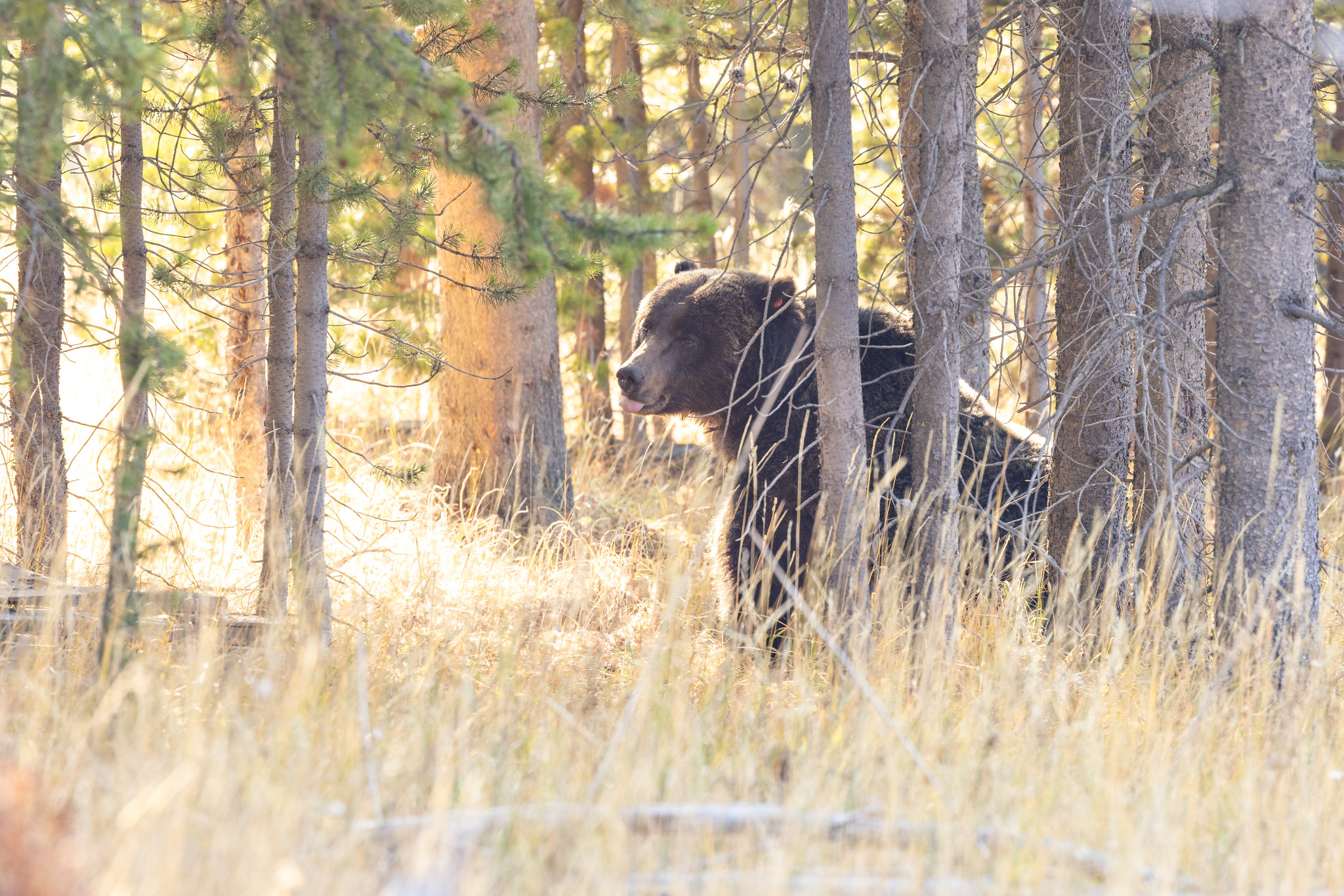
Biologists to begin 2025 grizzly bear captures for research purposes in Yellowstone National Park
As part of ongoing monitoring efforts to document recovery of grizzly bears in the Greater Yellowstone Ecosystem under the Endangered Species Act, the U.S. Geological Survey, in conjunction with Yellowstone National Park, is working to inform the public that pre-baiting and scientific capture operations are once again about to begin within Yellowstone National Park. Agency biologists with the Interagency Grizzly Bear Study Team (IGBST) will begin the field captures Sept. 1 and continue through Oct. 15. Capture operations can include a variety of activities, but all areas where work is being conducted will have major access points marked with warning signs. It is critical that all members of the public heed these signs.
Monitoring of the grizzly bear population is vital to ongoing research and management of grizzly bears in the Greater Yellowstone Ecosystem. To attract bears, biologists use natural food sources such as recently road-killed deer and elk. Potential capture sites are baited with these natural foods and if indications are that grizzly bears are in the area, culvert traps or foot snares are used to capture bears. Once captured, bears are handled in accordance with strict safety and animal care protocols developed by the IGBST and approved by the U.S. Geological Survey.
Whenever bear capture activities are being conducted for scientific purposes, the area around the site will be posted with bright warning signs to inform the public of the activities occurring. These signs are posted along the major access points to the capture site. It is important that the public heed these signs and do not venture into an area that has been posted. For more information regarding grizzly bear capture efforts call the IGBST trapping hotline at 406-994-6675. Information about the grizzly bear research and monitoring is available from the IGBST website.
************************************************************************************
Check out our online trail guides:
Monitoring of the grizzly bear population is vital to ongoing research and management of grizzly bears in the Greater Yellowstone Ecosystem. To attract bears, biologists use natural food sources such as recently road-killed deer and elk. Potential capture sites are baited with these natural foods and if indications are that grizzly bears are in the area, culvert traps or foot snares are used to capture bears. Once captured, bears are handled in accordance with strict safety and animal care protocols developed by the IGBST and approved by the U.S. Geological Survey.
Whenever bear capture activities are being conducted for scientific purposes, the area around the site will be posted with bright warning signs to inform the public of the activities occurring. These signs are posted along the major access points to the capture site. It is important that the public heed these signs and do not venture into an area that has been posted. For more information regarding grizzly bear capture efforts call the IGBST trapping hotline at 406-994-6675. Information about the grizzly bear research and monitoring is available from the IGBST website.
************************************************************************************
Check out our online trail guides:
- Glacier National Park: HikinginGlacier.com
- Grand Teton National Park: TetonHikingTrails.com
- Rocky Mountain National Park: RockyMountainHikingTrails.com
Thursday, August 21, 2025
Grand Teton National Park seeks input on proposed Taggart Lake improvements
Grand Teton National Park is moving forward with a project to enhance visitor access and improve facilities at the popular Taggart Lake Trail area and would like public input about the proposed improvements. The project is aimed at meeting growing visitor demand while improving safety, accessibility, and the overall visitor experience.
The Environmental Assessment (EA) for the project is now available for public review. A 35-day public comment period will run through September 23, 2025, and will include a virtual public meeting to provide additional information and answer questions.
Key elements of the proposed project include:
* A larger parking lot to reduce congestion and enhance safety.
* New toilets and a potable water station at the trailhead.
* A redesigned, accessible trailhead area and improved multiuse pathway connections.
* Upgrades to the Taggart Lake Trail, including reconstruction to meet accessibility standards up to the trail’s first bridge.
* Shoreline improvements at Taggart Lake to better define access points and protect natural resources.
* Accessibility and facility improvements to the Cottonwood Creek Picnic area.
How to participate:
* Visit the NPS Planning, Environment & Public Comment (PEPC) website through September 23 to review the EA and submit comments.
* The park will host a virtual public meeting during the comment period. Details will be announced on the PEPC website and the park’s social media channels.
The estimated construction cost for the project is $14.6 million, with about $10.5 million in philanthropic funding through the generous support of the Grand Teton National Park Foundation. Construction and associated closures should begin in 2026.
Visit https://parkplanning.nps.gov/taggartlakeexperience-ea for project information.
*******************************************************************************
Rising more than 7000 feet above Jackson Hole, the majestic mountains of Grand Teton National Park provide one of the most dramatic landscapes in the world. With more than 240 miles of trails meandering throughout this park, how will you find and choose the most scenic and rewarding hikes?
Exploring Grand Teton National Park takes all the guesswork out by focusing on the most amazing hikes, and provides you with handpicked recommendations that will allow you to make the most of your trip to Grand Teton:
The Environmental Assessment (EA) for the project is now available for public review. A 35-day public comment period will run through September 23, 2025, and will include a virtual public meeting to provide additional information and answer questions.
Key elements of the proposed project include:
* A larger parking lot to reduce congestion and enhance safety.
* New toilets and a potable water station at the trailhead.
* A redesigned, accessible trailhead area and improved multiuse pathway connections.
* Upgrades to the Taggart Lake Trail, including reconstruction to meet accessibility standards up to the trail’s first bridge.
* Shoreline improvements at Taggart Lake to better define access points and protect natural resources.
* Accessibility and facility improvements to the Cottonwood Creek Picnic area.
How to participate:
* Visit the NPS Planning, Environment & Public Comment (PEPC) website through September 23 to review the EA and submit comments.
* The park will host a virtual public meeting during the comment period. Details will be announced on the PEPC website and the park’s social media channels.
The estimated construction cost for the project is $14.6 million, with about $10.5 million in philanthropic funding through the generous support of the Grand Teton National Park Foundation. Construction and associated closures should begin in 2026.
Visit https://parkplanning.nps.gov/taggartlakeexperience-ea for project information.
*******************************************************************************
Rising more than 7000 feet above Jackson Hole, the majestic mountains of Grand Teton National Park provide one of the most dramatic landscapes in the world. With more than 240 miles of trails meandering throughout this park, how will you find and choose the most scenic and rewarding hikes?
Exploring Grand Teton National Park takes all the guesswork out by focusing on the most amazing hikes, and provides you with handpicked recommendations that will allow you to make the most of your trip to Grand Teton:
Wednesday, August 20, 2025
Star Party at Logan Pass this Friday
Glacier National Park posted this on their social media yesterday:
************************************************************************************
Check out our online trail guides:
Have you ever wanted to experience a dark night sky in the heart of Glacier National Park? Join us for our Logan Pass Star Party on Friday, August 22!
Tickets are required ($5 per vehicle) and will go on sale Thursday, August 21 at both the St. Mary Visitor Center and the Apgar Visitor Center, beginning at 8 am. You do not need a vehicle reservation to access either of those locations. Tickets are limited.
There will be an introduction to the night sky, constellation tours, Blackfeet star stories, and telescope viewing! All participants must arrive at the Logan Pass Parking lot no later than 9:30 pm and plan on staying until midnight. The Star Party will officially begin at 10 pm.
In the event that bad weather forces a cancellation of the Star Party, we will post that message on our social media, at visitor centers, and on our website by 2 pm Friday.
Happy stargazing!
************************************************************************************
Check out our online trail guides:
- Glacier National Park: HikinginGlacier.com
- Grand Teton National Park: TetonHikingTrails.com
- Rocky Mountain National Park: RockyMountainHikingTrails.com
Monday, August 18, 2025
Bridger-Teton National Forest Implements Improvements at Nelson Drive Trailhead on Jackson District
Bridger-Teton National Forest is excited to implement parking lot and sign improvements at Nelson Drive Trailhead. The trailhead area and adjacent trails will be closed temporarily for approximately two weeks to reconstruct the existing parking area into a more efficient and sustainable design that better accommodates visitors and protects soil, plant, and water resources. The project includes regrading the existing native surface road to address chronic erosion and drainage issues. The trailhead will be closed from Monday, August 25th through Friday, September 5th.
Nelson Knoll Loop, Water Tank Road, Lower Putt Putt, Woods Canyon, and Crystal Lite trails will be temporarily closed during construction. Putt Putt, Woods Canyon, and Crystal Butte trails can still be accessed above the closure area from Cache Creek Trailhead.
While the trailhead is closed during the reconstruction project, technicians will gather geo-technical information adjacent to the existing Forest Service housing units that will inform future Forest Service housing plans.
During the Nelson Trailhead reconstruction project, local pedestrian neighborhood access to Putt Putt and Woods Canyon Trails may occur from the Henley Access Trail off Nelson Drive. Trail users planning to park should use Cache Creek Trailhead.
Nelson Knoll Loop, Water Tank Road, Lower Putt Putt, Woods Canyon, and Crystal Lite trails will be temporarily closed during construction. Putt Putt, Woods Canyon, and Crystal Butte trails can still be accessed above the closure area from Cache Creek Trailhead.
While the trailhead is closed during the reconstruction project, technicians will gather geo-technical information adjacent to the existing Forest Service housing units that will inform future Forest Service housing plans.
During the Nelson Trailhead reconstruction project, local pedestrian neighborhood access to Putt Putt and Woods Canyon Trails may occur from the Henley Access Trail off Nelson Drive. Trail users planning to park should use Cache Creek Trailhead.
Subscribe to:
Posts (Atom)