The Flathead Avalanche Center in Hungry Horse has issued a BACKCOUNTRY AVALANCHE WARNING for the following areas: NWS Missoula MT - MTC 029 (Flathead County)...MTC 047 (Lake County)...MTC 053 (Lincoln County)
* WHAT...The avalanche danger for the warning area will rise to high today.
* WHERE...The Whitefish, Swan, and Flathead Ranges, as well as the Lake McDonald region in Glacier National Park, and the mountains near Marias Pass.
* WHEN...In effect from Mon 06:00 MST to Tue 07:00 MST.
* IMPACTS...Prolonged warming and solar radiation will result in widespread avalanches. Large avalanches will occur naturally or be easily triggered by a person or machine.
* PRECAUTIONARY / PREPAREDNESS ACTIONS...Very dangerous avalanche conditions. Travel in avalanche terrain is not recommended. Avalanches may run long distances and can run into mature forests, valley floors, or flat terrain.
Consult http://www.flatheadavalanche.org/ or www.avalanche.org for more detailed information.
Similar avalanche danger may exist at locations outside the coverage area of this or any avalanche center.
Jeff
HikinginGlacier.com
TetonHikingTrails.com
RockyMountainHikingTrails.com
Ramble On (2nd edition book on the rich history of hiking)
Exploring Glacier National Park
Exploring Grand Teton National Park

Monday, January 29, 2024

Along The Trail At The Head Of Cascade Canyon
The photo below was originally published by the U.S. Department of the Interior in a pamphlet called, Grand Teton [Wyoming] National Park. Published in 1937, the photograph appears with the title, Along The Trail At The Head Of Cascade Canyon.
After some discussion on social media, and a closer analysis of the photo, I now believe this photo was taken from South Teton. It appears it may have been taken by Don Grant, who appears to have been a mountain climber from that era (I originally thought that the rock outcropping in the lower left-hand corner of the photo was Inspiration Point, but this is incorrect). Regardless, this is a pretty amazing shot:
 Even as far back as 85 years ago, Cascade Canyon was considered to be a popular destination in the park. The Spring 1939 issue of Grand Teton Nature Notes reports that, "By far the most popular trail in the park is the lower portion of the Cascade Canyon Trail which leaves Jenny Lake and climbs above Hidden Falls."
*******************************************************************************
Rising more than 7000 feet above Jackson Hole, the majestic mountains of Grand Teton National Park provide one of the most dramatic landscapes in the world. With more than 240 miles of trails meandering throughout this park, how will you find and choose the most scenic and rewarding hikes?
Exploring Grand Teton National Park takes all the guesswork out by focusing on the most amazing hikes, and provides you with handpicked recommendations that will allow you to make the most of your trip to Grand Teton: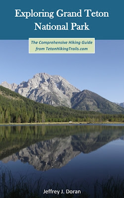
After some discussion on social media, and a closer analysis of the photo, I now believe this photo was taken from South Teton. It appears it may have been taken by Don Grant, who appears to have been a mountain climber from that era (I originally thought that the rock outcropping in the lower left-hand corner of the photo was Inspiration Point, but this is incorrect). Regardless, this is a pretty amazing shot:

*******************************************************************************
Rising more than 7000 feet above Jackson Hole, the majestic mountains of Grand Teton National Park provide one of the most dramatic landscapes in the world. With more than 240 miles of trails meandering throughout this park, how will you find and choose the most scenic and rewarding hikes?
Exploring Grand Teton National Park takes all the guesswork out by focusing on the most amazing hikes, and provides you with handpicked recommendations that will allow you to make the most of your trip to Grand Teton:
Saturday, January 27, 2024
Wyoming State Trails, Forest Service Project Recognized by Coalition for Recreational Trails
A Wyoming Trails project involving the installation of the Hawks Rest Pack Stock Bridge in the Bridger-Teton National Forest has been recognized by the Coalition for Recreational Trails in the Construction and Design category.
Representatives from the Wyoming State Trails program and the Forest Service will receive the award during a special awards ceremony on March 6, in Washington, D.C. followed by a reception on Capitol Hill.
“This is a fantastic example of how well State and Federal government partnerships can work to get projects to the ground in order to provide a much-needed recreational infrastructure” Forrest Kamminga, Wyoming State Trails Program manager.
The Hawks Rest Pack Stock Bridge project was very unique and complicated and wouldn’t have been possible without the partnerships of several federal and state agencies along with several combined contracts that totaled more than $1 million. Funding for the project came from multiple funding sources that included a Recreational Trails Program non-motorized grant, a non-Federal match from the Wyoming State Parks agency, and the United States Forest Service non-federal outfitter and guides’ special use permit fees.
 This unique project consisted of the replacement of a remote bridge and concrete abutments that were originally constructed in 1959 and buried deep in the Thorofare area that spans the boundary of the northern Teton Wilderness and Yellowstone National Park on the upper Yellowstone River approximately 28 miles from any trailhead or road.
The project was managed by the Bridger-Teton National Forest, Blackrock Ranger District staff and had very complex design and construction challenges due to the wilderness designation that restricted the use of mechanized equipment that limited the transportation of the new pre-fabricated bridge structure and pre-fab concrete abutments to solely a helicopter that was only allowed by obtaining special permission. All the remaining materials and crews to build the structure were hauled in by a Stock pack string which required a full day, one way to access the bridge location, and a working season of about 8 weeks a year.
“This will allow for easy and safe passage of wilderness travelers for many years into the future.” Todd Stiles, Blackrock District Ranger said.
This is the eleventh time the Wyoming Trails Program has been recognized by the CRT.
Jeff
HikinginGlacier.com
TetonHikingTrails.com
RockyMountainHikingTrails.com
Ramble On (2nd edition book on the rich history of hiking)
Exploring Glacier National Park
Exploring Grand Teton National Park
Representatives from the Wyoming State Trails program and the Forest Service will receive the award during a special awards ceremony on March 6, in Washington, D.C. followed by a reception on Capitol Hill.
“This is a fantastic example of how well State and Federal government partnerships can work to get projects to the ground in order to provide a much-needed recreational infrastructure” Forrest Kamminga, Wyoming State Trails Program manager.
The Hawks Rest Pack Stock Bridge project was very unique and complicated and wouldn’t have been possible without the partnerships of several federal and state agencies along with several combined contracts that totaled more than $1 million. Funding for the project came from multiple funding sources that included a Recreational Trails Program non-motorized grant, a non-Federal match from the Wyoming State Parks agency, and the United States Forest Service non-federal outfitter and guides’ special use permit fees.
The project was managed by the Bridger-Teton National Forest, Blackrock Ranger District staff and had very complex design and construction challenges due to the wilderness designation that restricted the use of mechanized equipment that limited the transportation of the new pre-fabricated bridge structure and pre-fab concrete abutments to solely a helicopter that was only allowed by obtaining special permission. All the remaining materials and crews to build the structure were hauled in by a Stock pack string which required a full day, one way to access the bridge location, and a working season of about 8 weeks a year.
“This will allow for easy and safe passage of wilderness travelers for many years into the future.” Todd Stiles, Blackrock District Ranger said.
This is the eleventh time the Wyoming Trails Program has been recognized by the CRT.
Jeff
HikinginGlacier.com
TetonHikingTrails.com
RockyMountainHikingTrails.com
Ramble On (2nd edition book on the rich history of hiking)
Exploring Glacier National Park
Exploring Grand Teton National Park
Wednesday, January 24, 2024
Glacier National Park 2024 Vehicle Reservations Open January 25
Glacier National Park reminds visitors that advance vehicle reservations become available on Recreation.gov starting January 25, 2024 at 8 a.m. Mountain Time.
Vehicle reservations will be available on Recreation.gov through two types of booking windows; A portion of vehicle reservations will be available 120 days or approximately four months in advance on a daily rolling basis, beginning January 25 at 8 a.m. Mountain Time. Next day vehicle reservations will be available at 7 p.m. Mountain Time for next-day entry, starting May 23, 2024 on a daily rolling basis.
Reservations will be required for the Going-to-the-Sun Road, North Fork and Many Glacier Valley. Each of the specified areas of the park will require a separate reservation. For more information, please click here.
Jeff
HikinginGlacier.com
TetonHikingTrails.com
RockyMountainHikingTrails.com
Ramble On (2nd edition book on the rich history of hiking)
Exploring Glacier National Park
Exploring Grand Teton National Park
Vehicle reservations will be available on Recreation.gov through two types of booking windows; A portion of vehicle reservations will be available 120 days or approximately four months in advance on a daily rolling basis, beginning January 25 at 8 a.m. Mountain Time. Next day vehicle reservations will be available at 7 p.m. Mountain Time for next-day entry, starting May 23, 2024 on a daily rolling basis.
Reservations will be required for the Going-to-the-Sun Road, North Fork and Many Glacier Valley. Each of the specified areas of the park will require a separate reservation. For more information, please click here.
Jeff
HikinginGlacier.com
TetonHikingTrails.com
RockyMountainHikingTrails.com
Ramble On (2nd edition book on the rich history of hiking)
Exploring Glacier National Park
Exploring Grand Teton National Park
Monday, January 22, 2024
Fern Lake Shapes "Suite: Judy Blue Eyes"
In the early 1900s Dr. William J. Workman began construction on a fishing lodge along the shores of Fern Lake in Rocky Mountain National Park. This would eventually evolve into the Fern Lake Lodge, which would include a dining room, as well as a dormitory and log cabins that could accommodate up to 55 people. Although the lodge ceased most operations in the late 1930s, it continued serving light snacks through the 1950s. During the summer of 1958 the lodge was managed by budding folksinger Judy Collins, and her husband at that time, Peter Taylor. In 1976 the National Park Service razed the property and returned the area to its natural state.
 Although Collins attained a fair amount of fame on her own with hits such as "Both Sides, Now," it was arguably the Crosby, Stills & Nash smash hit, "Suite: Judy Blue Eyes," which would immortalized her. At the time the song was written Collins was dating Stephen Stills. In a 2016 Facebook post Collins recalled her time at the lodge:

*******************************************************************************
From Montana to New Mexico, the American Rockies stretch for more than a thousand miles. Within this spectacular mountain range are thousands of miles of hiking trails. With such an overwhelming number of options, how will you find and choose the most scenic and rewarding hikes?
Ultimate Hiking Guide to the Rocky Mountains takes all the guesswork out by focusing on some of the most amazing hikes across this range, and provides you with a handpicked list of options that will allow you to make the most of your trips in the Rockies: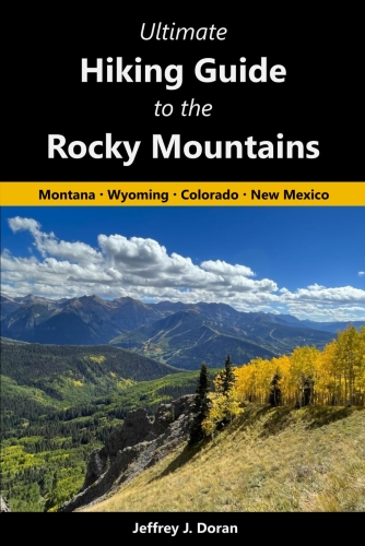

"I ran Fern Lake Lodge in 1958 for a summer and I and my family will never forget the mountains and our time there--RIP Denver John (her brother) and Clark-and my ex, Peter Taylor, who ran the water down from the springs into the pipes and into the lodge and kept the first [fires] burning and the wood chopped--our memories float over the spring run-offs and the sunsets and sunrises as hikers take to the mountains to see the Columbines and Paintbrush, the leaping trout and the nutcrackers and Rocky Mountain bluebirds. I will go up that 9 and 1/2 mile hike again, over the 11,000 foot pinacle above Odessa Lake and above Bear Lake, and down into the Fern Lake terrain. The Lodge where we worked--I baking bread and pies on a wood stove-and slept, down on the river bank are all gone, but the memories live on."Thousands of hikers still visit Fern Lake each year, but none will ever find any evidence that the lodge ever existed. Here's a photo of Judy Collins performing at Fern Lake Lodge:

*******************************************************************************
From Montana to New Mexico, the American Rockies stretch for more than a thousand miles. Within this spectacular mountain range are thousands of miles of hiking trails. With such an overwhelming number of options, how will you find and choose the most scenic and rewarding hikes?
Ultimate Hiking Guide to the Rocky Mountains takes all the guesswork out by focusing on some of the most amazing hikes across this range, and provides you with a handpicked list of options that will allow you to make the most of your trips in the Rockies:
Subscribe to:
Posts (Atom)