Saturday, June 29, 2024

Yellowstone National Park statement about white bison calf

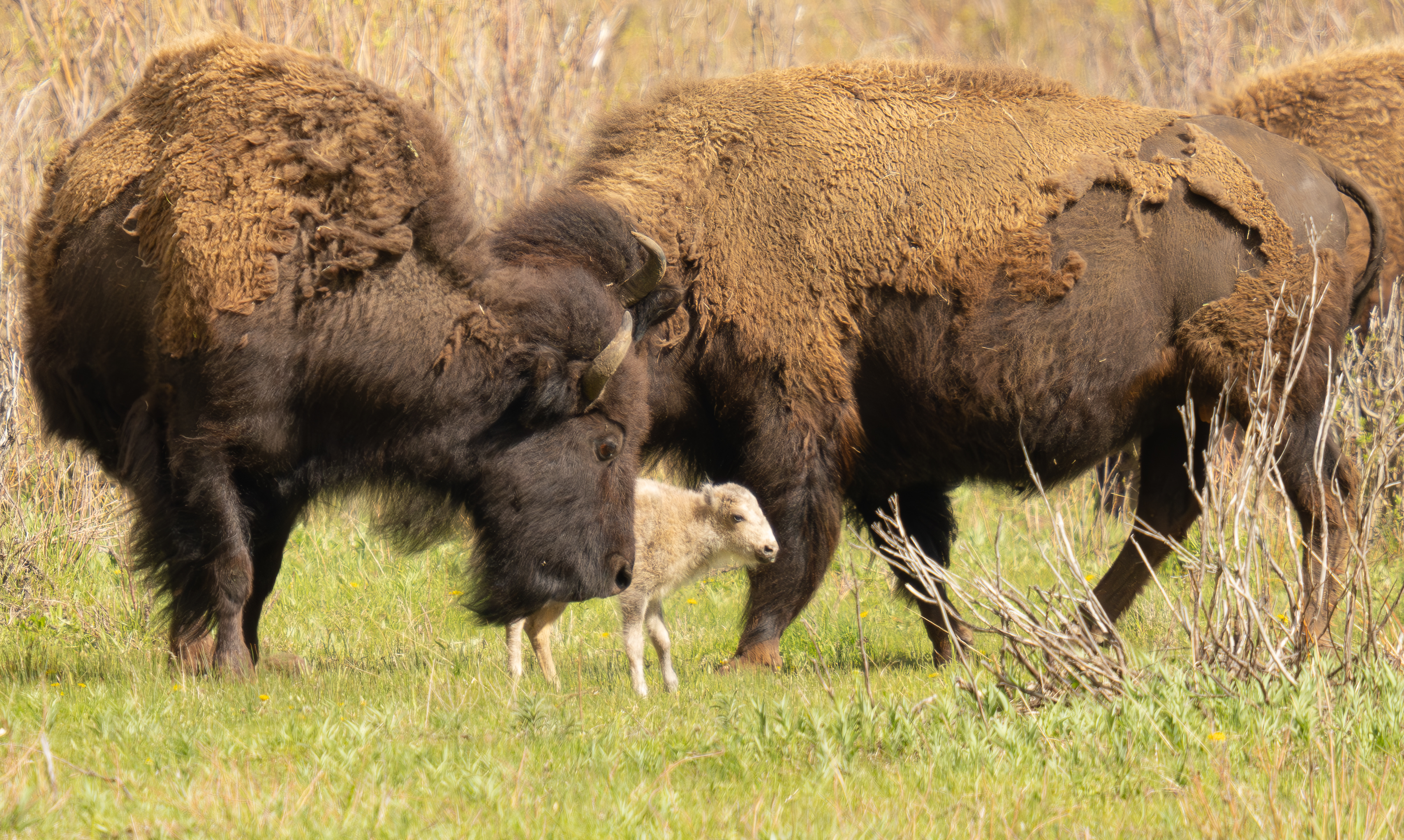
At this time, Yellowstone National Park can confirm, based on multiple creditable sightings, that a white bison calf was born in Lamar Valley on June 4, 2024.

Yellowstone’s Center for Resources Bison Management Team received numerous reports and photos of the calf taken on June 4th from park visitors, professional wildlife watchers, commercial guides and researchers. To date, park staff have been unable to locate the calf. To the park's knowledge, there have been no confirmed sightings by park visitors since June 4th.

Photos provided to park biologists indicate the calf is leucistic (black eyes and hooves with some pigmentation), rather than an albino animal.

Significance

The birth of a white bison calf was a rare natural phenomenon that once occurred before the near extinction of bison in the late 19th century, when bison numbered in the tens of millions. The birth of a white bison calf may reflect the presence of a natural genetic legacy that was preserved in Yellowstone’s bison, which has revealed itself because of the successful recovery of a wild bison population of 3,000-6,000 animals.

The birth of a white bison calf in the wild is a landmark event in the ecocultural recovery of bison by the National Park Service (NPS). The NPS has never reported a white calf being born within Yellowstone National Park. The birth of a white bison calf in the wild is believed to occur in 1 in 1 million births or even less frequently. The NPS acknowledges the cultural significance of a white bison calf for American Indians.

Bison Population

The bison population fluctuates from 3,000 to 6,000 animals in two subpopulations, defined by where they gather for breeding. The northern herd breeds in the Lamar Valley and on the high plateaus around it. The central herd breeds in Hayden Valley. The NPS estimates the 2024 pre-calving bison population around 4,550.


              ************************************************************************************

Check out our online trail guides:


Thursday, June 27, 2024

WYO 22/Teton Pass to reopen midday Friday with new detour

Wyoming State Highway 22, Teton Pass will reopen this Friday with an interim detour around the Big Fill landslide at milepost 12.8.

Wyoming Department of Transportation officials began work on a detour around the site immediately after its collapse on June 8. Crews from Evans Construction and WYDOT personnel have been working around the clock for the last three weeks to construct a paved, two-lane detour to connect the severed communities in the Teton Valley.

The current 60,000 lbs gross vehicle weight restriction will remain in place as the road opens. There will be no additional restrictions. Trailer traffic will be allowed, but WYDOT encourages drivers to be cautious and aware of the reduced speed and obey all traffic signs. More information about driving Teton Pass is available here: https://www.wyoroad.info/Highway/Teton.pdf.

WYDOT’s professional geologists have evaluated the stability of the detour roadway. Geotechnical analysis confirms that the temporary detour meets or exceeds minimum requirements as outlined in guidance from the Federal Highway Administration. The calculated factor of safety for stability of the detour exceeds 1.2, with 1.1 being the minimum acceptable to WYDOT’s professional licensed engineers.

WYDOT remains committed to monitoring the area with geologic infrastructure, including real time information on subsurface movement and ground based radar detection, along with personnel inspections.

The new detour is roughly 600 feet long, with a grade of 11.2 percent and a sharper curvature. The speed limit will be reduced to 20 mph through the area.

Crews are currently striping and placing barrier. WYDOT estimates the road to open around midday Friday, June 28th. Drivers are encouraged to sign up for 511 Notify alerts at https://www.wyoroad.info/511/511NotifyAnnouncement.html. A text alert will be issued when the roadway is open for traffic.

For more information about oversize loads and weight restrictions statewide and mountain pass road information, visit the Wyoming Highway Patrol at https://whp.wyo.gov/commercial-carrier/mountain-road-information.

At the mudslide location at mile marker 15.5, crews have installed the box culvert and are planning for paving operations today. Work has been underway to improve drainage at the site. The Wyoming Transportation Commission recently awarded the emergency bid to Avail Valley Construction LLC during a special meeting. The work was originally scheduled for completion around the same time as the temporary detour, but to provide more flexibility in the schedule, the work will continue after the temporary detour at milepost 12.8 is opened. However, WYDOT and Avail Valley are committed to conducting the work under two-way traffic, so as not to impact travel on Teton Pass.

WYDOT is thankful for the support from other government agencies, including the US Forest Service and the Idaho Transportation Department, which has allowed WYDOT to mobilize quickly with planning and repairs.

The reopening will provide hikers with access to Mt. Glory, Black Canyon Overlook and Coal Creek Meadows.


                *******************************************************************************

Rising more than 7000 feet above Jackson Hole, the majestic mountains of Grand Teton National Park provide one of the most dramatic landscapes in the world. With more than 240 miles of trails meandering throughout this park, how will you find and choose the most scenic and rewarding hikes?

Exploring Grand Teton National Park takes all the guesswork out by focusing on the most amazing hikes, and provides you with handpicked recommendations that will allow you to make the most of your trip to Grand Teton:


Wednesday, June 26, 2024

Fire Danger increased to Moderate in Grand Teton

Teton Interagency fire managers announced the fire danger has been elevated to “moderate” for Grand Teton National Park, Bridger-Teton National Forest, and the National Elk Refuge. The potential for fire activity has increased due to summer curing of vegetation combined with warmer and windy conditions.

A moderate fire danger rating means fires can start from most accidental causes. Unattended campfires and brush fires have potential to escape, especially on windy days, in dry, open areas.

When determining fire danger, fire managers use several indicators such as the moisture content of grasses, shrubs, trees, and dead and downed materials; projected weather conditions including temperatures and possible wind events; the ability of fire to spread after ignition; and availability of firefighting resources both locally and nationally.

As the Independence Day holiday approaches, visitors and local residents alike are reminded that fireworks are not permitted in Grand Teton National Park, on the Bridger-Teton National Forest, within the National Elk Refuge, or in Sublette and Teton counties in Wyoming. These fireworks regulations play a critical role in fire prevention.

As we approach the Fourth of July holiday, visitors are reminded that personal fireworks are never allowed and that campfires must always be attended and cold to the touch before abandoning. To extinguish a campfire, several gallons of water must be used as opposed to a single water bottle. The process requires you to soak the campfire, stir the ashes, feel for heat, and to repeat the process until no heat remains.

When enjoying a campfire, remember it should always remain attended and must be completely extinguished before leaving. Simply pouring water on the remains of a fire is not sufficient. The charred remains must be repeatedly doused with water and stirred into the campfire ring. All embers and logs, not just the red ones, should be broken up and covered with dirt. Before leaving the area, the campfire remains must be cold to the touch.

Visit the Teton Interagency Fire website at TetonFires.com to learn more about fire safety and what fire regulations may be in place. To report a fire or smoke in the immediate area, call the Teton Interagency Fire Dispatch Center at 307-739-3630.


                *******************************************************************************

Rising more than 7000 feet above Jackson Hole, the majestic mountains of Grand Teton National Park provide one of the most dramatic landscapes in the world. With more than 240 miles of trails meandering throughout this park, how will you find and choose the most scenic and rewarding hikes?

Exploring Grand Teton National Park takes all the guesswork out by focusing on the most amazing hikes, and provides you with handpicked recommendations that will allow you to make the most of your trip to Grand Teton:


Tuesday, June 25, 2024

Glacier National Park offers more details concerning opening of Going-to-the-Sun Road

As mentioned over the weekend, Going-to-the-Sun Road in Glacier National Park officially opened on Saturday morning. In a press release, the park offered a few more details that visitors should be aware of. They include the following:

* Services at Logan Pass include restroom facilities, but potable water is currently not yet available. Visitors should plan to bring their own drinking water.

* Visitor information services will be provided at the Logan Pass Visitor Center from 9 am to 7 pm daily starting June 22. The Glacier National Park Conservancy bookstore will be operating inside of the Logan Pass Visitor Center.

* While driving along the road, particularly through the Rim Rock area (approximately one mile west of Logan Pass) visitors should be aware of potential rockfall and should not slow down or stop in this section. Rocks and other debris continue to fall throughout the summer, requiring daily clean up. With the level of snow at Logan Pass, visitors should use extreme caution and refrain from crossing snowfields or standing under snow overhangs.

* The Highline Trail and a portion of Grinnell Glacier Trail remain closed due to hazardous snow conditions and emerging vegetation. Hidden Lake Trail will be closed June 15 to August 7 from the overlook to Hidden Lake due to bear activity near the lake outlet while fish are spawning.

* For up-to-date information on trail conditions and clearing activities, visit the park’s trail status webpage.


                *******************************************************************************

Glacier National Park preserves more than a million acres of some of the most spectacular scenery on Earth. With more than 740 miles of trails meandering throughout this vast park, how will you find and choose the most scenic and rewarding hikes?

Exploring Glacier National Park takes all the guesswork out by focusing on the most amazing hikes, and provides you with handpicked recommendations that will allow you to make the most of your trip to Glacier:


Pennsylvania woman drowns near St. Mary Falls

On Sunday afternoon, a 26-year-old Pennsylvania woman drowned after falling into the water above St. Mary Falls on the east side of Glacier National Park.

According to witnesses, the woman was washed over the falls and trapped under water for several minutes. Bystanders pulled her from the water below the falls and administered CPR until emergency responders arrived. Park rangers and Babb ambulance personnel took over CPR upon arrival. ALERT helicopter landed nearby at about 6:20 pm and assisted with resuscitation efforts but the victim never regained consciousness. Resuscitation efforts were terminated at about 7 pm and ALERT personnel pronounced the woman deceased.

In a press release posted this afternoon, the park made a few clarifications:
The woman who drowned near St. Mary Falls on the east side of Glacier National Park Sunday has been identified as 26-year-old Gillian Tones from North Apollo, Pa.

It was first reported that Tones went into the water above St. Mary Falls but witnesses later clarified that she slipped on wet, slick rocks and fell into Virginia Creek between St. Mary and Virginia Falls, about 200 yards above the trail bridge. Tones was quickly swept up by the cold, fast moving water and went over a series of smaller waterfalls, then was pinned underwater by a log for several minutes until heroic efforts by other park visitors led to pulling her from the river.
Park dispatch received multiple 911 calls routed through Glacier County dispatch at approximately 5:20 pm. Park rangers were on the scene by approximately 5:45 pm.

ALERT flew the body to the 1913 Ranger Station near St. Mary, MT where they were met by the Glacier County coroner at about 7:30 pm. The coroner is transporting the body to the medical examiner in Missoula, MT for an autopsy.

The death is under investigation and additional details are still being gathered.

Park staff would like to thank Glacier County, ALERT, Babb Ambulance and US Border Patrol for their support, along with numerous bystanders for their immediate assistance.

The park extends their deepest condolences to family and friends of the woman and asks that the public respect their privacy.


              ************************************************************************************

Check out our online trail guides:


Monday, June 24, 2024

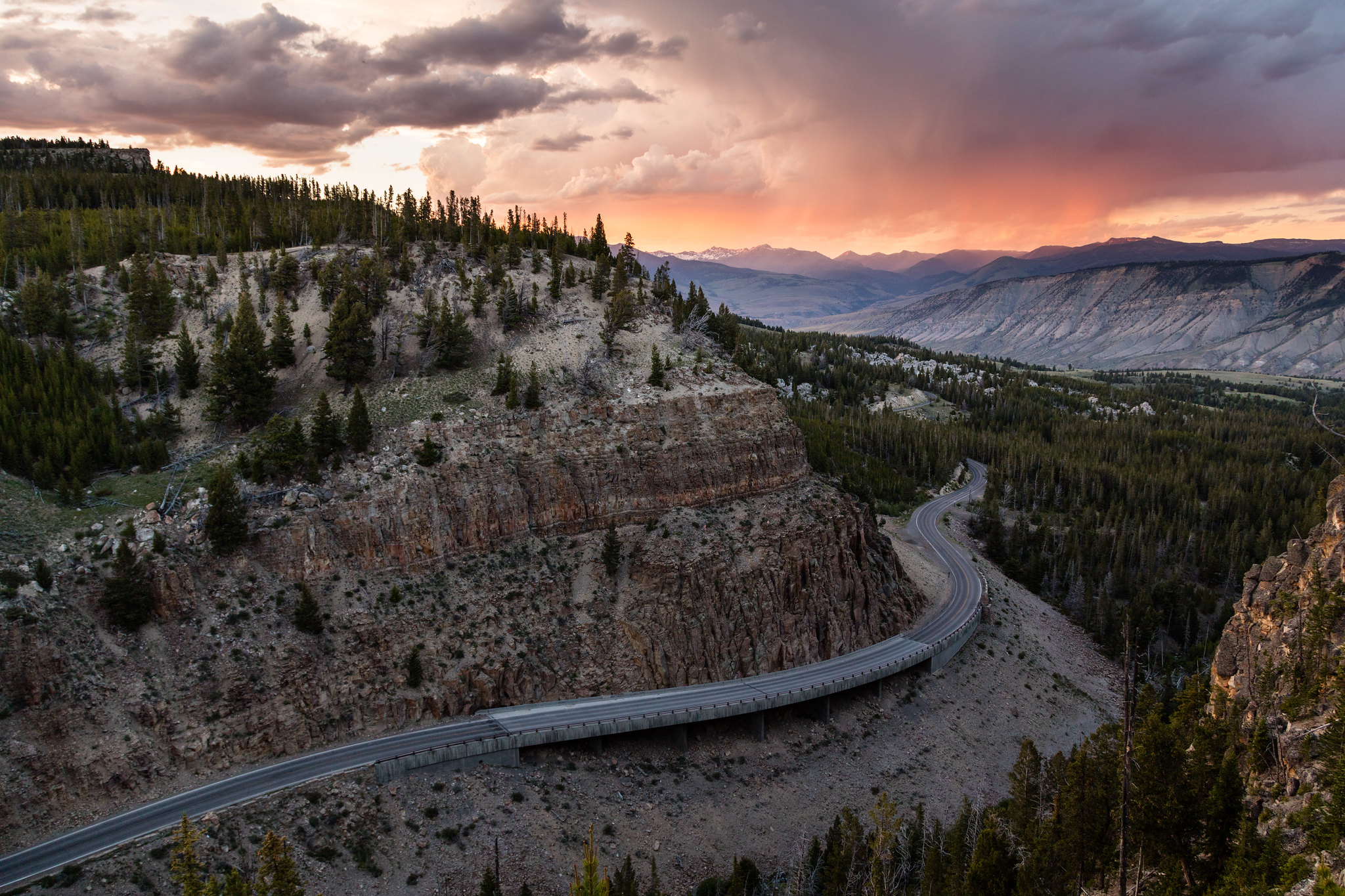
Federal Highway Administration Announces $22 Million for Transportation Improvements at Yellowstone National Park

The U.S. Department of Transportation’s Federal Highway Administration (FHWA) has announced a $22 million grant to the Department of the Interior’s National Park Service to modernize and reconstruct a 0.7-mile segment of the Norris to Golden Gate roadway in Yellowstone National Park. The road is a critical transportation link to Yellowstone’s major destinations and the millions of people who visit the park each year as well as local residents and surrounding communities. The project will significantly improve the exceptionally difficult and challenging roadway to improve safety and pedestrian access, alleviate rockfall hazards, and upgrade vehicle pullouts and parking areas, and add new pedestrian facilities to separate people from traffic.

“The funding announced today is the latest in a multitude of collaborations undertaken as part of our partnership spanning decades with the National Park Service,” said Federal Highway Administrator Shailen Bhatt. “This partnership is helping to make visits to Yellowstone and the 428 other national parks across the country safer, more enjoyable, and convenient for years to come. We’re thrilled to be working with the National Park Service to improve access to and from this national treasure by providing a safer, more modern and reliable travel experience.”
Tourism is the critical driver of the economy in and around Yellowstone National Park. In 2021, over 4.9* million people visited the park and spent over $630 million in communities near the park, according to the National Park Service. That spending supported about 8,740 jobs in the local area and had a cumulative benefit to the local economy of over $834 million. Transportation improvements to the Norris to Golden Gate roadway will contribute to increased tourism and a higher-quality visitor experience, promoting sustained economic competitiveness for the entire rural region.

The Yellowstone National Park project is one of five nationwide receiving a total of $88.2 million in Fiscal Year 2023 funding under FHWA’s Nationally Significant Federal Lands and Tribal Transportation Projects Program. FHWA also announced $20.5 million in Tribal Transportation Program Safety Fund (TTPSF) grants for 80 projects today.


              ************************************************************************************

Check out our online trail guides:


Saturday, June 22, 2024

Going-to-the-Sun Road is officially open!

Glacier National Park posted this on their social media earlier today:
Going-to-the-Sun Road officially opened this morning for the 2024 summer season. The road may now be accessed by motorized vehicles over Logan Pass from both the West Glacier and St. Mary entrances.

As a reminder, vehicle reservations are not required at the East Entrance in 2024. St. Mary provides access to Going-to-the-Sun Road driving east to west. Please note that visitors who enter from the east side will not be able to return through the Apgar Check Point without a vehicle reservation between 6 am and 3 pm.

Vehicle reservations are needed when accessing Going-to-the-Sun Road from West Entrances. Visitors will have access to the Apgar Visitor Center and park shuttles. Daily shuttle service begins July 1.


                *******************************************************************************

Glacier National Park preserves more than a million acres of some of the most spectacular scenery on Earth. With more than 740 miles of trails meandering throughout this vast park, how will you find and choose the most scenic and rewarding hikes?

Exploring Glacier National Park takes all the guesswork out by focusing on the most amazing hikes, and provides you with handpicked recommendations that will allow you to make the most of your trip to Glacier:


Friday, June 21, 2024

Teton Pass interim detour may open next week

Wyoming State Highway 22, Teton Pass remains closed as crews continue work on the interim detour for the Big Fill landslide at milepost 12.8. The Wyoming Department of Transportation and contractors have also begun work on drainage improvements for the mudslide at milepost 15.

Officials hope to have the detour paved and the detour opened to traffic by the end of next week. More updates on what day that will take place will be available next week.

The new detour will feature a paved roadway with two 12-foot lanes, one in each direction. The detour will also have concrete barriers protecting motorists from any hazards. The detour has been constructed on the interior of the curve, away from the unstable slide area. The detour will create a slightly sharper curve and steeper grade. WYDOT plans to reduce the speed through the area to accommodate the grade and increased curvature. What speed and restrictions that will be in place when the detour opens will be available next week. There will be advanced signage warning drivers of the reduced speed and any other applicable restrictions.

Beginning today, June 21, the Wyoming Department of Transportation and contractors will be hauling crushed base and asphalt to the detour site. Crews are asking all bicycle traffic to utilize the pathway or the Old Pass Road on the east side to access the area for recreation and refrain from cycling on the road throughout the weekend. The safety of cyclists and recreational users is paramount during this time, as there will be more construction traffic on Teton Pass during this time.

More permanent reconstruction plans are underway. WYDOT engineers are working internally with their geologists, environmental services and planning and design departments to develop long term reconstruction options.

Update on the mudslide at milepost 15:

Crews have already begun work on a project to improve drainage at milepost 15, the location of the recent mudslide that initially closed WYO 22, Teton Pass. The Wyoming Transportation Commission recently awarded the $880,600 emergency bid to Avail Valley Construction LLC during a special meeting.

Based out of Victor, Idaho, Avail Valley will construct a box culvert at the slide area. The culvert will help improve drainage. WYDOT and crews from Avail have already begun mobilizing for the work. This work was originally scheduled for completion around the same time as the temporary detour, but to provide more flexibility in the schedule, the work may carry on after the temporary detour at milepost 12.8 is opened. However, WYDOT and Avail Valley are committed to conducting the work under two-way traffic, so as not to impact travel on Teton Pass.

In the meantime, commuters are still being asked to detour around, using US 26 through Swan Valley and then into the Snake River Canyon.


              ************************************************************************************

Check out our online trail guides:


Tuesday, June 18, 2024

Would you be a hiker if hiking clubs never existed?

The following was adapted from my book, Ramble On:


How the First Hiking Clubs Brought Hiking into the Mainstream:

The significance of the first hiking clubs cannot be understated. Not only were they responsible for the construction of thousands of miles of hiking trails, but they also played leading roles in the establishment of several national parks. Perhaps most importantly, they helped to expose countless numbers of people to the fledgling sport of hiking, and in the process, made it one of America‘s most popular outdoor activities.

Hiking clubs came in all shapes and sizes, each having their own sets of goals and reasons for organizing. Most formed to hike as groups in local forests and nearby mountains, thus allowing their members to socialize with other like-minded individuals. A majority of the clubs that were established between the Civil War and World War II focused at least some of their time on building trails, many of which are still in existence today. Both large and small clubs were responsible for the construction and/or maintenance of several iconic trails across America; including the Appalachian Trail, Long Trail, John Muir Trail, Colorado Trail and the Mountains-to-Sea Trail, among many other shorter and lesser-known footpaths. Still others formed to advocate for the creation and preservation of parks, mountains and forests. To state the obvious, hikers needed places to hike. Thus, hiking provided another reason for preserving wilderness areas. An array of clubs across the country would play extremely important roles in the establishment of Mt. Rainier, Yosemite, Kings Canyon, Crater Lake, Olympic, Rocky Mountain and the Great Smoky Mountains as national parks. Many of these same organizations also helped to secure federal protection for other wilderness areas, such as the Indiana Dunes National Lakeshore (now a national park), Cascade Range Forest Reserve, Oregon Caves National Monument, Muir Woods National Monument, Linville Gorge Wilderness and the Shining Rock Wilderness.

Arguably the most far-reaching impact of hiking clubs was their effectiveness at introducing the new pastime to novices, especially through various forms of media. Almost from the start, clubs used a wide array of communication tools to promote themselves, and in turn, the sport of hiking itself. Most clubs published periodic newsletters, many of which were shared with other organizations throughout the country. Some clubs announced their outings and events to the general public in local newspapers. Many also published magazines, trail guides and maps, all of which were easily disseminated to the general public.

It was specifically the use of newsletters that would help to promote the sport to expanding audiences of hikers. Hiking organizations typically used newsletters to announce outings, events, upcoming meetings, past meeting minutes, news items, hiking tips and advice, and of course trip reports, some of which were extensively detailed. Some included poems, book reviews, information on pertinent legislation, progress on trail building efforts, reports on the geography and natural history of the local mountains and forests, while others published detailed scientific data, such as barometric observations to measure the elevations of nearby mountains. Many clubs also published news and articles from other club newsletters.
Although it may not be widely known or recognized, hiking clubs were not exclusively comprised of anonymous individuals who have been lost to history. In fact, there were countless individuals who already were, or would become nationally famous. There were highly accomplished mountaineers, such as Fay Fuller, Fanny Bullock Workman, Bradford Washburn, Jim Whittaker and Annie Peck. There were several future politicians, such as Franklin Delano Roosevelt, William O. Douglas, Nelson Rockefeller and Dick Lamm. Hiking clubs across America also counted among its membership individuals who were instrumental in the creation of national parks, or were leaders in the conservation movement. This included John Muir, Stephen Mather, Enos Mills, Roger Toll, William Henry Jackson, Ansel Adams, Bob Marshall, Gifford Pinchot, Harvey Broome, George Masa and Horace Kephart.

Below are brief profiles of the first hiking clubs:

The Exploring Circle (1850): Most writers and historians point to the Alpine Club of London as being the first mountaineering club in the world, and the Alpine Club of Williamstown as being the first hiking club in America. However, it should be noted that the U.S. National Park Service recognizes the Exploring Circle as preceding both of those clubs by several years. The Exploring Circle was founded in 1850 by Cyrus M. Tracy and three other men from Lynn, Massachusetts. The four men, all mechanics, formed the club to advance their knowledge of the natural sciences as they pertained to the wooded areas adjacent to their town. This included zoology, topography, mapping, mineralogy, meteorology, as well as documenting botanical specimens and unusual geological formations. They also took part in other educational pursuits that would help to enhance their understanding of the natural sciences, such as the study of language. Although not a true hiking club in the same sense as the clubs that would emerge several years later, the National Park Service does recognize the Exploring Circle as “the first hiking club in New England.” In addition to their pursuit of knowledge, the club held periodic outings, and built trails and camps in Lynn Woods, some of which still survive today. Throughout the years the group added new members, and is documented as having existed until at least 1881. Tracy’s greatest legacy was securing funds to save the wooded areas around Lynn, which became known as the “Free Public Forest,” and is now the second largest municipal park in America. The forest is now part of the Lynn Woods Historic District, which was added to the National Register of Historic Places in 1996.

The Alpine Club of London (1857): A few years after the founding of the Exploring Circle the Golden Age of Alpinism was commenced with the ascent of the Wetterhorn in Switzerland. Over the next eleven years several major peaks in the Alps would be climbed for the first time, including the Matterhorn in 1865, which marked the end of this historical era in mountaineering. Most of these first ascents were made by British climbers. It was against this backdrop that eleven prominent mountaineers met at Ashley's Hotel in London in 1857 to discuss the formation of a club for accomplished mountaineers. Within a few years the Austrian, Italian and Swiss Alpine Clubs would also be organized, and by 1900 several dozen alpine clubs had been established across the globe, most of them in Europe.

The Alpine Club of Williamstown (1863): The Alpine Club of Williamstown appears to be the first hiking club of any type to include women. In addition to Professor Albert Hopkins, Professor Paul Chadbourne and Reverend Harry Hopkins of Williams College, there were nine unmarried ladies from Williamstown who formed the nucleus of the original club. Over the course of its first full year, four more women and nine men were added to its membership rolls. Most of the new male members were students from Williams College. During its brief existence, Professor Hopkins led students and town citizens on several hiking and camping excursions across the region. The inclusion of women in this club likely set a precedent for the clubs that would follow. Among the second wave of individuals to join the club was Samuel H. Scudder, who would become one of the co-founders of the Appalachian Mountain Club. It seems likely that he saw the inclusion of females as a positive, and advocated for their involvement while helping to establish the Appalachian Mountain Club more than a decade later.

White Mountain Club (1873): A few years after the demise of the short-lived Williamstown club, six leading citizens from Portland, Maine established the White Mountain Club. The idea for the club was hatched during an extended weekend climbing trip on Mount Carrigain in New Hampshire. Although they didn’t reach the summit during that fateful August trip, the six men decided to form a hiking club. Like the Alpine Club of Williamstown, the White Mountain Club was also short-lived, lasting only until 1884. Despite its brevity, the club left a more physical legacy than its predecessor. The White Mountain Club built trails, took barometric pressure readings to calculate the heights of mountains, and created maps that accurately identified trails, mountains and other significant landmarks in the Mt. Carrigain area, and in the Mahoosuc Range of western Maine. Additionally, one of its members, John M. Gould, published Hints for Camping and Walking: How to Camp Out in 1877, which was likely the first true camping guide to be published in America.

Rocky Mountain Club (1875): In 1875, the first “Rocky Mountain Club” was formed in Denver, Colorado. Little is known about this club, other than its famous members, which included Frederick Hayden, Albert Bierstadt and Cyrus West Field. Charles Fay, one of the charter members of the Appalachian Mountain Club, speculated that the club didn’t last long because that area of the country was still unsettled, and as a result, the pioneers who lived there simply didn’t have time for recreational activities. Another club bearing the same name was established in 1896.

Appalachian Mountain Club (1876): In 1876 the Appalachian Mountain Club was formed in Boston “for the advancement of the interests of those who visit the mountains of New England and adjacent regions, whether for the pursuit of scientific research or summer recreation.” Among the founding members were Edward Pickering, Samuel Scudder, Charles Fay and several other natural science and mountain enthusiasts, many of whom were academics from MIT, Harvard and Tufts University. Over the course of its first few decades the AMC built trails, constructed overnight shelters, published maps, played a critical role in the construction of the Appalachian Trail, and acted as an organizational model for future hiking clubs. The Appalachian Mountain Club is now the oldest hiking club in America. It has 12 chapters located throughout the Northeast, and boasts more than 150,000 members, advocates and supporters, including more than 16,000 volunteers who lead roughly 8000 trips each year. In 2015, the club employed 735 full time and seasonal staff, and in 2021, had an endowment exceeding $96 million. The club also maintains more than 1800 miles of trails, including nearly 350 miles of the Appalachian Trail.


                *******************************************************************************

Virtually no one went hiking before the 19th century. What occurred that inspired ordinary people to take a walk through the woods for pleasure? Ramble On explores the rich history of hiking, and how it evolved into one of the most popular pastimes in the world:

Sunday, June 16, 2024

Legislators urge U.S. Dept. of Transportation to help repair Teton Pass

On Wednesday of this week, U.S. Senators John Barrasso (R-WY), Cynthia Lummis (R-WY), Jim Risch (R-ID), Mike Crapo (R-ID) and Representatives Harriet Hageman (R-WY) and Mike Simpson (R-ID) sent a letter to Transportation Secretary Pete Buttigieg urging the U.S. Department of Transportation to provide necessary federal assistance to the Wyoming Department of Transportation as it works to repair Teton Pass following a catastrophic landslide that wiped out a section of the highway on June 8th.

Here's that letter:
Dear Secretary Buttigieg:

We write regarding the June 8th catastrophic structural failure at mile marker 12.8 on Wyoming State Highway 22, also known as Teton Pass. The restoration of Teton Pass is critical for thousands of residents in Wyoming and Idaho, local businesses and services, and the region’s economy. We appreciate your recent calls and personal attention to this over the weekend and as we determine next steps to restore the highway. We stress the urgency of restoring travel for more than 7,000 daily drivers between the greater Jackson area of Wyoming and Victor, Idaho. The highway closure jeopardizes livelihoods and impacts a significant portion of the workforce—around 15 percent— that routinely commutes to Jackson from Idaho. The alternative route adds a burdensome additional hour (or more) of travel time each way on roads and through communities not designed to handle the extra traffic. Highway 22 is a critical connector between Idaho and Yellowstone National Park, Grand Teton National Park, Teton County, Jackson Hole and countless outdoor destinations for visitors from around the world to enjoy.

As you are aware, Wyoming Governor Mark Gordon issued a Declaration of Emergency in Executive Order 2024-06. The Wyoming Department of Transportation (WYDOT) plans to submit the requisite documentation for emergency relief funds in the immediate future. We ask that emergency relief funds be provided as expeditiously as possible for any eligible short and long-term means of restoring travel on Highway 22.

Thank you again for your ongoing efforts to facilitate restored travel over Teton Pass and alleviate the hardships on those who depend on this vital corridor.


              ************************************************************************************

Check out our online trail guides:


Friday, June 14, 2024

Washington man receives jail sentence for thermal trespass and a closure violation in Yellowstone National Park

Viktor Pyshniuk, 21 of Lynwood, Washington, was sentenced to seven days in jail for thermal trespass at Steamboat Geyser in the Norris Geyser Basin in Yellowstone National Park (YNP). In addition, he was placed on two years of unsupervised release and received a two-year ban from YNP for a closure violation. The court also ordered Pyshniuk to pay a $1,500 fine, $30 mandatory court processing fee and $20 special assessment.

According to court documents, a YNP law enforcement officer was dispatched to the thermal area at Steamboat Geyser by an on-duty park employee who reported a person walking off the boardwalk at that location. The employee had taken a photo of the defendant who had clearly crossed over the fence and was walking up the hillside within 15-20 feet of Steamboat Geyser’s steam vent. When contacted, Pyshniuk told the officer he left the boardwalk to take photos. While speaking with Pyshniuk, the officer showed him the signs posted throughout the area stating it is illegal to leave the boardwalk and explained that walking in a thermal area is very dangerous due to possible weak ground layer, the geothermal features of mud pots, heated steam and water, and all other dangers associated with walking in a heated, unpredictable geothermal area.

Magistrate Judge Stephanie A. Hambrick imposed the sentence on June 4. During sentencing she explained to the defendant that the sentence was designed to deter him, specifically, but also the public from leaving the boardwalk in this area. She expressed her concern that the defendant’s actions were seen by the people around him, and they might have thought it was okay to do the same thing. And if every visitor to YNP disobeyed the rules, the park would be destroyed, and no-one would be able to enjoy it.

“Trespassing in closed, thermal areas of Yellowstone National Park is dangerous and harms the natural resource,” said Acting United States Attorney Eric Heimann. “In cases like this one where we have strong evidence showing a person has willfully disregarded signs and entered a closed, thermal area, federal prosecutors will seek significant penalties, including jail time.”

Steamboat Geyser is a prominent feature within YNP and the world’s tallest active geyser, but it is also the most dangerous. It has erratic and unpredictable eruptions that can rise anywhere from six to 300 feet high. In the last four years, the intervals between eruptions ranged anywhere from three to 89 days according to the YNP website. Judge Hambrick also explained that the three-foot fencing around the boardwalk is a clear sign that the area is closed and prohibited from entering.


                *******************************************************************************

From Montana to New Mexico, the American Rockies stretch for more than a thousand miles. Within this spectacular mountain range are thousands of miles of hiking trails. With such an overwhelming number of options, how will you find and choose the most scenic and rewarding hikes?

Ultimate Hiking Guide to the Rocky Mountains takes all the guesswork out by focusing on some of the most amazing hikes across this range, and provides you with a handpicked list of options that will allow you to make the most of your trips in the Rockies:


Wednesday, June 12, 2024

Transportation Commission approves Teton Pass detour; detour could open in two weeks

The Wyoming Transportation Commission awarded a $430,000 emergency bid to Evans Construction during a special meeting yesterday afternoon.

Based out of Jackson, Evans will construct the temporary detour around the Big Fill slide at mile marker 12.8 on Wyoming Highway 22, also known as Teton Pass. Additional emergency Transportation Commission meetings are expected as the Wyoming Department of Transportation works to repair the mudslide at mile marker 15 and as the department begins identifying long term fixes for the failed portion of Teton Pass.

WYDOT crews are hoping to have the detour in place within two weeks, weather permitting. More details about specific weight, width or other traffic restrictions will be announced as they are finalized.

WYDOT geology crews have been drilling into the slide area and investigating the soil profiles to confirm the cause of the landslide and to collect better data for potential reconstruction.

WYDOT continues to work closely with the US Forest Service and other agencies to secure the area and investigate long term reconstruction options. Currently, WYDOT geologists and engineers are confident they can build a safe, temporary detour around the slide area using local fill material and paving two temporary lanes.

The USFS and WYDOT are also working to provide access to recreation areas outside the slide area, despite the road closure. Vehicle traffic is still prohibited over Teton Pass, but the Teton Pass trails on the east side of the pass will remain open. Recreation users can access the area from the Trail Creek trailhead at the end of the Old Pass Road. WYDOT asks recreationists to stay on the Jackson side of the pass and to please not descend west toward the slide path.

Crews continue to manage the mudslide at milepost 15, and geologists and engineers are working on a plan to provide more drainage to the affected area by installing a box culvert. They are planning to do this work simultaneously with the temporary detour work at milepost 12.8. The work is dependent on availability of crews and materials, but WYDOT’s goal is to have this work completed when the road opens with the new detour at 12.8.

WYDOT is thankful for the quick responsiveness and support from other government agencies, including the USFS and the Idaho Transportation Department, which has allowed WYDOT to mobilize quickly with planning and repairs.

Teton Pass remains closed as crews continue to construct an interim detour for the Big Fill landslide at milepost 12.8 repairing the mudslide at milepost 15. In the meantime, commuters have been asked to detour around, using US 26 through Swan Valley and then into the Snake River Canyon. WYDOT would like to remind drivers to remember to obey all roadside signs, traffic control devices and closures. To receive alerts on this and other road conditions and closures, drivers can sign up for 511 Notify alerts at https://www.wyoroad.info/511/511NotifyAnnouncement.html.


                *******************************************************************************

Rising more than 7000 feet above Jackson Hole, the majestic mountains of Grand Teton National Park provide one of the most dramatic landscapes in the world. With more than 240 miles of trails meandering throughout this park, how will you find and choose the most scenic and rewarding hikes?

Exploring Grand Teton National Park takes all the guesswork out by focusing on the most amazing hikes, and provides you with handpicked recommendations that will allow you to make the most of your trip to Grand Teton:


Tuesday, June 11, 2024

Teton Pass road closure continues, interim detour planned

The Wyoming Department of Transportation has closed access to Wyoming State Highway 22/Teton Pass due to a major landslide at milepost 12.8, and a mudslide at milepost 15. Commuters have been asked to detour around using US 26 through Swan Valley and then into the Snake River Canyon. WYDOT crews are currently evaluating the stability of the area and investigating adjacent areas for potential safety hazards. This is being considered an extended closure, and there currently is no estimated opening date.
WYDOT crews have been working closely with other agencies and partners to secure the area and explore potential interim access, as well as long term reconstruction options. Currently, WYDOT geologists and engineers are confident they can build a safe, temporary detour around the slide area using local fill material and paving two temporary lanes. They are hoping to have a temporary detour open to the public, likely with some strict weight and width restrictions, in a few weeks.

Geologists and engineers are evaluating the area and putting together a long term plan to rebuild the road. There is no current estimated timeline for that construction. WYDOT will be flying the area with a survey plane and doing some geological drilling in preparation for the reconstruction.

WYDOT is working closely with the US Forest Service to provide access to recreation areas outside the slide area, despite the road closure. Agencies are collaborating to place signage on the road to allow users to access campsites unaffected by both the landslide at milepost 12.8 and the mudslide at milepost 15. Yellowstone National Park and Grand Teton National park remain open for visitors.

Crews continue to manage the mudslide at milepost 15, and geologists and engineers are working on a plan to provide more drainage to the affected area by installing a box culvert. They are planning to do this work simultaneously with the temporary detour work at milepost 12.8. The work is dependent on availability of crews and materials, but WYDOT’s goal is to have this work completed when the temporary detour at 12.8 is ready for limited traffic.

Governor Mark Gordon has issued an Executive Order declaring an emergency in response to both the mudslide at milepost 15 and the landslide at milepost 12.8. The declaration will help the state access additional resources from the Federal Highway Administration (FHWA) to begin the substantial repairs required.

WYDOT is thankful for the quick responsiveness and support from other government agencies, including the US Forest Service and the Idaho Transportation Department, which has allowed WYDOT to mobilize quickly with planning and repairs.

"WYDOT’s response through this crisis demonstrates the commitment, passion and ingenuity of our crews,” said WYDOT director Darin Westby. “We certainly want to thank the Governor, the Federal Highway Administration, the Idaho Transportation Department, the Wyoming Office of Homeland Security, Evans Construction and the US Forest Service for their quick response, teamwork and dependability in our time of need.”

WYDOT would like to remind drivers to obey all roadside signs, traffic control devices and closures. To receive alerts on this and other road conditions and closures, drivers can sign up for 511 Notify alerts at https://www.wyoroad.info/511/511NotifyAnnouncement.html.


                *******************************************************************************

Rising more than 7000 feet above Jackson Hole, the majestic mountains of Grand Teton National Park provide one of the most dramatic landscapes in the world. With more than 240 miles of trails meandering throughout this park, how will you find and choose the most scenic and rewarding hikes?

Exploring Grand Teton National Park takes all the guesswork out by focusing on the most amazing hikes, and provides you with handpicked recommendations that will allow you to make the most of your trip to Grand Teton:


Monday, June 10, 2024

Grand Teton rangers rescue eight rafters stranded overnight on Snake River

Grand Teton posted this on their social media about an hour ago:
The Snake River is running high and fast as it carries runoff from snow melting at higher elevations and significant wood debris.

On Saturday evening a commercially guided group’s raft on the Snake River hit a log jam in the area known as “Black Hole” near Bar BC Ranch north of Moose. The raft had overturned leaving eight individuals, including the guide, trapped in the river. Over several hours and into the early morning raft guides and rangers rescued all the individuals. They are now recuperating and safe.

Though the Snake River in Grand Teton National Park does not consist of any whitewater, it is a complex and unpredictable braided river. A strong current, shifting channels, numerous logjams, eddies, and snags all combine to make floating the Snake a challenging proposition. These obstacles often require floaters to set up maneuvers well in advance.

Rangers have assigned difficulty levels to the various stretches of river in the park. The section from Deadman's Bar to Moose Landing, the stretch where the incident occurred, is rated "advanced."

Boaters floating the Snake River should check conditions before every trip, as the river can change hourly.


              ************************************************************************************

Check out our online trail guides:


National Park Service releases a Final Environmental Impact Statement for bison management at Yellowstone National Park

Yesterday, June 6, the National Park Service (NPS) released the Final Environmental Impact Statement (FEIS) for a Bison Management Plan at Yellowstone National Park. The FEIS presents a broad range of actions for managing bison inside the park. This plan allows the NPS to manage bison based on new scientific information and changed circumstances, explore ways to increase the transfer of bison to American Indian Tribes, and continue working closely with Tribal Nations and agency partners in management.

The purpose of the EIS is to preserve an ecologically sustainable population of wild and migratory bison while continuing to work with partners to address issues related to brucellosis transmission, human safety, property damage, and to fulfill Tribal trust responsibilities.

The FEIS solidifies the significant progress made over the past two decades by the Interagency Bison Management Plan (IBMP) partners and continues Yellowstone National Park’s commitment to the IBMP objectives which include: 1) maintain a wild, free-ranging bison population; 2) reduce the risk of brucellosis transmission from bison to cattle; 3) manage bison that leave Yellowstone National Park and enter the State of Montana; and 4) maintain Montana’s brucellosis-free status for domestic livestock.
The FEIS also considers the bison management actions likely to occur on lands outside the park in Montana, maintains NPS’s continued commitment to working with the State of Montana, Tribes, and other federal partners to balance bison management efforts, while acknowledging the NPS does not have jurisdiction or control over actions such as hunting or tolerance for bison beyond the park boundary.

The NPS’s FEIS considers alternatives to managing bison with varying population ranges and management activities. These include:

Alternative 1: The NPS would continue management of bison pursuant to the existing Interagency Bison Management Plan (IBMP), approved in 2000. This would maintain a population range of bison similar to the last two decades (3,500 to 5,000 bison after calving), continue hunt-trap coordination to balance population regulation in the park by using harvest and hunting opportunities outside the park, increase the number of brucellosis-free bison relocated to Tribal lands via the Bison Conservation Transfer Program, and work with the State of Montana to manage the already low risk of brucellosis spreading from bison to cattle.

Alternative 2-Preferred Alternative: Bison would be managed within a population range of about 3,500 to 6,000 animals after calving with an emphasis on using the Bison Conservation Transfer Program to restore bison to Tribal lands and Tribal treaty harvest, and public hunting outside the park to regulate numbers.

Alternative 3: The NPS would rely on natural selection, bison dispersal, and public and Tribal harvests in Montana as the primary tools to regulate numbers, which would likely range from 3,500 to 7,000 or more animals after calving.

On June 7, 2024, the Notice of Availability of the FEIS will publish in the Federal Register and initiates a 30-day wait-period. At the conclusion of the wait-period, the NPS will sign and publish a Record of Decision, detailing the selected action.

Find the FEIS and additional information here: https://parkplanning.nps.gov/YellowstonebisonEIS.


              ************************************************************************************

Check out our online trail guides:


Saturday, June 8, 2024

"Catastrophic" failure at Teton Pass

As mentioned yesterday, Teton Pass has been closed since yesterday morning due to a mudslide near milepost 15. However, sometime during the early overnight hours, the road completely collapsed near milepost 12.8. The Wyoming Department of Transportation (WYDOT) said crews were working to repair a crack in the pavement at milepost 12.8 when the road "catastrophically failed." Fortunately, no one was injured, nor was any equipment damaged. Here's a photo of the landslide from WYDOT:
Yesterday morning, WYDOT closed Wyoming 22 at Teton Pass due to a mudslide. The mudslide came down near milepost 15, breaching both lanes of travel. Crews had been working to clear the debris, but additional material continued to flow onto the roadway. Further up the road a major crack in the pavement formed near milepost 12.8. The crack was first detected on Thursday after a motorcyclist hit the rupture and crashed into the guardrail.

Here's a photo of the crack before the catastrophic failure occurred:
Wyoming Governor Mark Gordon met with state officials this morning from WYDOT and the Wyoming Office of Homeland Security to coordinate a response. In a press release, Gordon stated:
"WYDOT geologists and engineers will be on site today to conduct an assessment and develop a long-term solution to rebuild the roadway. At this point, we do not have an estimated timeline for the road to reopen. I recognize the impacts this closure has to Teton County residents, regional commuters and the local economy. We will continue to provide updates on the road status as additional information becomes available."
WYDOT Director Darin Westby posted this statement on the agency's social media outlets:
”We understand this highway is a lifeline for commuters, deliveries, medical care access and tourism, especially with limited alternatives and the summer season upon us. WYDOT engineers, surveyors and geologists mobilized quickly to try to maintain highway viability as long as possible, but catastrophic failure could not be avoided. WYDOT remains on site decisively engaged on fixing the road and restoring connectivity to the Teton Valley. Safety is our utmost priority, and we ask that recreationists and curious residents avoid the area until it can be stabilized.”
The impact of this on residents, workers and visitors cannot be understated.

Update: WYDOT just published this video of drone footage from the slide:


              ************************************************************************************

Check out our online trail guides:


Grand Teton Kicks Off Latest Phase of Multi-Year Sagebrush Habitat Restoration Efforts

Grand Teton National Park vegetation management specialists are once again engaged in habitat restoration projects in the park as part of a multi-phase restoration effort to replace approximately 4,500 acres of non-native grass fields with native sagebrush habitat. A healthy sagebrush ecosystem in Grand Teton is vital for the diversity and abundance of native plants and wildlife species like elk, bison, moose, pronghorn, and sage grouse that rely on them.

More than one hundred years ago, homesteaders converted large swaths of sagebrush habitat to hayfields for their livestock. Over the past century, the converted pastures have persisted, decreasing the value to wildlife in the heart of year-round wildlife habitat and migration corridors.

For the past 17 years, Grand Teton National Park staff, through the support of the Grand Teton National Park Foundation, have worked to return these pastures to their native sagebrush habitat. This is a long-term project and successful restoration of these areas will take years to complete. To date, 1,400 acres are in various stages of restoration, with areas containing diverse, well-established native plants that provide a source of food and shelter for a wide range of pollinators and wildlife who thrive on wildflowers, sagebrush, and other native plants. Work this summer will focus on a 40-acre located in the Slough South unit west of Mormon Row.

The Park has also been restoring sagebrush habitat on a 110-acre site located in the McBride unit south of the Jackson Hole Airport and east of North Spring Gulch Road. This project, funded by the Jackson Hole Airport, specifically aims to restore vital sage grouse habitat as mitigation in the 2014 Wildlife Hazard Management Plan. Visitors may notice hand crews, trucks, and UTVs on site in late May and early June and again in the fall.

Once non-native grass has been successfully removed, park staff will disperse mixed seed made up of native grasses, shrubs, and forbs; monitor and treat for invasive weed species; and ensure the successful re-establishment of these important plant communities for the long-term. This fall, park staff will seed 55 acres at McBride and 25 acres at Slough South.

Grand Teton National Park Foundation has successfully raised funds for this project over multiple years from dozens of supporters, including National Fish and Wildlife Foundation, Teton County Conservation District, Alpyn Beauty, WYldlife for Tomorrow, and many generous conservation-minded individuals. These combined efforts have allowed much of the pastures to return to their native glory.


                *******************************************************************************

Rising more than 7000 feet above Jackson Hole, the majestic mountains of Grand Teton National Park provide one of the most dramatic landscapes in the world. With more than 240 miles of trails meandering throughout this park, how will you find and choose the most scenic and rewarding hikes?

Exploring Grand Teton National Park takes all the guesswork out by focusing on the most amazing hikes, and provides you with handpicked recommendations that will allow you to make the most of your trip to Grand Teton:


Friday, June 7, 2024

Teton Pass remains closed

Wyoming State Highway 22, Teton Pass, remains closed as of 1 p.m. The Wyoming Department of Transportation (WYDOT) closed WYO 22, Teton Pass, this morning due to a mudslide. The mudslide came down at milepost 15, near the scale house, breaching both lanes of travel. Crews have been working to clear the debris, but additional material continues to flow into the roadway. There is no estimated time of completion.
Due to the continued movement at milepost 12.8, crews are now working on a temporary solution to stabilize the slide area by removing the asphalt on the roadway, minimizing the weight on the unstable ground. This in turn will help reduce the driving force pushing the movement. The road will be realigned closer to the mountain in shoe fly detour configuration, similar to what drivers see on a two-lane road construction project. WYDOT is currently mobilizing crews and equipment to perform the work.

Both the ongoing work at milepost 15 and milepost 12.8, Teton Pass will likely remain closed for the rest of the day and tonight. Crews will be working to open the road within the next day or two, but opening will be dependent on availability of equipment and contractors, as well as weather. Work will be ongoing at milepost 12.8 as WYDOT crews pursue a more permanent solution.


              ************************************************************************************

Check out our online trail guides:


Wednesday, June 5, 2024

Four New National Recreation Trails Designated

In celebration of Great Outdoors Month and National Trails Day, Secretary of the Interior Deb Haaland has announced the designation of four new national recreation trails in four states, adding 33.5 miles to the National Trails System. The newly designated trails join a network of more than 1,300 existing national recreation trails, which can be found in every U.S. state, the District of Columbia and Puerto Rico. 

“These four new national trails will build connections in communities, ensuring bikers, hikers and all who love our public lands have increased access to outdoor recreation opportunities close to home,” said National Park Service Director Chuck Sams. “This National Trails Day and Great Outdoors Month, I encourage everyone to visit these trails and enjoy the view.” 

National recreation trails are jointly coordinated and administered by the National Park Service and the U.S. Forest Service, in conjunction with a number of federal and nonprofit partners. A national recreation trail can be designated by either the Secretary of the Interior or the Secretary of Agriculture on an existing local or regional trail with the consent of the federal, state, Tribal, local, nonprofit or private entity that has jurisdiction over the trail. The trail's managing agency or organization must apply for the distinction. The application period for new national recreational trails is currently open until November 1, 2024.

Secretary Haaland has designated the following as national recreation trails. Each will retain their existing ownership and receive a certificate of designation, a set of trail markers and a letter of recognition.     

OREGON: Banks-Vernonia State Trail 

The Banks-Vernonia State Trail is a 21-mile paved rail-to-trail route connecting the towns of Banks and Vernonia through the foothills of Oregon’s lush coastal mountain range. The gentle grade allows hikers, bicyclists, equestrians and people of all ages and abilities to enjoy the scenic mountains, fields and forests of Washington and Columbia Counties. 

TEXAS: Comal River Water Trail 

Flowing through the heart of New Braunfels, the Comal River Water Trail is 1.5 miles is recognized for being one of the best tubing rivers in Texas. The cool and clear spring-fed waters hail from the Edwards Aquifer and provides important habitat for rare aquatic flora and fauna. You can find locals and visitors at the river trail year-round, taking advantage of the wide range of recreational opportunities. From tubing, to kayaking, to fishing and scuba diving, the Comal River Water Trail is a special place and leaves a lasting impression on visitors. 

UTAH: Hell’s Revenge Trail 

The most popular off-highway vehicle trail near Moab is the 9.7-mile Hell’s Revenge Trail, located just outside of town and within the BLM Sand Flats Recreation area. The trail consists of long stretches of slickrock with outstanding views, including Arches and Canyonlands National Parks, the Colorado Rover Gorge, several Wilderness Study Areas surrounding Moab, and the outstanding landscape of the Sand Flats Recreation Area.

WEST VIRGINIA: Sweet Spring Turnpike Trail 

At just over one mile, the Sweet Springs Turnpike Trail is a multiuse gentle grade scenic trail that transitions from open pastures to dense forest. It boasts magnificent views of Sweet Springs Valley and the Andrew S. Rowan Memorial Farm, and beautiful seasonal foliage with a wide variety of tree species, raptors, and wildlife. Trail runs along a remarkably intact section of the historic 19th century stage road known as The Price's Mountain-Sweet Springs Turnpike and is associated with the nearby Old Sweet Springs Historic District. 


                *******************************************************************************

From Montana to New Mexico, the American Rockies stretch for more than a thousand miles. Within this spectacular mountain range are thousands of miles of hiking trails. With such an overwhelming number of options, how will you find and choose the most scenic and rewarding hikes?

Ultimate Hiking Guide to the Rocky Mountains takes all the guesswork out by focusing on some of the most amazing hikes across this range, and provides you with a handpicked list of options that will allow you to make the most of your trips in the Rockies:


Tuesday, June 4, 2024

Woman gored by bison in Yellowstone National Park

On June 1, a bison gored an 83-year-old woman from Greenville, South Carolina, near the Storm Point Trail at Yellowstone Lake.

The bison, defending its space, came within a few feet of the woman and lifted her about a foot off the ground with its horns. The woman sustained serious injuries. Park emergency responders transported her to the Lake Medical Clinic where she was flown by helicopter to Eastern Idaho Regional Medical Center. The incident remains under investigation and there is no additional information to share at this time, including the woman’s condition.

The park reminds visitors that it is your responsibility to respect safety regulations and view wildlife from a safe distance. Move away from wildlife if they approach you.


                *******************************************************************************

From Montana to New Mexico, the American Rockies stretch for more than a thousand miles. Within this spectacular mountain range are thousands of miles of hiking trails. With such an overwhelming number of options, how will you find and choose the most scenic and rewarding hikes?

Ultimate Hiking Guide to the Rocky Mountains takes all the guesswork out by focusing on some of the most amazing hikes across this range, and provides you with a handpicked list of options that will allow you to make the most of your trips in the Rockies:


Monday, June 3, 2024

Grand Teton National Park releases the Grand Glimpse: 2024 State of the Park

Last week Grand Teton National Park announced the release of Grand Glimpse: 2024 State of the Park. The report shares updates in each of the park’s strategic emphasis areas and highlights the amazing accomplishments of park staff, volunteers, and partners who work to support these efforts.

“We are honored to share the progress and successes we have achieved towards our strategic priorities for Grand Teton National Park and the John D. Rockefeller, Jr. Memorial Parkway this past year,” said Grand Teton National Park Superintendent Chip Jenkins. “Some of this work you may know about and much of it may pleasantly surprise you. Every achievement in 2023 reflects the continued progress of addressing key issues, from the dynamic ecosystem, to changing visitation, and the evolving needs of our workforce. The creativity, adaptability, and plain hard work of the teams and individuals who contribute to this success is impressive. We are grateful for each and every contribution, because the work we do is ultimately accomplished through collaboration. The park’s success is a direct result of the dedicated people–employees, volunteers, and partner organizations–who commit their time and energy to protect and conserve this inspiring place. As we look ahead, we are committed to our shared core values and upholding the mission of the National Park Service by our work to protect the natural and cultural resources and to serve people today and for generations to come.”

The 65-page report provides a glimpse into the extensive operations and responsibilities required to manage Grand Teton National Park and shares a comprehensive overview of the various key actions taken to do so.


                *******************************************************************************

Rising more than 7000 feet above Jackson Hole, the majestic mountains of Grand Teton National Park provide one of the most dramatic landscapes in the world. With more than 240 miles of trails meandering throughout this park, how will you find and choose the most scenic and rewarding hikes?

Exploring Grand Teton National Park takes all the guesswork out by focusing on the most amazing hikes, and provides you with handpicked recommendations that will allow you to make the most of your trip to Grand Teton:


Sunday, June 2, 2024

Bridger-Teton National Forest Continues Road Construction and Improvements on Pinedale District

The Pinedale Ranger District of the Bridger-Teton National Forest will be starting a large road reconstruction project in partnership with the Federal Highway Administration, Central Federal Lands Highway Division, Sublette County, and the town of Pinedale. This work will begin in June 2024, and will continue into the late summer. Work will not take place in the winter months. The segment of road construction will be on the Fremont Lake Road from Skyline Drive to the Lower Boat Ramp at Fremont Lake.

During this construction process delay times of up to a half-hour may be observed. No traffic will be given priority access during these planned delays except for Law Enforcement and First Responder traffic. Longer delays may persist, and the Forest will notify the public when they know of any extended traffic delays or closures.

Construction activities taking place include, but will not be limited to, grading, drainage improvements, pulverization, aggregate base, and asphalt surfacing. While traveling in the area, heavy construction traffic may be present at any point, and a heightened attention to this activity will be necessary for the safety of everyone involved. Please keep in mind that the planned construction delays are there to help improve safety margins for those in the area.

“We understand this may inconvenience individuals traveling in the area, so we appreciate the cooperation and understanding from the public,” said Public Affairs Officer Mary Cernicek. Adherence to traffic restrictions and following appropriate signage will be critical to the safety of all people in the project area. This short inconvenience will give use many years of great road surface to travel on to access some of Sublette County’s favorite attractions.


                *******************************************************************************

Rising more than 7000 feet above Jackson Hole, the majestic mountains of Grand Teton National Park provide one of the most dramatic landscapes in the world. With more than 240 miles of trails meandering throughout this park, how will you find and choose the most scenic and rewarding hikes?

Exploring Grand Teton National Park takes all the guesswork out by focusing on the most amazing hikes, and provides you with handpicked recommendations that will allow you to make the most of your trip to Grand Teton: