Wednesday, July 31, 2013

Grizzly Bear Relocated from Lizard Creek Area in Tetons

In an effort to provide for public safety and foster the future welfare of the animal, a 212-pound male grizzly bear was captured and relocated from the Lizard Creek campground at Grand Teton National Park on Monday afternoon, July 29. The bear was radio-collared and released northwest of Grand Teton in coordination with the U.S. Fish and Wildlife Service grizzly bear recovery coordinator, Caribou-Targhee National Forest, and Wyoming Game and Fish Department.

The 3 to 4 year-old grizzly bear had been frequenting the Lizard Creek campground for several days as it actively foraged on native vegetation. Efforts by park rangers and biologists to haze the bear away from this developed area were unsuccessful.

The grizzly was not a food-conditioned bear, and it did not receive any human food rewards during the time it remained in and around the campground. The decision to relocate the animal for public safety resulted from its repeated and frequent return to the campground, and its relative ease around people.

As a temporary safety measure before the grizzly bear was captured, a restriction was implemented on Sunday evening for hard-sided camping units at Lizard Creek campground. That restriction was lifted after the bear was caught and relocated Monday. Restrictions for hard-sided camping only are in place at several campgrounds throughout the greater Yellowstone area in response to the regular presence of grizzly bears at those locations.

This young grizzly bear was in good physical condition. Although part of the greater Yellowstone grizzly bear population, it had not been previously identified and has no documented history with Interagency Grizzly Bear Study Team biologists.


Jeff
Hiking in Glacier National Park

Monday, July 29, 2013

Fall for Glacier: September 19-22

If you haven't done so yet, mark your calendars for September 19-22, 2013.

The Glacier National Park Conservancy will be holding its annual Fall for Glacier event on September 19-22, 2013. This year, the event will be held at the historic Izaak Walton Inn in Essex, MT near the southern tip of Glacier National Park.

The Conservancy is lining up their traditional wide variety of amazing activities such as an all-star cast of guest speakers, guided hikes, Red Bus tours and more, as well as great food and lodging in a wonderfully unique setting. Hikes will be led by experts in fields such as geology and wildlife biology, and will explore the lightly-visited southern portion of the park. One hike will be led by ultra-hiker Jake Bramante, who in 2011 became the first person to hike every trail within Glacier National Park in one year. Chas Cartwright, the former Glacier National Park Superintendent, will also be leading a hike this year.

Some of the destinations included on this year's hiking schedule include a hike along the Flathead River, Garry Lookout, Stanton Lake, Firebrand Pass, Three Bears Lake, Elk Mountain (with Jake Bramante), and Scalplock Lookout (with Chas Cartwright).

For more information on the event, please click here.

If planning to attend, or just visiting Glacier this summer or fall, you can find a variety of lodging options on our Accommodations page.


Jeff
Hiking in Glacier National Park

Saturday, July 27, 2013

Bison EA Comment Period Extended

Montana Fish, Wildlife and Parks and the Montana Department of Livestock have extended the public comment period on a draft environmental assessment (EA) reviewing the potential for bison to occupy public lands adjacent to Yellowstone National Park on a year-round basis.

Public comments on the EA will now be accepted until 5 p.m. September 13, 2013; the original deadline was August 13, 2013.

The draft EA evaluates several options, or “alternatives,” allowing for increased tolerance of bison in the Hebgen and Gardiner Basins. It also includes a “No Action” alternative which would result in no changes to current bison tolerance zones defined by the Interagency Bison Management Plan (IBMP).

The full text of the document can be found online here.

Comments can be emailed to YearRoundBison-EA@mt.gov, or mailed to Bison Year-Round Habitat EA, Montana Fish, Wildlife & Parks, 1400 S. 19th Ave. Bozeman, MT 59718.


Jeff
Hiking in Glacier National Park

Friday, July 26, 2013

Grand Teton Rangers Rescue Injured Off-Trail Hiker

Five rangers from Grand Teton National Park conducted one of the more physically taxing ground-based rescues in the last several years during the afternoon and evening of Monday, July 22nd.

A 61-year-old Colorado woman sustained an injury somewhere below the very steep talus slope that runs from Lake Taminah to the bottom of Shosoko Falls. Dispatch was notified of the injured hiker by cell phone around 5 p.m. The woman tried to continue her descent, but her injury made it too challenging for her to bear weight.

Avalanche Canyon has some of the most difficult terrain of any of the mountain canyons in the park. There are no maintained trails through the canyon, so hikers have to “bushwhack” their way through dense marsh and vegetation in the lower part of the canyon. Higher in the canyon, hikers must scramble up long sections of steep scree and boulder fields.

Due to the challenges of the terrain, rangers were unable to use standard rescue devices such as a wheeled litter to carry the woman out of Avalanche Canyon. Instead, rescuers traded off physically caring her on their backs for short segments, slowly making their way down the canyon. Once they reached the maintained trail near Taggart Lake, rangers placed her in a wheeled litter to carry her the last two miles to the trailhead.

Both of the Teton interagency contact helicopters were out of the valley on fire assignments and unavailable. If the incident had occurred earlier in the day or if the woman’s injuries had been life threatening, rangers would have likely sought assistance from a short-haul capable helicopter.

This was the park’s 17th major search and rescue operation this year.


Jeff
Hiking in Glacier National Park

Grand Tetons Announces Decisions for Pathway System Expansion & Safety Improvements

Superintendent Mary Gibson Scott announced earlier in the week that the National Park Service (NPS) has made final decisions regarding the next two phases of the Grand Teton National Park pathway system. These phases will extend the current network by 2.2 miles and improve safety for users of the existing segments.

In January 2013, Grand Teton worked with professional planners and industry experts to complete a separate Value Analysis (VA) for each of the next two phases; a VA involves a deliberative value-based, decision-making process. The two VAs were done to identify and select recommended approaches to expand Grand Teton's pathway system and improve safety for all pathway users accessing the Phase 2, or Highway 89, segment. Conclusions and final decisions on these next pathway phases were determined after a thorough review of options by a team that included Federal Highway Administration professionals, Wyoming Department of Transportation and Teton County engineers, as well as NPS staff with requisite knowledge and expertise.

Design is already underway for the next pathway segment that will extend the system along Highway 89 an additional 1.2 miles north from the tunnel at Moose Junction to Antelope Flats Road. The park has adopted the team's recommendation that this new pathway will cross the Ditch Creek ravine via a widening of the existing roadway fill. A short retaining wall will surround the Ditch Creek culvert and thus reduce impacts to the creek and surrounding riparian area. Improvements will also be made to the culvert to facilitate passage upstream for native fish. The VA identified this earthen fill crossing as the option with the most overall advantages, and the least cost of all alternatives considered. Construction of this segment is expected to begin the fall of 2014 and be completed by the fall of 2015, with an opening in late spring 2016.

A separate one-mile extension to the Grand Teton pathway system will parallel Sagebrush Drive west of the Gros Ventre Junction and link to a Teton County pathway along Spring Gulch Road. The connection between this new segment and the existing Highway 89 pathway will be made via two pathway crossings—one on Highway 89 and the other on the Gros Ventre Road—that will be integrated into a modern roundabout. The roundabout solution adopts the recommendation of the VA team that evaluated the best alternatives for safety improvements to the pathway system at Gros Ventre Junction.

The comprehensive VA process evaluated three alternatives that were identified by a September 2012 Bike Road Safety Audit (BRSA) of the Gros Ventre Junction area. The BRSA suggested three potential long-term strategies that would improve safety for pathway users at Gros Ventre Junction. The roundabout option was determined to be the most cost effective alternative, and the one that caused the least impact to wildlife and other natural resources. An extensive body of literature confirms that modern roundabouts are significantly safer than traffic lights or stop signs at busy intersections, and they improve pedestrian, bicycle and vehicular safety while also facilitating traffic flow and reducing vehicle speeds through such intersections. Other options reviewed, but rejected, included alternatives for possibly two tunnels: one under Highway 89 and a second under the Gros Ventre Road.

Interim safety improvements, including signs and striping, were completed at the Gros Ventre Junction this spring. Design of the Sagebrush Drive phase will begin this summer with construction likely in 2015, subject to availability of funds.

For a review of the BRSA, please click here.


Jeff
Hiking in Glacier National Park

Thursday, July 25, 2013

Climber Dies from Fall Near Grinnell Point

Glacier National Park Rangers recovered the body of Matthew Needham, a 21-year old male from Simi Valley, California, Thursday afternoon, July 25, near Grinnell Point in the northeast area of the park. The individual was climbing the mountain in the Many Glacier Valley with two other climbers when he fell at least 60 feet to his death.

At approximately 11:18 a.m. today, park dispatch received a report from a Glacier Park Boat Company employee that a climber fell from below Grinnell Point. A group of eight hikers later reported they found the climber, but did not see signs of life. The area in which the fall took place is very steep, with cliffs and rocky terrain.

Park rangers traveled to the vicinity of the incident by helicopter via Minute Man Aviation and located the climber's body this afternoon. A 100-foot long line helicopter operation was utilized to recovery the body. Death was confirmed by rangers at approximately 2:30 p.m.

All three members of the climbing party are employees of the park's concessioner Glacier Park, Inc. and work at the Many Glacier Hotel. Grinnell Point is located near Lake Josephine in the Many Glacier Valley.

The Glacier County Coroner confirmed death and the body will be transported to a local funeral home. The incident is under investigation by the National Park Service.


Jeff
Hiking in Glacier National Park

Entire Inside North Fork Road Anticipated to Open This Weekend

All 28 miles of the Inside North Fork Road between Fish Creek Campground and Polebridge is anticipated to open this weekend. Glacier National Park road crews are currently completing temporary repairs, including utilization of existing gravel to fill holes in the road due to annual spring runoff flooding. The section of the road between Polebridge and Logging Creek opened in May of this year to vehicle travel.

Flooding and road washout has caused significant damage to the Inside North Fork Road, particularly near the Anaconda Creek and Logging Creek areas. Yearly spring floods cause recurring damage to these areas of the road. A third location on the road between Quartz Creek and Logging Creek converges with the North Fork of the Flathead River. The river is beginning to undercut this section of the road due to sloughing of the riverbank, posing safety concerns and potential road loss issues.

Planning is needed for long-term solutions to the continual damage occurring on the Inside North Fork Road. When planning efforts begin, public input will be sought for long-term solutions that would ensure visitor safety and best protect park resources. An announcement will be released once the planning effort begins. Future temporary repairs to the road will be considered on a case-by-case basis.

The Inside North Fork Road was listed in the National Register of Historic Places in 1996. It is a narrow, gravel road and use of recreational, towed, and low-clearance vehicles is strongly discouraged. In ideal conditions, at least two hours are needed to travel the entire length of the Inside North Fork Road. Visitors are advised to prepare for travelling this road by carrying plenty of water and food. Also be prepared to encounter possible downed trees.

For more information on the current status of roads within the park, please click here or call 406-888-7800.


Jeff
Hiking in Glacier National Park

Glacier Park Lodge

Last month Glacier Park Lodge in East Glacier Park celebrated its 100th anniversary. If you've never had the opportunity to visit this magnificent structure, this short video by Finley-Holiday Films will likely have you putting it on your bucket list. The lodge features a five-story-high lobby of douglas fir log pillars, and is one of four great historic lodges in Waterton-Glacier International Peace Park.


As mentioned in the video, the Two Medicine area of Glacier National Park is just down the road from the lodge. This somewhat "hidden" gem offers some of the best hiking in Glacier. To discover some of the spectacular trails in the Two Medicine valley, and to plan your hiking itinerary, please click here.


Jeff
Hiking in Glacier National Park

Wednesday, July 24, 2013

Backcountry Hiker Rescued from Webb Canyon in Northern Teton Range

Just before 9 a.m. on Thursday, July 18th, Grand Teton National Park rangers rescued a 27-year-old man who injured his foot while hiking in Webb Canyon located in the northern portion of the Teton Range. Michael Zinke of Solvang, California was with a large group of people who intended to traverse the Teton Range over the course of several days from Webb Canyon to the String Lake Trailhead.

At approximately 10 a.m. on Wednesday, July 17th, Zinke glissaded down a snowfield and had traveled approximately 50 feet when he struck a boulder with his foot in an attempt to stop. Zinke did not carry an ice axe and tried to self-arrest with one of his trekking poles, instead. Although the incident occurred mid-morning, Zinke and his party continued hiking their planned route until he could no longer apply pressure to his injured foot and the party was forced to stop.

At 7:25 Wednesday evening, Teton Interagency Dispatch Center received a call from a representative with the International Dispatch Center who reported that an individual activated a SPOT personal locator somewhere in Webb Canyon. All together, the International Dispatch Center received four "911" messages from that SPOT device over the next 11 hours.

Because SPOT locators do not allow for two-way communication, park rangers were not able to determine the nature of the emergency, and because of the late hour, rangers were not able to arrange for a reconnaissance flight before nightfall. Therefore, plans were made to summon a Teton Interagency contract helicopter for a flight at first light on Thursday morning to locate the caller and determine the emergency.

Rangers boarded the Teton Interagency contract helicopter early Thursday morning and flew to the area where the SPOT device had registered latitudinal and longitudinal coordinates. At 8:05 a.m., rangers in the helicopter spotted the hiking party, and were able to land nearby to assess the situation and begin a rescue. Rangers provided emergency medical care to the injured Zinke and placed him in the ship for evacuation to a temporary landing zone established just south of Colter Bay. Zinke was then transferred to a park ambulance for transport to St. John's Medical Center in Jackson, Wyoming.

SPOT devices utilize satellites in order to communicate. The device allows hikers, climbers and other recreators a way to contact a central response coordination center in the event of an emergency, and when cell phones and other communication devices are ineffective. In Zinke's case, he utilized his SPOT device to send out a "911" signal which was sent to an International Dispatch Center that notified Teton Interagency Dispatch Center located at Grand Teton National Park's headquarters campus in Moose, Wyoming.

Rangers remind backcountry users to be prepared for emergencies and take personal responsibility for the welfare of each member of the party. Often in the event of an accident, hikers or climbers must depend first on themselves and their own party. Factors such as weather, darkness, or unexpected hazards may delay or even prevent an organized rescue response. Rangers also urge inexperienced hikers and climbers to obtain instruction and experience in proper ice axe technique (self-arrest and self-belay) before tackling routes that require potentially hazardous snowfield crossings.


Jeff
Hiking in Glacier National Park

Partnership Announced to Protect Water Supply from Wildfire Risk - Horsethief Reservoir / Flathead River on List

Last week U.S. Department of Agriculture Secretary Vilsack and U.S. Department of the Interior Secretary Sally Jewell announced a federal, local and private partnership that will reduce the risks of wildfire to America’s water supply in western states.

Through the Western Watershed Enhancement Partnership, the U.S. Department of Agriculture (USDA) and the U.S. Department of the Interior (Interior) will work together with local water users to identify and mitigate risks of wildfire to parts of our nation’s water supply, irrigation and hydroelectric facilities. Flows of sediment, debris and ash into streams and rivers after wildfires can damage water quality and often require millions of dollars to repair damage to habitat, reservoirs and facilities.

USDA’s Forest Service and Interior’s Bureau of Reclamation will kick off the new partnership through a pilot in the Upper Colorado Headwaters and Big Thompson watershed in Northern Colorado. The partnership will include the Northern Colorado Water Conservancy District and Colorado State Forest Service and builds off of past agreements between the Forest Service and municipal water suppliers, such as Denver Water’s Forest to Faucets partnership.

The Memorandum of Understanding signed on Friday at Horsetooth Reservoir outside of Ft. Collins, Colo., will facilitate activities such as wildfire risk reduction through forest thinning, prescribed fire and other forest health treatments; minimizing post-wildfire erosion and sedimentation; and restoring areas that are currently recovering from past wildfires through tree planting and other habitat improvements.

Horsetooth Reservoir is part of the Colorado-Big Thompson water system which provides water to 860,000 people within eight counties (Boulder, Broomfield, Larimer, Logan, Morgan, Sedgwick, Washington and Weld) and to more than 650,000 acres of agricultural land. It also generates enough electricity to power 58,300 homes annually. The area has experienced several fires in the last few years, including the destructive High Park Fire in June, 2012.

USDA and Interior are working with state and local stakeholders toward formalizing additional partnerships in the following areas:

• Salt River-CC Cragin project in Arizona
• Boise River Reservoir in Idaho
• Mid-Pacific Reclamation Region in California
• Yakima Basin in Washington State
• Horsethief Reservoir/Flathead River in Montana

Nationwide, the National Forest System provides drinking water to more than 60 million Americans. The share of water supply originating on national forest lands is particularly high across much of the West, including the upper Colorado River basin where nearly half of all water comes from National Forests. Healthy forests filter rain and snowmelt, regulate runoff and slow soil erosion – delivering clean water at a far lower cost than it would take to build infrastructure to replace these services.

The goal of the Western Watershed Enhancement Partnership is to restore forest and watershed health and to proactively plan for post-wildfire response actions intended to protect municipal and agricultural water supplies, infrastructures and facilities, water delivery capabilities and hydro-electric power generation. Forest and watershed restoration activities and proactive planning can help minimize sedimentation impacts on reservoirs and other water and hydro-electric infrastructure by reducing soil erosion and the impacts of wildfires, helping water managers avoid costs for dredging, water filtration, and the need to replace damaged infrastructure.


Jeff
Hiking in Glacier.com

Tuesday, July 23, 2013

National Park Service Approves Construction Of Cell Tower For Yellowstone’s Fishing Bridge And Lake Village

The National Park Service has given final approval permitting Verizon Wireless to build a cell tower to serve the Fishing Bridge and Lake Village developed areas in Yellowstone National Park.

A Right-of-Way permit clearing the way for construction of the new cell tower was recently approved by John Wessels, the Director of the Intermountain Region of the National Park Service.

Cell phone service originating from inside the boundaries of Yellowstone National Park is currently limited to the Mammoth, Old Faithful, Canyon, Tower-Roosevelt, and Grant developed areas. The Lake developed area is the one additional location in the park where park managers determined new cell phone coverage could be added under the park’s 2008 Wireless Communications Services Plan Environmental Assessment and its associated Finding of No Significant Impact.

The new cellular site will be located next to a buried water tank on a 100-foot rise above the Lake Administrative Area and 700 feet below the top of the Elephant Back Ridge. This site already has access via an existing service road and is near existing electric and phone lines. Antennas will be configured to minimize spillover coverage into Yellowstone’s backcountry.

The National Park Service previously evaluated the potential visual impacts of a 100-foot tower at the site using weather balloons and a crane. These efforts demonstrated that the tower would not be visible from the nearby Lake Hotel, Fishing Bridge, Lake Lodge Historic Districts, and area hiking trails, but will allow for cell service within the developed area.

The tower will extend 30 feet above the neighboring 70-foot-high average tree canopy, but will not break the skyline views from any popular visitor use areas or roads. The height will benefit the environment by allowing co-location of additional communications equipment while avoiding the need to build new towers for additional communication needs in the future.

This proposed site location and design was released for a 60-day public review and comment period last fall. Those comments and the response to comments as well as additional background on the project may be found on the National Park Service Planning, Environment and Public Comment website.


Jeff
Hiking in Glacier National Park

Black Bear Captured and Euthanized in Glacier National Park

Glacier National Park Rangers captured and euthanized a black bear in the Fish Creek Campground area yesterday afternoon after numerous incidents in which the bear exhibited aggressive and food-conditioned behavior towards park visitors.

The black bear was frequenting the Fish Creek Campground area and displaying aggressive behavior almost daily for the past two weeks. The bear was entering campsites, foraging, and charging visitors. This behavior is consistent with behavior displayed by habituated and food-conditioned wildlife. Attempts to haze were unsuccessful in deterring the bear from frequenting the campground. The female bear was approximately three years old and weighed 100 pounds.

After the recent incidents in the Fish Creek Campground area, park rangers set traps and captured the suspect animal at approximately 7:30p.m., Sunday, July 21. After Glacier National Park personnel verified that the correct animal had been captured through distinct markings, the bear was euthanized. This action is consistent with Glacier National Park's Bear Management Plan.

This bear was determined to be a food-conditioned bear and a potential threat to human safety. Food-conditioned bears are those that have sought and obtained non-natural foods, destroyed property or displayed aggressive non-defensive behavior towards humans, and are removed from the wild. Food-conditioned bears are not relocated due to human safety concerns.

Black bears are not good candidates for animal capture facilities such as zoos and animal parks due to the plentiful nature of the species throughout the United States.

Visitors are reminded to keep campgrounds and developed areas clean and free of food and trash. Regulations require that all edibles, food containers, and cookware be stored in a hard-sided vehicle or food locker when not in use, day or night. Place all trash in bear-proof containers. Do not burn waste in fire rings or leave litter around your camp. Fire rings should be free of trash before vacating a campsite. Report all bear sightings to the nearest ranger.

Visitors to Glacier National Park are reminded that the park is home to black and grizzly bears. Hikers are highly encouraged to hike in groups, make noise when hiking, and have bear spray accessible and know how to use it. For more information about recreating in bear country, please visit the park website and the bear page on HikinginGlacier.com.


Jeff
Hiking in Glacier National Park

Black bear euthanized after breaking into tents

A black bear that apparently lost its fear of people was euthanized last week after it broke into two occupied tents at a Forest Service campground south of Red Lodge.

Campers at the Sheridan Campground reported that a bear ripped through a pop-up tent trailer and a backpacking tent in the early morning hours of Saturday July 13. Both were occupied but none of the campers was injured.

The incidents were reported July 15, at which time U.S. Forest Service officials closed the campground to accommodate a bear trap. Montana Fish, Wildlife and Parks biologists caught a 175-pound, five-year-old male black bear that fit the description of the troublesome animal July 16.

Because the bear was habituated to people and likely to return to the campground, it was euthanized for the safety of people in the area. The campground has since reopened only to hard-sided campers.

FWP wildlife biologist Shawn Stewart said he heard reports of a black bear rummaging around cabins south of Red Lodge this summer. Bears can become habituated to humans if they find food around cabins, campgrounds or vehicles.

Black bears and grizzly bears live throughout south central Montana. If they encounter unsecured garbage, dog food, bird feeders, barbecue grills or other food sources, the bears will return and could become habituated to people. If bears lose their fear of people, it almost always is fatal for the bear.

FWP is advising cabin owners to bear-proof their property by removing anything that looks or smells like food. That includes cleaning up and locking up garbage and garbage cans, cleaning and storing barbecue grills, emptying birdfeeders, storing pet food and livestock feed supplements inside and regularly cleaning up around gardens and fruit trees.

Campers should adhere to backcountry bear-safety protocols, which call for storing anything that smells like food – including dishes and clothing used during cooking – in secured vehicles, bear-proof containers or away from tents.


Jeff
Hiking in Glacier National Park

Monday, July 22, 2013

GAO Report Identifies Maintenance Gaps on National Forest Trails

The U.S. Government Accountability Office (GAO) was recently asked by members of Congress to review the U.S. Forest Service's trail maintenance activities. The study, published in late June, concluded that while the Forest Service does a good job overall of offering trail-users recreational opportunities and maintaining the most popular trails, there remains a significant maintenance backlog, the result of a growing gap between trail maintenance needs and available resources.

The study points out that the Forest Service has more miles of trail than it has been able to maintain, resulting in a persistent maintenance backlog with a range of negative effects. In fiscal year 2012, the agency reported that it accomplished at least some maintenance on about 37% of its 158,000 trail miles, and that about one-quarter of its trail miles met the agency's standards. The Forest Service estimated the value of its trail maintenance backlog to be $314 million in fiscal year 2012, with an additional $210 million for annual maintenance, capital improvement, and operations. Trails not maintained to quality standards have a range of negative effects, such as inhibiting trail use and harming natural resources, and deferring maintenance can add to maintenance costs.

The Forest Service relies on a combination of internal and external resources to help maintain its trail system. Internal resources include about $80 million allocated annually for trail maintenance activities, plus funding for other agency programs that involve trails. External resources include volunteer labor, which the Forest Service valued at $26 million in fiscal year 2012, and funding from federal programs, states, and other sources.

Collectively, agency officials and stakeholders GAO spoke with identified a number of factors complicating the Forest Service's trail maintenance efforts, including:

1) Factors associated with the origin and location of trails

2) Some agency policies and procedures

3) Factors associated with the management of volunteers and other external resources

For example, many trails were created for purposes other than recreation, such as access for timber harvesting or firefighting, and some were built on steep slopes, leaving unsustainable, erosion-prone trails that require continual maintenance. In addition, certain agency policies and procedures complicate trail maintenance efforts, such as the agency's lack of standardized training in trails field skills, which limits agency expertise. Further, while volunteers are important to the agency's trail maintenance efforts, managing volunteers can decrease the time officials can spend performing on-the-ground maintenance.

Agency officials and stakeholders GAO interviewed collectively identified numerous options to improve Forest Service trail maintenance, including:

1) Assessing the sustainability of the trail system

2) Improving agency policies and procedures

3) Improving management of volunteers and other external resources.

In a 2010 document titled A Framework for Sustainable Recreation, the Forest Service noted the importance of analyzing recreation program needs and available resources and assessing potential ways to narrow the gap between them, which the agency has not yet done for its trails. Many officials and stakeholders suggested that the agency systematically assess its trail system to identify ways to reduce the gap and improve trail system sustainability. They also identified other options for improving management of volunteers. For example, while the agency's goal in the Forest Service Manual is to use volunteers, the agency has not established collaboration with and management of volunteers who help maintain trails as clear expectations for trails staff responsible for working with volunteers, and training in this area is limited. Some agency officials and stakeholders stated that training on how to collaborate with and manage volunteers would enhance the agency's ability to capitalize on this resource.

In commenting on a draft of the report, the U.S. Forest Service generally agreed with GAO's findings and recommendations. You can read the full report by clicking here.


Jeff
Hiking in Glacier.com

Sunday, July 21, 2013

August Ranger-Led Hikes and Programs Published

The August Ranger-Led Hikes and Programs Schedule for Glacier National Park was released this past Friday. Visitors will find many of the traditional hikes on the schedule for the upcoming month, while a few new hikes have been added to the list (compared to previous years). I really like that the park is now publishing the schedule on a monthly basis, rather than the old format the spanned roughly 6 or 7 weeks.

To see the brand new August schedule, please click here.

Once you have an idea of which hikes you think you're going to want to take during your visit, please visit HikinginGlacier.com to get more detailed information on (most of) those hikes.


Jeff
Hiking in Glacier.com

Saturday, July 20, 2013

Flathead National Forest To Examine Risks and Benefits of Road System

The U.S. Forest Service is conducting an analysis of the road system on three of the ranger districts in the Flathead National Forest. Every national forest will complete a travel analysis report by 2015. The Hungry Horse, Glacier View and Spotted Bear Ranger Districts are scheduled to complete their analysis this year.

The travel analysis will include the identification of risks and benefits on National Forest System Roads (NFSR) roads as they pertain to safe and efficient travel and the protection, management, and use of the national forest.

Flathead National Forest Supervisor Chip Weber says, “The travel analysis is not a proposal or decision, but is intended to help inform possible future road management planning. We will need public input to inform the analysis, but this will not be a formal public comment process. Before any projects are implemented on the ground the public will have an opportunity to comment through the National Environmental Policy Act (NEPA) process.”

Once the analysis has captured the known risks and benefits, an interactive mapping tool reflecting the initial results of the analysis will be posted to the FNF website and available for the public to view and make comments. The mapping tool will allow the public to provide input to better inform the analysis and help identify risks and benefits we may have missed.

The agency expects to maintain an appropriately sized and environmentally sustainable road system that is responsive to ecological, economic and social concerns. The national forest system of the future must continue to provide access for recreation and resource management, as well as support watershed restoration and resource protection to sustain healthy ecosystems. Nearly everyone who uses the National Forest will be affected by possible future road management decisions, making it important to work together today to identify a sustainable road system.

When maps are available that capture the results of the analysis, additional information will be released to let everyone know how to access the maps and what kind of input we will be seeking.


Jeff
Hiking in Glacier.com

Friday, July 19, 2013

Public Invited to 10th Annual Science and History Day in Glacier

Waterton-Glacier International Peace Park will host the Waterton-Glacier Science and History Day on Tuesday, July 30th, from 9:30 a.m. – 3:30 p.m. at the West Glacier Community Building in Glacier National Park. The event is free of charge and all are encouraged to attend. This year marks the 10th anniversary of the event, which alternates between Glacier and Waterton Lakes National Parks.

Science and History Day is a great way for the public to hear the latest results from scientists and historians carrying out projects in and around the Waterton-Glacier International Peace Park. Topics are presented in a non-technical manner, and are grouped into themes such as ecosystem dynamics, history, and wildlife. Some of the topics for this year include: bat inventory, Civilian Public Service Corps presence in the park, non-invasive grizzly bear monitoring, Going-to-the-Sun Road rehabilitation, ecological restoration, and environmental history revealed through sediment cores.

Glacier National Park Acting Superintendent Kym Hall stated, "We are honored to host Science and History Day this year and welcome everyone to Glacier. Please join us to learn more about the history of this special place and some of the research initiatives in the Peace Park."

Waterton Lakes National Park Superintendent Ifan Thomas noted, "This event is a unique opportunity to hear from park experts about a variety of topics. Joint research initiatives reflect our longstanding spirit of cooperation as the world's first International Peace Park."

Office of Public Instruction (OPI) renewal units will be available for Montana teachers who attend this conference. Attendees are reminded that a passport is required for crossing the U.S./Canada Border. A detailed agenda is available at visitor centers in Glacier National Park and online.

For more information please contact the Crown of the Continent Research Learning Center, Glacier National Park at 406-888-5827, or Waterton Lakes National Park at 403-859-5127.

--------------------------------------------------------------------------------------------------------------------

Planning to visit Glacier National Park this summer or fall? Please help support HikinginGlacier.com by supporting the sponsors on our Accommodations page.


Jeff
Hiking in Glacier.com

Thursday, July 18, 2013

Visitors Hit by Lightning in Glacier are in Serious Condition

The three individuals that were hit by lightning yesterday are in serious but stable condition, and are anticipated to remain in the hospital for several days.

A 23-year old male from Kalispell, a 23-year old female from Missoula, and a 11-year old boy were hit by lightning late Wednesday afternoon as they were on the St. Mary Falls Trail on the east side of Glacier National Park. The three individuals are not family members, but were recreating together.

Several visitors in the proximity of the incident stated they quickly responded to the scene and successfully administered CPR to all three victims. It is believed that all three victims were unconscious and not breathing.

Park rangers believe there are no witnesses with a first-hand account of the incident, other than the three victims. Several park visitors located in other areas on the east side of the park communicated that they believe they saw one or two lightning strikes in the area of the incident. The area of the incident did receive a small amount of rain and wind late Wednesday afternoon, as a weather system quickly moved through the park.

Park dispatch received a call at approximately 4:30 p.m. Wednesday from a park interpretive ranger reporting that a group of hikers was believed to have been hit by lightning on the St. Mary Falls Trail. The group was approximately three quarters of a mile from the trail head. Nearby visitors indicated that they initiated CPR and first aid to the victims as park rangers responded to the scene.

ALERT helicopter from Kalispell and Mercy Flight helicopter from Great Falls were requested, and park medics were flown to the scene. Park crews and employees from all areas of the park responded to the incident. Park employees, Glacier County Sheriff's Office personnel and other visitors used litters to hand carry each individual to the trailhead near the Going-to-the-Sun Road. Glacier County Sheriff's Office personnel helped with traffic control on the road. The road was temporarily closed for the incident.

ALERT responded and Mercy Flight was unable to respond due to weather. Glacier County Ambulance from Babb and Browning Ambulance were called and arrived at the scene.

The child was airlifted to Kalispell via ALERT and Glacier County Ambulance transported the two adult patients to Kalispell. ALERT returned and rendezvoused with the ambulance to transport the male patient and the ambulance continued on to Kalispell with the female patient.

The incident is under investigation by the National Park Service.


Jeff
Hiking in Glacier.com

Body of Missing Hiker Found in Northwest Yellowstone

Searchers this morning discovered the body of a young man who went on a solo hike to a mountain peak in the northwestern part of Yellowstone National Park on Tuesday, and failed to return.

The last contact with 23-year old Joseph Austin Parker was a cell phone call he made to friends about 2:30 p.m. Tuesday. Parker told his friends he was below the summit of Electric Peak, and because of nearby lightning, he was starting to descend the mountain.

Parker was reported missing by a friend about 7:30 p.m. Tuesday and a search was initiated by the National Park Service.

An aerial search by both airplane and helicopter and ground search by teams in 4-wheel drive vehicles, on horseback, and on foot did not turn up any clues to Parker’s whereabouts Wednesday.

Parker’s body was discovered below the summit of Electric Peak shortly after the search resumed Thursday morning. The cause of death is under investigation.

Originally from Valdosta, Georgia, Parker was working at a local Gardiner, Montana business.

Electric Peak is a nearly 11,000 foot mountain in the Gallatin Range, located west of Gardiner, Montana in the northwest portion of Yellowstone National Park.

The National Park Service worked closely with a variety of agencies and landowners including the Park County, Montana Sheriff’s Office in conducting the search.


Jeff
Hiking in Glacier.com

Montana Angler Dies In Yellowstone River

A 73-year-old man from southwest Montana died yesterday in Yellowstone National Park after losing his footing while fishing.

The man was fishing in the Yellowstone River near the Nez Perce picnic ground in the Mud Volcano area when witnesses say he lost his footing in chest-deep water while attempting to cross the river and was carried approximately 200 yards downstream in the swift current.

Another visitor ran downstream and pulled the unconscious man ashore and initiated CPR. Park rangers and medical staff were notified and responded but were unable to revive the victim.

The cause of death remains under investigation, and his name is being withheld pending completion of notification of family members.


Jeff
Hiking in Glacier.com

Three Hikers Injured in Lightning Strike at Glacier National Park

Three individuals, a male age 23, a female age 23 and a child are believed to have been struck by lightning late yesterday afternoon as they were hiking on the St. Mary Falls Trail on the east side of the Glacier National Park. It's unknown if they are a family unit.

Park dispatch received a call at approximately 4:30 p.m. from a park interpretive ranger reporting that a group of hikers was believed to have been hit by lightning on the St. Mary Falls Trail. The group was approximately three quarters of a mile from the trail head. Bystanders at the scene initiated CPR as park rangers responded to the scene.

ALERT helicopter from Kalispell and Mercy Flight helicopter from Great Falls were requested, and park medics were flown to the scene. Park crews and employees from all areas of the park responded to the incident. Park employees and Glacier County Sheriff’s Office personnel used litters to hand carry each individual to the trailhead near the Going-to-the-Sun Road. Glacier County Sheriff’s Office personnel helped with traffic control on the road. The road was temporarily closed for the incident.

ALERT responded and Mercy Flight was unable to respond due to weather. Glacier County Ambulance from Babb and Browning Ambulance were called and arrived at the scene.

The child was airlifted to Kalispell via ALERT and Glacier County Ambulance transported the two adult patients to Kalispell. ALERT returned and rendezvoused with the ambulance to transport the male patient and the ambulance continued on to Kalispell with the female patient.

A weather system, including wind and rain, moved through the area quickly during the late afternoon.

The condition of the three individuals is unknown at this time. The incident is under investigation by the National Park Service.

This incident also comes on the heels of a lightning strike that injured four visitors standing at Mather Point in the Grand Canyon this past Monday. For information on what you should do if a storm approaches while in the backcountry, please click here.


Jeff
Hiking in Glacier.com

Summer Backcountry Camping - Part 2

Yesterday we published a video by Glacier National Park that offered advice to hikers and backpackers with regards to wildlife encounters while out on the trail or in camp. Part 2 of this two-part series discusses weather conditions and camping etiquette:


For more information on camping in Glacier, please click here.


Jeff
Hiking in Glacier.com

Wednesday, July 17, 2013

Summer Backcountry Camping - Part 1

With camping season in full gear right now, I thought I would post a video published by Glacier National Park from a few years ago. This short video offers some sound expert advice for hikers and backpackers who venture into the backcountry, especially in grizzly bear country:


Tomorrow we'll post part 2 from the the two-part series. For more information on camping in Glacier, please click here.

For more information on recreating in bear country, please click here.


Jeff
Hiking in Glacier.com

Tuesday, July 16, 2013

Two More Backcountry Rescues in the Grand Tetons

Grand Teton National Park rangers initiated a rescue and conducted an aerial evacuation on Friday afternoon, July 12, after a climber seriously injured his leg while glissading down a snowfield in Hanging Canyon. Lauren Hall, age 33, of Jackson, Wyoming and a companion successfully climbed a feature known as The Jaw in Hanging Canyon on Mount St. John and were on their way down from the climb when Hall punched through thin snow near a rock about 10 a.m. and sustained the injury that ultimately prevented him from hiking much further.

Hall and his climbing partner spent an arduous four hours moving just one mile from the accident site to their backcountry campsite near Ramshead Lake. Hall's partner then hiked further down canyon until he reached a point where he could get cell service. Teton Interagency Dispatch Center received that call for help at 3:45 p.m. Hall's partner then hiked further until he could connect with park rangers at Lupine Meadows rescue cache who were making arrangements for a reconnaissance flight to the scene via a Teton Interagency contract helicopter.

Although there are limited landing zones within Hanging Canyon, one was located near Ramshead Lake and only 100 yards from the climber's backcountry campsite. Consequently, the helicopter was able to get relatively close for the rescue mission. The contract helicopter carrying two park rangers arrived on scene at 5:45 p.m. Hall was loaded inside the ship and flown to the Lupine Meadows rescue cache on the valley floor by 6:10 p.m. Hall was then transported by private vehicle to St. John's Medical Center in Jackson.

Hall and his companion did not carry ice axes during their excursion into Hanging Canyon. While park rangers do not believe an ice axe would have necessarily prevented this injury, they recommend that backcountry users carry an ice axe as basic gear and as a safety measure for glissading and/or crossing most snow slopes in the Tetons.

On Sunday evening, July 14, a second rescue was conducted in Hanging Canyon in as many days. A 52-year-old hiker injured his leg and subsequently called for help. Two park rangers hiked in to assist the injured man, and they helped him walk to the Jenny Lake boat dock where he took a shuttle boat to the east shore and his parked vehicle at South Jenny Lake. The injured hiker then transported himself to medical care.

In all, 5 rescues were conducted in the Grand Tetons within a five day period this past week. Two climbers in two separate incidents were rescued on the Grand Teton, and a paraglider was rescued in Death Canyon.


Jeff
Hiking in Glacier.com

Monday, July 15, 2013

Construction Work Begins On 9-Mile Site, Continues On Tower Road

New construction has begun on a section of the East Entrance road in Yellowstone National Park, located near Lake Butte at the northern edge of Yellowstone Lake known as “Nine-Mile.”

A combination of water runoff from the mountain above and an unstable earth layer underneath the road surface has caused a section of the road edge to break away over time. Throughout the construction, which is expected to be completed by the end of the season, traffic will be guided through a short, one-lane section with a portable traffic light. Temporary closures may be a possibility, but are not expected.

Motorists entering the park from points east can also chose to enter the park through the Northeast Entrance at Cooke City, Montana, via the Beartooth All-American Highway (US-212) from Red Lodge, Montana, or via the Chief Joseph Scenic Highway (US-296) from Cody, Wyoming.

Construction also continues on the road between Tower Fall and Tower-Roosevelt. No nighttime closures are in effect, yet visitors could experience delays of up to a half an hour passing through the area.

The National Park Service (NPS) will notify the public in advance if any road closures are implemented due to ongoing construction projects.

For current road conditions 24 hours a day, call (307) 344-2117.


Jeff
Hiking in Glacier.com

Saturday, July 13, 2013

Body Recovered Near The Loop on the Going-to-the-Sun Road

An investigation is underway regarding the discovery and recovery of a body identified as that of 25-year old Cody Lee Johnson of Kalispell.

Park dispatch received a report of a possible body located below The Loop area of the Going-to-the-Sun Road. Park rangers initiated a search, and at approximately 9:45 a.m. yesterday morning, the body of Johnson was discovered.

Due to the steep and rocky terrain, a helicopter and specialized short-haul rescue team from Parks Canada assisted with the recovery of the body. The Going-to-the-Sun Road was closed temporarily to facilitate the situation. Kalispell City Police Department, Flathead County Sheriff’s Office and the Federal Bureau of Investigation (FBI) assisted with the search and recovery operations.

The body was transported to a local funeral home and an autopsy will be conducted.

Anyone with information that may be related to this incident is encouraged to contact Glacier National Park at 406-888-7801.

No further information is available at this time.


Jeff
Hiking in Glacier.com

Friday, July 12, 2013

Rescue Conducted for Injured Climbers from Separate Accidents on the Grand Teton

Park rangers orchestrated the rescue and aerial evacuation of two injured climbers from the Lower Saddle of the Grand Teton on Thursday, July 11th, in Grand Teton National Park. Each of the climbers was injured in separate, unrelated accidents while ascending the Grand Teton - one accident occurred on Wednesday afternoon, July 10th, and the other on Thursday morning.

Teton Interagency Dispatch Center received a call for assistance on the first climber at 8:40 a.m., July 11th. Todd Hanna, age 39, of Austin, Texas injured an ankle on Wednesday, when a rock he grabbed pulled loose and he fell while on a guided climb of the Grand Traverse. After his fall, Hanna was able to scale the North Ridge, where he was met by other guides who then assisted him to the Lower Saddle of the Grand Teton. Hanna spent the night at a base camp on the Lower Saddle, but his injury prevented his ability to hike out from the high elevation camp on Thursday morning.

Rangers summoned the Teton Interagency contract helicopter to conduct an evacuation of Hanna and three rangers were flown to the Lower Saddle to assist with the mission. While loading Hanna in the ship, rangers were approached by other climbers in the area who reported a second injured person.

While climbing with a companion, Hannah Marshburn, age 24, of Jackson, Wyoming took a fall at the Golden Staircase of the Exum Ridge on the Grand Teton and sustained a facial injury and possible head injury. Rangers responded to this new situation and provided emergency medical care to Marshburn before placing her, along with Hanna, in the Teton Interagency helicopter for a quick flight to the Lupine Meadows rescue cache.

The double rescue of injured climbers was completed by late morning. Both Hanna and Marshburn were transported via private vehicles to St. John's Medical Center for further care.


Jeff
Hiking in Glacier.com

Public Invited to Noxious Weed Blitz on July 23rd

Glacier National Park's Citizen Science Program announces two opportunities to help with early detection of invasive plants along park trails: Noxious Weed Blitz on July 23rd, and an on-line training course for the Invasive Plants Citizen Science Program. Both opportunities are free of charge and open to the public.

The fourth annual Noxious Weed Blitz will take place on Tuesday, July 23rd from 10:00 a.m. to 4:00 p.m., meeting at the park's Community Building in West Glacier. Participants will be trained to assist the Invasive Plant Management Program by learning to identify, map, and pull invasive plants. A free lunch will be provided by the Glacier National Park Conservancy. Be prepared to spend the afternoon in the outdoors, pulling invasive plants. Please bring gloves for hand pulling, footwear for hiking, and drinking water. Please RSVP if you would like to attend.

An on-line training opportunity teaches participants how to identify five targeted invasive plants, conduct surveys, and map locations of invasive plants using GPS units. Once training has been completed, visitors may check-out GPS units from the Crown of the Continent Research Learning Center to detect invasive plants while in the park. The on-line training program can be accessed here.

The Invasive Plant Management Program at Glacier manages non-native invasive plants that displace native flora, interrupt ecological processes, or degrade natural scenery. Most infestations of invasive plants in the park are closely correlated to disturbed areas such as roadsides, recreational areas, and construction sites. However, the 700 miles of backcountry trails also provide a corridor for invasive plants to spread and monitoring is often difficult.

In 2008, the Invasive Plant Management Program and Crown of the Continent Research Learning Center established a citizen science program to enlist the help of the public to map the spread of invasive species in the backcountry. The Citizen Science Program is supported by the Glacier National Park Conservancy, fostering stewardship while providing critical baseline information on Common Loons, mountain goats, pikas, and invasive plants. For more information about the Crown of the Continent Research Learning Center, click here.

Attending the Noxious Weed Blitz or completing on-line training enables participants to continue monitoring invasive plants during future hikes in the backcountry. To sign-up for the Noxious Weed Blitz, or learn more about the event, please contact the Crown of the Continent Research Learning Center at 406-888-7986 or via e-mail.


Jeff
Hiking in Glacier.com

Injured Paraglider Rescued from Death Canyon in Grand Tetons

A local paraglider made a forced landing in Death Canyon Wednesday afternoon, July 10th, triggering a search and rescue operation in Grand Teton National Park. Teton Interagency Dispatch Center received a call for help at 4 p.m. for Rebecca Bredehoft, age 29, of Jackson, Wyoming, after she took a hard landing about 4.5 miles up canyon from the Death Canyon trailhead. Bredehoft sustained serious injuries during that landing.

Bredehoft, an expert paraglider, and a companion launched from Teton Village intending to glide north over the Teton Range before returning to land at Teton Village. While she was over Death Canyon, Bredehoft lost her thermal lift causing a forced descent to the canyon floor. Hikers, who witnessed her descent, assisted Bredehoft in moving her paraglider and other gear down the canyon trail where she subsequently met park rangers responding to the scene.

Grand Teton National Park rangers and a Teton Interagency contract helicopter flew to a landing zone about a half mile above Bredehoft's location in Death Canyon. Once rangers arrived on scene they provided emergency medical care and prepared Bredehoft for a short-haul evacuation from the canyon to the valley floor. With a ranger attending, Bredehoft was short-hauled in a litter to a landing zone at the historic White Grass Ranch where she was met by a park ambulance and transported to St. John's Medical Center in Jackson.

Short-haul is a rescue technique where an individual is suspended below the helicopter on a 100 to 200 foot rope. This method allows a rescuer more direct access to an injured party, and it is often used in the Teton Range where conditions make it difficult to land a helicopter in the steep and rocky terrain. Patients are typically flown out via short-haul with a ranger attending to them below the helicopter, as was the case for this rescue.

Rangers remind park users that taking off or landing by a paraglider, hang glider, hot air balloon or other airborne means is not permitted in Grand Teton National Park. People who chose to engage in these activities are reminded that the responsibility lies with each individual to ensure that they can make an appropriate landing outside the park boundary.


Jeff
Hiking in Glacier.com

Thursday, July 11, 2013

Sperry Chalet is now open for the season

It's official, the Sperry Chalet today opened for the 2013 season. According to the website the chalet will be open through September 8th this year.

Day hikers may want to note that the dining room at Sperry is open to the public from 11:30 to 5:00 every day. They offer a lunch menu that includes soups, sandwiches and snacks. For dinner or breakfast, reservations are required, and can be made by calling the reservation office at 1-888-345-2649.

For more information on hiking the trail to Sperry Chalet, from Lake McDonald, please click here. For general information on the chalet, including some historical background on Glacier's backcountry chalets, please click here.


Jeff
Hiking in Glacier.com

Glacier National Conservancy announces the Friends of Glacier Program

The Glacier National Park Conservancy board of directors proudly announces the release of the Friends of Glacier program. The giving program is an exciting, new way for visitors and locals to “be more” and to support important Glacier National Park projects in the areas of education, research, and preservation. As Glacier National Park’s official non-profit fundraising partner, the Glacier National Park Conservancy plays a vital and effective role in preserving one of our country’s most cherished national parks. The Conservancy asks anyone that loves Glacier to be a part of the legacy by becoming a Friend of Glacier. New Friends of Glacier will be joining a family of supporters that share their passion for Glacier and commitment to honor its legacy and inspire future generations as stewards of the Park.

Named in honor of Glacier National Park’s iconic glaciers, the Conservancy offers giving levels for everyone. From the $35 Swiftcurrent Glacier Friend to the $500 Blackfoot Glacier Friend, there is also an affordable $20 student Friends of Glacier option. Every gift, no matter the level, makes a big difference to Glacier.

As a thank you for support, Friends of Glacier will receive exclusive discounts and offers that include:

• 15% discount at all Glacier National Park Conservancy stores in Glacier National Park, as well our other agency partner stores at Big Hole National Battlefield, Grant-Kohrs Ranch National Historic Site, National Bison Range, and Flathead National Forest

• 10-20% discount at similar stores in other national parks across the country

• Subscription to the Glacier National Park Conservancy newsletter and special Friends e-newsletter

• Friends of Glacier decal

• Invitations to exclusive Friends of Glacier gatherings, and advance notice of GlacierNational Park Conservancy events and sales.

• Additional thank you gifts for donations of $100 and above.

Join by visiting the Glacier National Park Conservancy website, or call 406-892-3250. You may also join at any one of the Conservancy bookstores in the Glacier National Park visitor centers at Logan Pass, St. Mary, Apgar, and the Belton Depot bookstore in West Glacier.

The Glacier National Park Conservancy is the official non-profit fundraising partner of Glacier National Park. Their mission is to assure the Glacier National Park experience by providing support for preservation, education, and research through philanthropy and outreach. For further information, call 406-892-3250.


Jeff
Hiking in Glacier.com

Wednesday, July 10, 2013

Climber Dies from 1000-Foot Fall in Glacier

Glacier National Park Rangers recovered the body of a 21-year old male from Davie, Florida, Tuesday evening, July 9th, on Apikuni Mountain in the northeast area of the park. The individual was climbing the mountain with three other climbers when he fell approximately 1,000 feet to his death.

At approximately 11:15 a.m. on Tuesday, park dispatch received a report from an individual calling from the Many Glacier Entrance Station that a member of their climbing party fell. The climbers could not see or reach the fallen climber, and indicated that he was not responding to any communication. The area in which the fall took place is very steep, with cliffs and rocky terrain.

Park rangers traveled to the vicinity of the incident by helicopter while other rangers conducted aerial reconnaissance to search for the climber. At approximately 6 p.m. the body of the climber was found. A helicopter and specialized short-haul rescue team from Parks Canada assisted park rangers to recover the body.

Witness statements indicate that four individuals departed from the Many Glacier area for Apikuni Mountain at approximately 7:45 a.m. Tuesday. All four members of the climbing party are employees of the park’s concessioner, Glacier Park, Inc., and work at the Many Glacier Hotel. Apikuni Mountain is located a few miles north of the hotel.

The Glacier County Coroner confirmed death and the body was transported to a local funeral home. The incident is under investigation by the National Park Service.

Short haul is an emergency rescue tool. It involves a rescuer being carried on a rope from a hovering helicopter to a victim below. The rescuer rigs a harness to the victim or places the victim in a litter basket and the helicopter lifts both to safety a short distance away.


Jeff
Hiking in Glacier.com

Program to Prevent Aquatic Invasive Species in Glacier Continues

Glacier National Park continues its boat inspection and permit program this summer as part of an ongoing effort to prevent introduction of new aquatic invasive species (AIS) in park waterways. Quagga and zebra mussels, along with other aquatic invasive species, are primarily transported on recreational watercraft and pose a threat to delicate ecosystems, recreational opportunities, and local economies.

Hand-propelled watercraft (canoes, kayaks, rowboats, rafts, catarafts) being launched within the park can obtain an AIS-free self-certification permit. The permit is free, completed by the boater, and is required upon each entry to the park. The permit must remain with boaters while they are floating. It is available at all park visitor centers, back-country permit offices, park headquarters, and at maintained boat launches. The permit is also available online at the park's website.

Motorboats and sailboats must have a thorough boat inspection conducted at a park boat inspection station upon every entry to the park. A free permit is issued after the inspection, which may take up to 30 minutes, depending on the complexity of the boat and number of boats needing inspection at one time. A boat may launch multiple times under a single permit provided the boat does not leave the park between launches. A new inspection and permit is required each time a boat, motorized or non-motorized, enters the park.

To receive a permit, boats must be clean, drained and thoroughly dry (including bilge areas and livewells) upon inspection. All boaters are encouraged to thoroughly clean, drain, and dry their watercraft and/or fishing equipment before coming to the park. Fishing equipment must be clean and dry as well. Dirty boats and boats that arrive with any standing water in the boat (including livewell and bilge areas) will not be issued a permit. Boats with inaccessible internal ballast tanks that can't be inspected are not allowed on park waters.

Launch hours are not restricted, however inspection hours are limited. Hours vary throughout the park and will be adjusted seasonally. Between now and Labor Day, permits are available from 7:00 a.m. to 7:00 p.m. at park headquarters in West Glacier, and 8:00 a.m. to 4:30 p.m. at all other locations, including the St. Mary Visitor Center, Two Medicine Ranger Station, and Many Glacier Ranger Station. Boaters wishing to launch on Bowman Lake should obtain a permit at park headquarters, then proceed immediately to Bowman Lake after the inspection.

Boats failing inspection will be denied a permit. Boaters may re-apply for a permit after their boat is thoroughly cleaned, drained and dried, or other issues of concern are adequately addressed. Boats found with infestations of any aquatic invasive species may be quarantined until they are fully decontaminated, which may take up to 30 days.

Invasive mussels have been found on boats within Montana and passing through the state in recent years. However, no invasive mussels have been detected in Montana waterways to date. Eurasian watermilfoil and other invasive aquatic plants are present in western Montana waterways, necessitating a high degree of vigilance to prevent spread. Federal law prohibits the transportation and introduction of invasive species throughout the United States, including into Glacier National Park. Park managers are currently in the process of developing an aquatic invasive species emergency response plan. If invasive mussels are detected in western Montana, emergency actions may include closing park waterways to boat use.

Park managers appreciate the cooperation of recreational boaters to help prevent aquatic invasive species from entering Glacier National Park. The consequences of aquatic invasive species becoming established in park waters which are the headwaters for the Columbia, Missouri and Hudson Bay Watersheds are dire for aquatic ecosystems, recreational opportunities, and economic concerns downstream. Park officials urge all boaters to clean, drain, and dry their boats and related equipment after every outing.

For more information on boating in Glacier National Park and the prevention of aquatic invasive species, please visit the park's website.


Jeff
Hiking in Glacier.com

Tuesday, July 9, 2013

Two Historic Park Buildings Rehabilitated at Lake McDonald

Two historic buildings near Lake McDonald Lodge in Glacier National Park, the Cobb House and Snyder Hall, have been successfully rehabilitated and are now available as visitor lodging through park concessioner, Glacier Park, Inc.

"We are very pleased to have been able to rehabilitate these important historic structures while at the same time expanding the variety of visitor lodging that is available in Glacier National Park," said Acting Glacier National Park Superintendent Kym Hall. "These renovations also help improve the number of visitor lodging units that can meet the needs of guests with mobility challenges as each building is now accessible."

The Cobb House has been converted to four upscale units, including three two-bedroom suites, and one large one-bedroom accessible suite. The former living room has been refurbished and provides a common room for guest use. The two-story bungalow style Cobb House was built by John Lewis, the owner of the Lake McDonald Lodge in 1918. It was used as the Lewis family home. More recently, the Cobb House has been used as housing for concession employees.

Snyder Hall has been converted to eight budget or "hostel" rooms with common restroom and shower facilities, including accessible options. Snyder Hall was built in 1911 for dances and public assemblies, but has served as concession employee housing in recent decades.

Renovations of these historic structures included stabilization, replacement of mechanical, plumbing and electrical systems, and ensuring buildings meet current code requirements for accessibility, and fire alarm and suppression. Glacier Park, Inc., contracted with A&E Architects of Missoula to design the rehabilitation and with Swank Enterprises of Kalispell to complete the work. Construction began in September 2012 and was recently completed.

Vice President and General Manager of Glacier Park, Inc. Ron Cadrette said, "Both buildings opened to the public July 1 and are fully booked through the end of this season. We are pleased to have facilitated these projects and hope they serve the public well in the decades to come."

The rehabilitation of the Cobb House and Snyder Hall and the conversion to guest accommodations are part of Glacier National Park's Commercial Services Plan. The plan called for the construction of new concession employee housing at a central location near Lake McDonald Lodge and the adaptive reuse of these two historic structures. The goals of these actions are to better separate guest and employee activities, address life and safety issues, improve housing conditions, and improve the range of visitor accommodations. New employee dormitories for Glacier Park, Inc. in the Lake McDonald Lodge area were completed in 2009 and 2011.


Jeff
Hiking in Glacier.com

Centennial Celebration Commemorating the Moulton Barn in the Grand Tetons

Superintendent Mary Gibson Scott and her staff will join Moulton family members and friends, as well as artists and history aficionados, to celebrate a milestone: the 100th anniversary of the Thomas Alma Moulton barn on Mormon Row in Grand Teton National Park. A series of activities that include remarks by national park, state and local officials will take place on Saturday, July 20, 2013, from 9 a.m. to 1 p.m.

As part of the day's events, remarks will be made at 12:30 p.m. by Superintendent Mary Gibson Scott, Mayor Mark Barron, County Commissioner Paul Vogelheim, Jerry Moulton, T.A. Moulton's grandson, and Sara Needles, the cultural resources administrator for Wyoming State Parks & Cultural Resources. Other activities planned for the day include story-telling by author Ken Thomasma, oral history chats by Jackson Hole Historical Society and Museum, walking tours by veteran historic preservation specialist Harrison Goodall, music by John Sidle, and a quick-draw contest for children. A concurrent celebration open to the public and hosted by descendants of T.A. Moulton on their adjoining ranch will include raffles and a silent auction. All proceeds from the family event will benefit a T.A. Moulton Barn Centennial Preservation Fund managed by the Grand Teton National Park Foundation and the Grand Teton Association.

Parking will be extremely limited on Antelope Flats Road and Mormon Row. Consequently, everyone wishing to attend the centennial activities should park and ride. Buses will shuttle people to and from the Mormon Row venue with a start from the parking lot near the Moose Post Office. This shuttle service is free and will run from 8:45 a.m. through 2 p.m. Attendees are advised to be prepared for a day in the sun and bring sunscreen, sun hats, shade umbrellas and water.

Thomas Alma's son, Clark Moulton, often said, "If I had a nickel for every picture that was taken of that barn, I'd be rich." Therefore, preceding the July 20 events, the Jackson Hole Historical Society & Museum (JHHSM) is hosting a fundraiser for future restoration work through a public art show called "A Nickel for the Barn." The JHHSM recently called upon all artists—amateur and professional—to submit original art with images of Mormon Row for a public exhibit. All proceeds will go to the T.A. Moulton Barn Centennial Preservation Fund. Installation of submitted pieces took place July 1 at the JHHSM building on North Cache in Jackson. The artwork is on display and for sale until July 21. All pieces will then be moved to the Craig Thomas Discovery and Visitor Center in Moose for a second show from July 22-August 4.

First built in 1913 as a flat-roofed shelter for horses, the modest T.A. Moulton barn was capped with its now-famous gabled roof some years later. Today, this treasured icon catches the eye of photographers and artists, as well as the interest of wedding parties, who wish to savor a bit of the Old West that embodies Jackson Hole and Grand Teton National Park.

For more information about the T.A. Moulton barn and life on Mormon Row, along with historic photos, please click here.


Jeff
Hiking in Glacier.com

Monday, July 8, 2013

Saturday, July 6, 2013

Keeping your cool while hiking this summer

Summer hiking season is already upon us. Anyone who has ever been to Glacier National Park during the summer knows how hot it can get in the Northern Rockies. I’d like to offer some tips for beating the heat during the summer months.

Before we dive into anything else, I would like to emphasize that the most important thing about hiking during the summer is staying properly hydrated. Hiking in hot, dry weather depletes your body of liquids. To replace lost fluids and electrolytes you need to drink frequently. If you wait until you feel thirsty, you’ll more than likely already be dehydrated. The more dehydrated you become, the less efficient your body is at cooling itself down, thus making your body become less efficient at walking.

Make sure you take plenty of water or some type of sports drink with you on any hike. Sports drinks are excellent sources of liquids because they replace both fluids and electrolytes. Good old Gatorade gets the job done for me.

You can sweat anywhere from 1/2 to 1 quart of fluid for every hour you walk in the heat. This fluid/electrolyte loss can exceed 3 quarts per hour if you hike uphill in direct sunlight and during the hottest time of the day.

When it's really hot, my wife and I will fill a couple of water bottles about half-way and stick them in the freezer the night before. Then, just before leaving for our hike the next day, we'll top-off the bottles with cold water. This way we'll have cool water to drink for a much longer time on the trail. Please note that you don't want to put a full bottle of water in the freezer as it will crack the plastic.

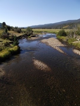
If you’re thinking about drinking water from the backcountry, know that it must be treated for Giardia lamblia, a parasite that can cause an intestinal infection with a variety of symptoms. To avoid this infection, boil water for at least one minute or use a filter capable of removing particles as small as 1 micron.

To help offset the effects of fatigue, bring a lunch and/or snack with you. Food is your body's primary source for fuel and salts (electrolytes) while hiking. Try eating a salty snack every time you take a drink.

Finally, stay away from sodas and alcohol as they will only promote dehydration.

Besides staying properly hydrated, there are a few other things you can do to help avoid over-heating while out on the trail.

For one, go slowly and rest often. Also, try hiking in the early morning as this is coolest part of the day.

Summer also provides a great opportunity to explore trails at the higher elevations in the park where it’s naturally cooler. Keep in mind, however, that the summer season can bring thunderstorms to Glacier. Never ascend above tree line when there’s lightning in the vicinity. If you’re already above tree line when a thunderstorm approaches you’ll want to descend immediately.

Wear moisture-wicking clothing made of polypropylene or polyester to carry sweat and moisture away from your body. Moisture-wicking material keeps you dryer, cooler and more comfortable than a sweat-soaked cotton shirt. It’s also a good idea to wear light colored clothing because it tends to reflect heat away from your body.

Wearing a hat - a baseball hat, or, preferably, a wide-brimmed hat - will help protect your face and neck from the sun. Don’t forget sunscreen either. Sun-burned skin makes you feel hotter.

Finally, you should be aware of heat related health issues on the trail. As part of your first aid training you should know the signs for heat exhaustion, heatstroke and even hyponatremia; and know what to do if someone in your party has any of these signs.

* For additional safety tips, please click here.

* To make sure you have all the essentials before heading out on the trail, please review our hiking checklist.


Jeff
Hiking in Glacier.com

Friday, July 5, 2013

Bighorn Canyon 1st Annual Pass Photo Contest

Have you taken an amazing photo of Bighorn Canyon that you would like to share? For the first time Bighorn Canyon is holding a photo contest looking for a dynamic new photo for the 2014 Bighorn Canyon Annual pass.

Submitted photos will be reviewed by park staff. The top ten photos will then be put on Facebook for park Facebook friends to vote on. The photo with the most votes will be on Bighorn Canyon's 2014 Annual Pass and the photographer will receive photo credit. This photo will be displayed on over 600 passes.

This contest is open to everyone, including Bighorn Canyon NRA employees and their family members. Any entrants under the age of 18, at time of entry, must have parental/legal guardian consent to enter the contest. Entrants will not be eligible to be judges.

Photos submitted for the contest will become property of Bighorn Canyon NRA and may be used on the park website, Facebook site, Twitter, on bulletin boards, brochures or signs. All photographers will receive photo credits if their photos are used.

For rules and participation information please visit the park website.

Submission deadline for entries is midnight, Mountain Standard Time, August 15, 2013.


Jeff
Hiking Glacier National Park

Thursday, July 4, 2013

Data Collection Begins in Grand Teton’s Moose-Wilson Corridor

Visitors traveling through the Moose-Wilson corridor in Grand Teton National Park may encounter researchers along the road, at trailheads, on trails, and in parking areas through October, 2013. Data collection this summer will be led by researchers from Utah State University (USU) though a cooperative agreement with the National Park Service (NPS). These data will be used to inform a planning process that will address future management of the corridor.

Research this summer will help determine visitor use patterns; areas and levels of user-created impacts (such as user-created parking areas and associated trails); and adequacy and efficiency of existing formal parking facilities. A variety of data collection methods will be used, including providing some visitors with GPS units while they visit destinations in, and travel through, the Moose-Wilson corridor. Additionally, researches will install cameras at key intersections to capture vehicle movement and use data from traffic and trail counters to determine levels and patterns of use. No personally identifiable information of visitors will be maintained.

USU professors Chris Monz, Ph.D., and Kevin Heaslip, Ph.D., will lead the research team. Monz and Heaslip have extensive experience collecting these types of data, and Dr. Monz has performed research in other national parks including Yosemite and Rocky Mountain.

The National Park Service is initiating a National Environmental Policy Act (NEPA) planning process to create a comprehensive management plan for the Moose-Wilson corridor in Grand Teton National Park. At this point, the NPS has initiated internal scoping for the project and assembled a planning team. Later this year, the Park Service will begin a formal public engagement process and seek public scoping comments.

The Moose-Wilson corridor, located in the southwest corner of Grand Teton National Park, is an exceptional area and favorite visitor destination within the park that has a remarkable diversity of wildlife and habitat. These unmatched natural communities are located within a geographical area that is about seven miles in length, five miles in width, and 15,000 acres in size. The corridor is delineated by the Teton Range to the west, the Snake River to the east, the community of Moose to the north, and the park's Granite Canyon entrance to the south.


Jeff
Hiking Glacier National Park