Showing posts with label Dawson Pass. Show all posts

Monday, March 11, 2024

Park Saddle Tour at Dawson Pass

Sitting along the Continental Divide at an elevation of 7598 feet, Dawson Pass forms the saddle between 8538-foot Mt. Helen towards the south, and 9225-foot Flinsch Peak to the north. The pass is named for Thomas Dawson, the son of Andrew Dawson, who was an official for the American Fur Company at Fort Benton. His mother was a Blackfoot Indian. Dawson's Blackfoot name was Little Chief, or Inuxina. The pass, therefore, is called Inuxina ozitamisohpi in the Blackfeet language. Dawson also acted as a guide during the early days of Glacier National Park.

If you've ever had the chance to dine at Serrano's Mexican Restaurant in East Glacier Park, you actually stepped foot in Tom Dawson's home. Built in 1909, the converted building is now the oldest house in East Glacier Park.

From its inception as a national park, Dawson Pass has been a popular destination in the Two Medicine area. This photo was taken from the pass in the 1930s, and is likely a group from a Park Saddle Horse tour:
The photo below is also likely that of a Park Saddle Horse tour near Dawson Pass from the 1920s or 30s:
You can read more about the Park Saddle Horse Company and the historic Circle Tours of Glacier National Park here.


                *******************************************************************************

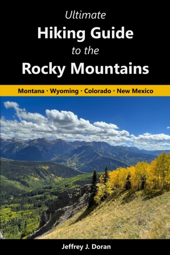
From Montana to New Mexico, the American Rockies stretch for more than a thousand miles. Within this spectacular mountain range are thousands of miles of hiking trails. With such an overwhelming number of options, how will you find and choose the most scenic and rewarding hikes?

Ultimate Hiking Guide to the Rocky Mountains takes all the guesswork out by focusing on some of the most amazing hikes across this range, and provides you with a handpicked list of options that will allow you to make the most of your trips in the Rockies:


Tuesday, July 31, 2012

Trail to Pitamakan Pass is now clear

The latest Trail Status update on the park website shows that the trail to Pitamakan Pass is now clear. The 15.4-mile roundtrip hike out of the Two Medicine area is perhaps one of the more underrated hikes in the park. The views from the knife-edge ridge are simply ouitstanding. Several lakes can be seen from either side of the pass, including Pitamakan Lake:

The more adventurous can continue on by taking the trail around Mt. Morgan which leads to Dawson Pass, and then back down to Two Medicine Lake, to create an epic 14.8-mile loop (provided you catch the shuttle boat in time – otherwise it would be 17.6-mile hike!). According to the latest update, "Dawson pass to Morgan ridge (is) clear and dry".


Jeff
Hikes in Glacier National Park

Thursday, February 23, 2012

Glacier's High Country

To see the best of what Glacier National Park has to offer you have to go deep into the high country. Fortunately, with more than 740 miles of trails meandering throughout the park, it's pretty easy to find a trail that offers mind blowing scenery.

Although not quite as popular as some of the other areas of the park, the Two Medicine area still provides some incredibly beautiful scenery. One of the best hikes in this area is Scenic Point. The rock outcropping that sits just above alpine tundra meadows, offers panoramic views of the Two Medicine Valley. On a clear day you can even see the Sweet Grass Hills rising above the Great Plains 90 miles away!

One of the most popular backcountry hikes in the Two Medicine area is the one up to Dawson Pass. Near the top a group of 9 or 10 bighorn sheep passed by us, no more than 20 yards away. As you can see, most of them were relatively young lambs. They stopped just long enough on this perch for a nice photo op:

Dawson Pass usually gets all the attention in Two Medicine. However, at least for me, I thought the views from Pitamakan Pass were much more dramatic. From the knife-edge pass you can see five lakes on either side of you. In this photo is the largest, Pitamakan Lake, sitting like a sapphire gem almost 800 feet below the pass:

This photo was also taken at Pitamakan Pass. The clouds above Rising Wolf Mountain were quite interesting:

One of my new favorite areas in Glacier is Preston Park, a large, incredibly beautiful alpine meadow, located in the valley between Mt. Siyeh and Matahpi Peak (near Logan Pass):

Of course one of the most popular hikes in Glacier is the Highline Trail. This world famous hike should be on the bucket list of any self respecting hiker. The views, the wildlife and the wildflowers, all combine to make this a hike you'll remember the rest of your life. From Logan Pass, high adventure awaits right from the start. Hikers have to walk on a six-foot ledge for roughly a quarter of a mile. One false move and your next stop is on the pavement of the Going-To-The-Sun Road, more than hundred feet below:

99% of the Highline Trail passes through open country, so there's never any dull scenery:

The trail is famous for wildlife as well, especially bighorn sheep and mountain goats. This goat was sitting on a ledge right below the trail when we passed him:

Glacier is also famous for its two backcountry chalets, Sperry and Granite Park. Similar to the LeConte Lodge, the only way to reach these is by foot or horseback. The Granite Park Chalet can be reached via a 7.6 mile hike along the Highline Trail, or a 4.2 mile climb from The Loop area on the Going-To-The-Sun Road:


Jeff
Hiking in Glacier.com