The following timeline of key dates in the history of hiking was adapted from my new book, Ramble On: A History of Hiking:
Over the last several decades, the sport of hiking has become one of the most popular outdoor activities in the world. According to the latest National Survey on Recreation and the Environment, 33.9% of all Americans above the age of 15 participated in hiking during the period between 2005 and 2009. Amazingly, there are several other countries that have far higher participation rates than the United States. This trend, however, leads to the burning question; when did people begin taking to the trail for pleasure? Since the dawn of mankind, humans have walked the earth to hunt, forage for wild edibles, explore, trade goods with neighboring communities, and migrate to other regions. At some point in our long evolution we realized that we didn’t need a utilitarian reason to walk. Somewhere along the line we discovered the joy of traipsing through the countryside, observing the beauty of a wildflower, watching wildlife in their natural habitat, marveling at the roar of a waterfall, or contemplating the scenic grandeur from the top of a mountain. Is this a fairly recent phenomenon, or is this an innate characteristic of human beings? No matter the answer to that question, the following are the key milestones in the history of hiking that has led to its immense popularity today:
~3300 BCE: In 1991, two German tourists discovered the mummified remains of “Otzi the Iceman” in the Ötztal Alps along the Austrian–Italian border. Although scientists aren’t entirely sure what this late-Neolithic man was doing at an elevation hovering just over 10,500 feet, there are some who have speculated that he may have been an early mountaineer. More importantly, however, the remnants of the rucksack (or backpack) that he carried on his back is the oldest rucksack ever found.
125: The 2nd century Roman Emperor, Hadrian, hiked to the summit of Mt. Etna on Sicily to see the sunrise, making this the earliest recorded hike for pleasure.
1642: Darby Field makes the first recorded ascent of Mt. Washington in New Hampshire, which would become the focus of one of the first tourist destinations in the United States in the early 1800s.
1760: The Industrial Revolution begins in Great Britain, and is generally recognized as lasting until the start of World War I. The Industrial Revolution gave rise to the labor movement, automobiles, environmentalism, club culture, and even art. As a result, it's arguably the single most important event to spur the development of hiking and walking for pleasure.
1778: Thomas West, an English priest, publishes A Guide to the Lakes, a detailed account of the scenery and landscape of the Lake District in northwestern England. The guide helped to popularize the idea of walking for pleasure, and is credited as being one of the first travel guides.
1786: The modern era of mountaineering is marked by the first ascent of 15,771-foot Mont Blanc in France, the tallest peak in the Alps.
1799: Williams College (of Massachusetts) President Ebenezer Fitch ascends Mt. Greylock with two other companions.
1819: Abel Crawford, along with his son Ethan, blaze an 8.25-mile trail to the summit of Mt. Washington in New Hampshire. The path is recognized as the oldest continually used hiking trail in the United States, and is likely the first footpath in the entire world to be built specifically for recreational hiking.
1830: A crew of 100 students and professors from Williams College blaze the Hopper Trail to the summit of Mt. Greylock. Later that same year, students constructed a 37-foot wooden tower atop the mountain. This tower, and its replacement, were maintained into the 1850s, and were used for sightseeing and scientific observations.
1850: The Exploring Circle is founded by Cyrus M. Tracey and three other men from Lynn, Massachusetts. The National Park Service recognizes the club as being “the first hiking club in New England," thus, in all likelihood, making it the first hiking club in the world.
1854: The beginning of the systematic sport of modern mountaineering as we essentially know it today is marked by the ascent of the Wetterhorn in the Swiss Alps by Sir Alfred Wills. His book, Wanderings Among the High Alps, published two years later, helped make mountaineering fashionable in Britain, and ushered in the systematic exploration of the Alps by British mountaineers. These events also marked the beginning of the so-called “Golden Age of Alpinism.”
1857: The world's first mountaineering club, the Alpine Club, was founded in London.
1863: Professor Albert Hopkins of Williams College founds the Alpine Club of Williamstown, whose stated mission was “to explore the interesting places in the vicinity, to become acquainted, to some extent at least, with the natural history of the localities, and also to improve the pedestrian powers of the members”. It was the first hiking club to accept women as members, which likely provided an important template for future hiking clubs in America.
1867: John Muir begins a 1000-mile walk from Indiana to Florida, which was recounted in his book, A Thousand-Mile Walk to the Gulf. The trek launched a lifetime career of hiking and wilderness advocacy. His conservation efforts, articles and books would help to establish several national parks during and after his lifetime.
1872: Yellowstone becomes the world’s first national park after legislation is signed by President U.S. Grant.
1876: The Appalachian Mountain Club, America’s oldest recreational organization, is founded to explore and protect the trails and mountains of New England.
1876: Newtown, England entrepreneur Pryce Pryce-Jones designs the "Euklisia Rug", considered by many to be the forerunner of the modern sleeping bag. The rug included a wool blanket with a pocket at the top for a sewn-in, inflatable, rubber pillow. Once inside, the camper (or soldier) folded the blanket over and fastened it together, thus keeping themselves “snug in a rug”.
1879: One of the first hiking clubs in England, the "Sunday Tramps," was founded by Leslie White. These early “rambling” (the English word for hiking or walking) clubs sprang up in the northern areas of England as part of a campaign for the legal "right to roam," a response to the fact that much of the land in England was privately owned.
1882: William Pickering publishes Walking Guide to the Mt. Washington Range, which is arguably the first modern trail guide to be published America.
1887: The first external frame rucksack is patented by Colonel Henry C. Merriam.
1922: Australian climber George Finch designs and wears a knee-length eiderdown parka during the 1922 British Everest Expedition. The shell of the coat was made from the waterproofed-cotton fabric of a hot-air balloon, which was filled with duck down. During the expedition, Finch and climbing partner Geoffrey Bruce reached a height of 27,300 feet during their summit attempt, which set the record for the highest altitude attained by any human up to that point.
1922: Lloyd F. Nelson submits his application to the U.S. Patent Office for his "Trapper Nelson's Indian Pack Board," which is acknowledged to be the first commercially successful external-frame backpack to be sold in the U.S. The "Trapper Nelson" featured a wooden "pack board" as its frame. Attached to the frame was a canvas sack that contained the hiker's gear, which rested on the hiker's body by two canvas shoulder-straps. Prior to his invention most hikers used a rucksack, which was essentially a loose sack with shoulder straps.
1930: The Green Mountain Club completes construction of the Long Trail, making it the first long-distance hiking trail in the United States.
1937: Italian climber and mountaineering guide, Vitale Bramani, invents "Carrarmato," which tranlates to “tank tread" in English. This new rubber lug pattern provides mountaineering boots with outstanding traction, and allows them to be used on a variety of surfaces. The product is launched under the brand name "Vibram".
1937: America's first “grand” trail, the Appalachian Trail, was completed in August of 1937. A forester by the name of Benton MacKaye conceived the idea in 1921.
1948: Earl Shaffer becomes the first person to thru-hike the entire Appalachian Trail.
1967: Climber Greg Lowe invents the internal frame backpack. The “Expedition Pack” also featured the first adjustable back system, first side compressors, first sternum strap and the first load stabilizers.
1968: The National Trails System Act is passed by Congress, resulting in thousands of miles of trails being designated as National Scenic Trails, National Historic Trails and National Recreation Trails.
1969: Bob Gore accidentally stretches a heated rod of polytetrafluoroethylene by almost 800%, which forms a microporous structure that was roughly 70% air. The discovery was introduced to the public under the trademark of "Gore-Tex," which became the first breathable, waterproof, and windproof fabric.
1992: Ray Jardine introduces the concept of ultralight backpacking with the release of his book, The Pacific Crest Trail Hiker's Handbook. During his first PCT thru-hike Jardine’s pack weighed just 25 pounds. By his third hike it weighed less than 9 pounds. “Ray’s Way” of thinking has led to several innovations that have benefitted both backpackers and hikers.
This timeline is only a brief overview of the people, events, inventions and social trends that have helped to shape the sport of hiking as we know it today. If you enjoyed this post, please check out my new book on the history of hiking, which provides a much more in-depth narrative on the rich and compelling history of hiking.
*******************************************************************************
Virtually no one went hiking before the 19th century. What occurred that inspired ordinary people to take a walk through the woods for pleasure? Ramble On: A History of Hiking explores the rich history of hiking, and how it evolved into one of the most popular pastimes in the world.
Friday, October 30, 2026
Key Milestones in the History of Hiking
Thursday, October 29, 2026
Bridger-Teton hosts open house on proposed non-motorized trail additions in Greater Snow King area
The Bridger-Teton National Forest, Jackson Ranger District invites the public to participate in an open house on Monday, Nov. 16, to learn more about four proposed non-motorized trail additions in the Greater Snow King Area to help reduce congestion and conflicts.
The proposed trails are the Ferrin’s Trail Alternate, Josie’s Ridge Trail Alternate, Leeks Canyon Trail Alternate, and Game Creek Parallel Trail. The proposals reflect more than 25 years of collaboration between the Forest Service, Friends of Pathways, local land managers and community members.
Environmental analysis and on-the-ground surveys of each proposed route were completed during summer 2026 by interdisciplinary specialists in wildlife, cultural resources, botany, fisheries, recreation, hydrology, rangeland management, and invasive species.
If approved, the four trail projects would be constructed over the next five years under a Categorical Exclusion USDA-26-USFS, “Construction and reconstruction of trails.” Trail building would be supported by a Forest Service trail crew, Friends of Pathways, conservation corps and volunteers. All new routes would follow Universal Trail Design principles to provide accessible, sustainable and enjoyable trail experiences for a wide range of users. National Environmental Policy Act analysis, along with the 2020 Jackson Ranger District Trails Assessment, will guide planning to ensure alignment with wildlife needs, sustainable trail design and community expectations.
Members of the public are encouraged to attend the open house to learn more and discuss the proposals with specialists. Jackson Ranger District staff will review the proposals and answer questions from 5 to 7 p.m. at the Jackson Ranger District Office, 340 North Cache Street in Jackson, Wyo.
For more details, visit the Proposed Greater Snow King Area Non-motorized Trail Additions webpage.
************************************************************************************
Check out our online trail guides:
The proposed trails are the Ferrin’s Trail Alternate, Josie’s Ridge Trail Alternate, Leeks Canyon Trail Alternate, and Game Creek Parallel Trail. The proposals reflect more than 25 years of collaboration between the Forest Service, Friends of Pathways, local land managers and community members.
Environmental analysis and on-the-ground surveys of each proposed route were completed during summer 2026 by interdisciplinary specialists in wildlife, cultural resources, botany, fisheries, recreation, hydrology, rangeland management, and invasive species.
If approved, the four trail projects would be constructed over the next five years under a Categorical Exclusion USDA-26-USFS, “Construction and reconstruction of trails.” Trail building would be supported by a Forest Service trail crew, Friends of Pathways, conservation corps and volunteers. All new routes would follow Universal Trail Design principles to provide accessible, sustainable and enjoyable trail experiences for a wide range of users. National Environmental Policy Act analysis, along with the 2020 Jackson Ranger District Trails Assessment, will guide planning to ensure alignment with wildlife needs, sustainable trail design and community expectations.
Members of the public are encouraged to attend the open house to learn more and discuss the proposals with specialists. Jackson Ranger District staff will review the proposals and answer questions from 5 to 7 p.m. at the Jackson Ranger District Office, 340 North Cache Street in Jackson, Wyo.
For more details, visit the Proposed Greater Snow King Area Non-motorized Trail Additions webpage.
************************************************************************************
Check out our online trail guides:
- Glacier National Park: HikinginGlacier.com
- Grand Teton National Park: TetonHikingTrails.com
- Rocky Mountain National Park: RockyMountainHikingTrails.com
Tuesday, October 27, 2026
Women’s Hiking Attire During The Victorian Era
The following is an excerpt from my new book, Ramble On: A History of Hiking.
During the Victorian Era, women's hiking attire was an extremely complicated affair. The subject was frequently discussed and debated throughout the pages of Appalachia during the Appalachian Mountain Club’s first decade or so. The December 1887 issue of the journal ran a lengthy article by Mrs. L. D. Pychowska on the “walking-costume for ladies.” It provided head-to-toe advice on how women should dress for a hike. This included wearing grey flannel trousers beneath two skirts. The underskirt, which reached to just below the knee, was also to be made of grey flannel. The outer skirt, however, was to be made of winsey or Kentucky jean, both of which were considered to be strong enough to resist tearing while walking through briars and undergrowth. The outer skirt was also meant to be worn to ankle length. However, if the hiker was traversing along steep terrain, she could simply pull out a strong clasp pin and raise the skirt higher, “washwomen fashion,” until the difficult section was completed. “Basquines,” or corsets, were optional apparel according to the author. At the end of the detailed piece, the writer assured club members that her recommendations on female attire would be “sufficiently presentable to enter a hotel or a railroad car” after a long tramp “without attracting uncomfortable attention.”
The practicalities of wearing a “costume” such as this, however, weren’t considered or debated in Mrs. Pychowska’s article. Conversely, a passage in an article from the June 1877 issue of Appalachia put an exclamation point on the dangers women faced as a result of the clothing they were forced to wear while tramping. The author related the story of a guided hike on Mt. Washington during the prior year. While descending Tuckerman Ravine, one of the ladies in the group paused momentarily to stand atop a large rock above a 25-foot outcrop. Unbeknownst to the hiker, her tattered dress had become snagged on a sharp protrusion on the rock. When she attempted to jump to another large rock, the snag violently jolted her back and left her dangling upside down above the abyss. Fortunately, the mountain guide was nearby and was able to pull the woman to safety before falling.
Apparently, women’s dresses could be a nuisance to men as well. In a passage on how to pack and dress for an excursion in A Lady’s Tour Round Monte Rosa, published in 1859, Eliza Cole observed that “A lady's dress is inconvenient for mountain travelling, even under the most careful management, and therefore every device which may render it less so should be adopted.” She continued by offering a viable solution, while also highlighting an unusual hazard that resulted from women wearing dresses in the mountains:
With the arrival of daylight the next morning, to their complete and utter horror, George and Lucy discovered they were within sight of the Tip Top House. Had they known they were that close, they could’ve easily made it to safety, and Lizzie likely would’ve survived. After her death, tourists and hikers began piling rocks on the spot where she succumbed. A stone monument now stands near the site to mark and commemorate her passing.
Did Lizzie’s attire contribute to her death? I think it’s very possible that it did. She wore a heavy skirt, petticoat, pantaloons and stockings. Nicholas Howe, author of Not Without Peril: 150 Years Of Misadventure On The Presidential Range Of New Hampshire, estimates that Lizzie may have worn as much as 45 yards of fabric! After the outfit was soaked in cold rain, there’s no doubt this would’ve weighed her down, resulting in more stress on her heart, and certainly would’ve accelerated the effects of fatigue, exposure and hypothermia.
While Mrs. Pychowska was espousing the benefits of wearing proper “costumes” that would comply with the mores of the Victorian Era, there was a long debate, at least among female members in the Appalachian Mountain Club, about what women should wear while hiking. During the May 9th meeting chronicled in the June 1877 edition of Appalachia, a Miss Whitman suggested that skirts be designed in a manner so that they “could be shortened to any necessary extent by rolling it up.” A Mrs. Nowell discussed the “disadvantage of ladies on mountain excursions on account of their long skirts, and recommended the use of gymnasium dresses or something similar, as an outside garment for such occasions.” In that same edition, Mrs. W.G. Nowell, one of the founding members of the club, and presumably the same Mrs. Nowell who spoke out during the May 9th meeting, contributed an article titled “A Mountain Suit for Women.” In this piece, Harriet (Mrs. W.G. Nowell) once again took issue with the garb women were expected to wear during this era. She also mentioned discussions she had with other women in the club about the impracticalities and dangers of women’s hiking attire. Apparently they had carefully deliberated over what their alternatives were and presented a possible solution: “The only thing we could think of was a good flannel bathing suit.” Mrs. Nowell continued by stating that they “could not see why it should be more improper to wear this” while hiking “than it would be along a crowded and fashionable beach.” She went on to make the point that women would be “relieved of the excessive weight of her ordinary dress,” thus allowing them to carry their own gear. She concluded her piece by declaring that “Our dress has done all the mischief. For years it has kept us away from the glory of the woods and the grandeur of the mountain heights. It is time we should reform.”
An article published on the Tramp & Trail Club of Utica’s website notes that by the 1920s women had solved the problem of impractical skirts by stuffing them in knapsacks once they had reached the trailhead, and then putting them back on before returning to town. Bold and daring women eschewed skirts altogether and simply wore knickers with long socks. Taking the Lead: Women and the White Mountains, an online exhibit on the Museum of the White Mountains at Plymouth State University’s website, notes that skirts had virtually disappeared by the mid-1910s, and by the 1930s, women were basically wearing clothes that are similar to what female hikers wear today, including shorts and halter tops.
Ramble On: A History of Hiking chronicles the evolution of hiking gear and apparel, including many other stories about the attire both men and women wore during the early years of the sport. This new, improved and expanded edition on hiking history is now available on Amazon.
Other excerpts from Ramble On:
* The Etymology of Hiking
* How did hiking become so popular across the globe?
* The Historic Circle Tours of Glacier National Park
* The Evolution of Hiking Boots
*******************************************************************************
Virtually no one went hiking before the 19th century. What occurred that inspired ordinary people to take a walk through the woods for pleasure? Ramble On: A History of Hiking explores the rich history of hiking, and how it evolved into one of the most popular pastimes in the world.
During the Victorian Era, women's hiking attire was an extremely complicated affair. The subject was frequently discussed and debated throughout the pages of Appalachia during the Appalachian Mountain Club’s first decade or so. The December 1887 issue of the journal ran a lengthy article by Mrs. L. D. Pychowska on the “walking-costume for ladies.” It provided head-to-toe advice on how women should dress for a hike. This included wearing grey flannel trousers beneath two skirts. The underskirt, which reached to just below the knee, was also to be made of grey flannel. The outer skirt, however, was to be made of winsey or Kentucky jean, both of which were considered to be strong enough to resist tearing while walking through briars and undergrowth. The outer skirt was also meant to be worn to ankle length. However, if the hiker was traversing along steep terrain, she could simply pull out a strong clasp pin and raise the skirt higher, “washwomen fashion,” until the difficult section was completed. “Basquines,” or corsets, were optional apparel according to the author. At the end of the detailed piece, the writer assured club members that her recommendations on female attire would be “sufficiently presentable to enter a hotel or a railroad car” after a long tramp “without attracting uncomfortable attention.”
The practicalities of wearing a “costume” such as this, however, weren’t considered or debated in Mrs. Pychowska’s article. Conversely, a passage in an article from the June 1877 issue of Appalachia put an exclamation point on the dangers women faced as a result of the clothing they were forced to wear while tramping. The author related the story of a guided hike on Mt. Washington during the prior year. While descending Tuckerman Ravine, one of the ladies in the group paused momentarily to stand atop a large rock above a 25-foot outcrop. Unbeknownst to the hiker, her tattered dress had become snagged on a sharp protrusion on the rock. When she attempted to jump to another large rock, the snag violently jolted her back and left her dangling upside down above the abyss. Fortunately, the mountain guide was nearby and was able to pull the woman to safety before falling.
Apparently, women’s dresses could be a nuisance to men as well. In a passage on how to pack and dress for an excursion in A Lady’s Tour Round Monte Rosa, published in 1859, Eliza Cole observed that “A lady's dress is inconvenient for mountain travelling, even under the most careful management, and therefore every device which may render it less so should be adopted.” She continued by offering a viable solution, while also highlighting an unusual hazard that resulted from women wearing dresses in the mountains:
Small rings should be sewn inside the seams of the dress, and a cord passed through them, the ends of which should be knotted together in such a way that the whole dress may be drawn up at a moment's notice to the requisite height. If the dress is too long, it catches the stones, especially when coming down hill, and sends them rolling on those below. I have heard more than one gentleman complain of painful blows suffered from such accidents.In one particular instance, the burdensome attire that women were expected to wear may have been, at the very least, partially responsible for the death of one female hiker. On September 13, 1855, 22-year-old Lizzie Bourne of Kennebunk, Maine became the first woman to perish while climbing Mt. Washington, and quite possibly the first female to die while hiking in America. On that late summer day, Lizzie had planned to hike to the Tip Top House atop Mount Washington with her uncle George and her cousin Lucy. Though early morning rain forced the group to postpone their trek, the weather eventually cleared, and they set out after lunch by proceeding up the partially completed carriage road. As the party climbed higher, however, they encountered another round of foul weather while ascending the Glen House Bridle Path, which continued to worsen with each step forward. In a letter to the Boston Journal, which was intended to provide “a correct account of the whole affair,” George Bourne attested that “Elizabeth began to show signs of weariness, and needed assistance” as they continued towards the summit. With night rapidly falling upon the mountains, darkness and fog conspired to obscure the view of their destination. Extreme fatigue also crept into each of them. Not knowing exactly where they were or how far they were from their objective, the trio made the decision to lie down on the trail and wait out the night. Despite building a windbreak out of nearby rocks, George was convinced that each of them would perish as a result of the extreme cold and violent wind. Indeed, that night, around ten o'clock, Lizzie quietly passed away while lying on the icy trail. In his letter to the Boston Journal, Bourne stated that it was “evident that Elizabeth did not die from the cold alone, but from some organic affection of the heart or lungs, induced by fatigue and exposure.”
With the arrival of daylight the next morning, to their complete and utter horror, George and Lucy discovered they were within sight of the Tip Top House. Had they known they were that close, they could’ve easily made it to safety, and Lizzie likely would’ve survived. After her death, tourists and hikers began piling rocks on the spot where she succumbed. A stone monument now stands near the site to mark and commemorate her passing.
Did Lizzie’s attire contribute to her death? I think it’s very possible that it did. She wore a heavy skirt, petticoat, pantaloons and stockings. Nicholas Howe, author of Not Without Peril: 150 Years Of Misadventure On The Presidential Range Of New Hampshire, estimates that Lizzie may have worn as much as 45 yards of fabric! After the outfit was soaked in cold rain, there’s no doubt this would’ve weighed her down, resulting in more stress on her heart, and certainly would’ve accelerated the effects of fatigue, exposure and hypothermia.
While Mrs. Pychowska was espousing the benefits of wearing proper “costumes” that would comply with the mores of the Victorian Era, there was a long debate, at least among female members in the Appalachian Mountain Club, about what women should wear while hiking. During the May 9th meeting chronicled in the June 1877 edition of Appalachia, a Miss Whitman suggested that skirts be designed in a manner so that they “could be shortened to any necessary extent by rolling it up.” A Mrs. Nowell discussed the “disadvantage of ladies on mountain excursions on account of their long skirts, and recommended the use of gymnasium dresses or something similar, as an outside garment for such occasions.” In that same edition, Mrs. W.G. Nowell, one of the founding members of the club, and presumably the same Mrs. Nowell who spoke out during the May 9th meeting, contributed an article titled “A Mountain Suit for Women.” In this piece, Harriet (Mrs. W.G. Nowell) once again took issue with the garb women were expected to wear during this era. She also mentioned discussions she had with other women in the club about the impracticalities and dangers of women’s hiking attire. Apparently they had carefully deliberated over what their alternatives were and presented a possible solution: “The only thing we could think of was a good flannel bathing suit.” Mrs. Nowell continued by stating that they “could not see why it should be more improper to wear this” while hiking “than it would be along a crowded and fashionable beach.” She went on to make the point that women would be “relieved of the excessive weight of her ordinary dress,” thus allowing them to carry their own gear. She concluded her piece by declaring that “Our dress has done all the mischief. For years it has kept us away from the glory of the woods and the grandeur of the mountain heights. It is time we should reform.”
An article published on the Tramp & Trail Club of Utica’s website notes that by the 1920s women had solved the problem of impractical skirts by stuffing them in knapsacks once they had reached the trailhead, and then putting them back on before returning to town. Bold and daring women eschewed skirts altogether and simply wore knickers with long socks. Taking the Lead: Women and the White Mountains, an online exhibit on the Museum of the White Mountains at Plymouth State University’s website, notes that skirts had virtually disappeared by the mid-1910s, and by the 1930s, women were basically wearing clothes that are similar to what female hikers wear today, including shorts and halter tops.
Ramble On: A History of Hiking chronicles the evolution of hiking gear and apparel, including many other stories about the attire both men and women wore during the early years of the sport. This new, improved and expanded edition on hiking history is now available on Amazon.
Other excerpts from Ramble On:
* The Etymology of Hiking
* How did hiking become so popular across the globe?
* The Historic Circle Tours of Glacier National Park
* The Evolution of Hiking Boots
*******************************************************************************
Virtually no one went hiking before the 19th century. What occurred that inspired ordinary people to take a walk through the woods for pleasure? Ramble On: A History of Hiking explores the rich history of hiking, and how it evolved into one of the most popular pastimes in the world.
Monday, October 26, 2026
Chiricahua National Monument Becomes America’s Newest National Park
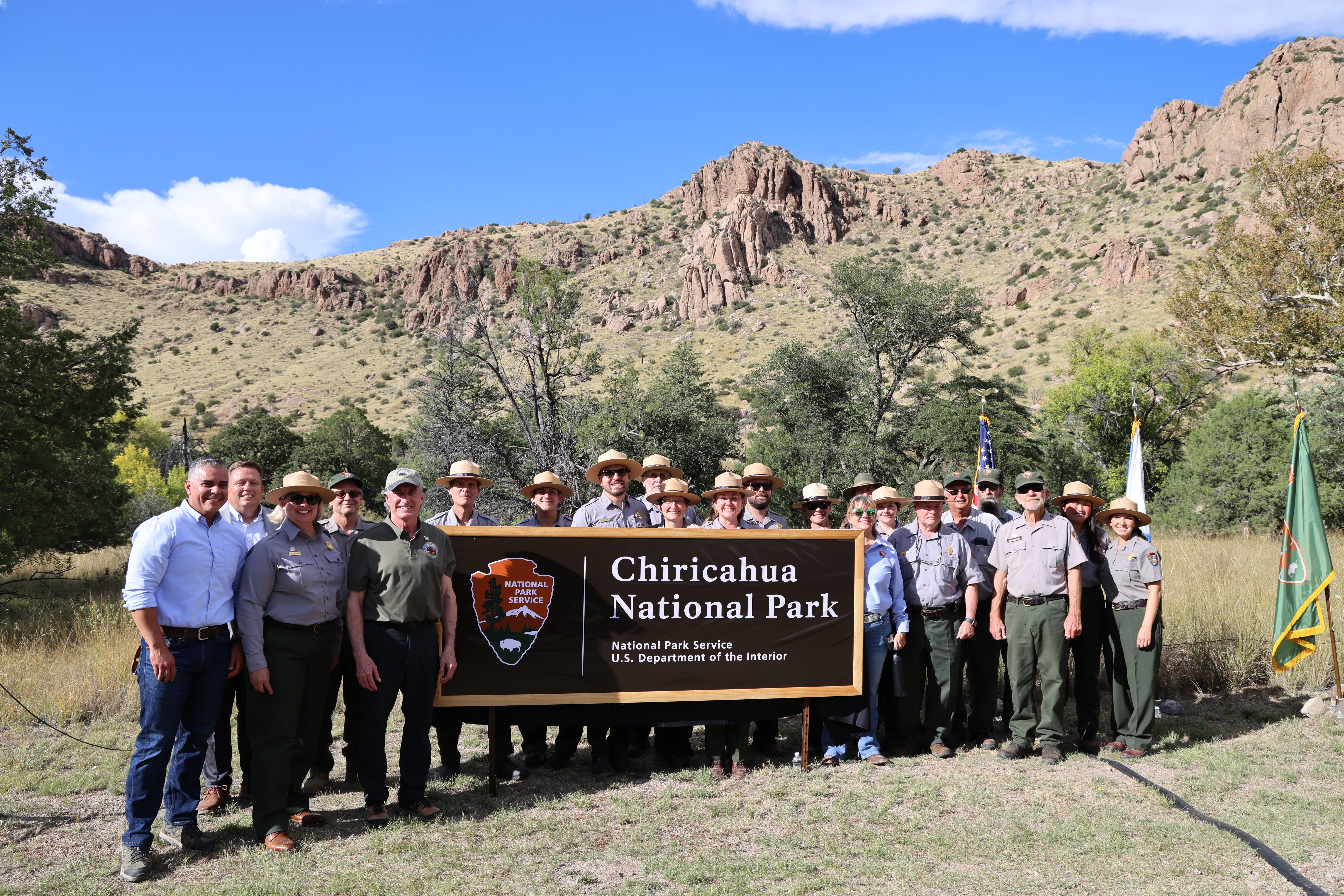
Chiricahua National Monument is now Chiricahua National Park, following President Donald J. Trump's signing of the Chiricahua National Park Act into law on Oct. 20, 2026. The redesignation recognizes the national significance of the area's extraordinary natural and cultural resources and marks a new chapter for one of Arizona's most distinctive landscapes.
“Chiricahua’s towering rock spires, rich Apache heritage and remarkable biodiversity make it one of America’s most extraordinary landscapes,” said Secretary of the Interior Doug Burgum. “This new designation will shine a national spotlight on one of Arizona’s hidden gems, creating opportunities to welcome more visitors, strengthen local economies and share this incredible landscape with more Americans.” Located in the southeastern corner of Arizona, the park protects a landscape of towering rhyolite rock spires and balanced rocks formed by an ancient volcanic eruption roughly 27 million years ago. Rising from the “sky island” of the Chiricahua Mountains, where desert, grassland, and forest ecosystems meet, the area supports remarkable biodiversity and provides opportunities for hiking, wildlife viewing, birding and stargazing.
“Chiricahua has been part of the National Park System for more than a century, and this new designation marks an exciting chapter in its history,” said Jessica Bowron, Comptroller Exercising the Delegated Authority of the Director of the National Park Service. “While its name is changing, our commitment remains the same: protecting this remarkable landscape and its cultural heritage while providing opportunities for visitors to experience and enjoy it for generations to come.”
First protected as a national monument in 1924, Chiricahua preserves thousands of years of human history, including its importance as the homeland of the Chiricahua Apache and its legacy of early homesteading families at Faraway Ranch. The redesignation reflects the national significance of the area’s natural and cultural resources and the longstanding efforts to conserve them.
The park will continue to offer its hiking, camping, scenic drives, wildlife viewing and other opportunities. Visitors can find current information at nps.gov/chir.
************************************************************************************
Check out our online trail guides:
“Chiricahua’s towering rock spires, rich Apache heritage and remarkable biodiversity make it one of America’s most extraordinary landscapes,” said Secretary of the Interior Doug Burgum. “This new designation will shine a national spotlight on one of Arizona’s hidden gems, creating opportunities to welcome more visitors, strengthen local economies and share this incredible landscape with more Americans.” Located in the southeastern corner of Arizona, the park protects a landscape of towering rhyolite rock spires and balanced rocks formed by an ancient volcanic eruption roughly 27 million years ago. Rising from the “sky island” of the Chiricahua Mountains, where desert, grassland, and forest ecosystems meet, the area supports remarkable biodiversity and provides opportunities for hiking, wildlife viewing, birding and stargazing.
“Chiricahua has been part of the National Park System for more than a century, and this new designation marks an exciting chapter in its history,” said Jessica Bowron, Comptroller Exercising the Delegated Authority of the Director of the National Park Service. “While its name is changing, our commitment remains the same: protecting this remarkable landscape and its cultural heritage while providing opportunities for visitors to experience and enjoy it for generations to come.”
First protected as a national monument in 1924, Chiricahua preserves thousands of years of human history, including its importance as the homeland of the Chiricahua Apache and its legacy of early homesteading families at Faraway Ranch. The redesignation reflects the national significance of the area’s natural and cultural resources and the longstanding efforts to conserve them.
The park will continue to offer its hiking, camping, scenic drives, wildlife viewing and other opportunities. Visitors can find current information at nps.gov/chir.
************************************************************************************
Check out our online trail guides:
- Glacier National Park: HikinginGlacier.com
- Grand Teton National Park: TetonHikingTrails.com
- Rocky Mountain National Park: RockyMountainHikingTrails.com
Thursday, October 22, 2026
White Nose Syndrome Detected in Bats in Glacier National Park
Glacier National Park has confirmed the presence of white-nose syndrome in a little brown bat found deceased in the Saint Mary area of the park in May. Samples collected from live bats in June also confirmed the presence of Pseudogymnoascus destructans, the fungus that causes WNS, in multiple bats on the park’s east side. These are the first detections of both the fungus and WNS in Glacier National Park and Glacier County.
WNS is a disease caused by a fungus that infects hibernating bats. The disease causes bats to wake during hibernation, depleting critical fat reserves and often leading to dehydration, starvation and death.
With support from the Glacier National Park Conservancy, Natural Resource Fund Source and National Fish and Wildlife Foundation, Glacier National Park has monitored bat diversity, occupancy and health since 2011. Biologists have documented 10 bat species within the park. All bats in Glacier feed on insects and serve as prey for other wildlife, including raptors and weasels. Significant declines in bat populations could have far-reaching effects on the park’s ecosystems and neighboring landscapes.
The park is also participating in ongoing research to evaluate a vaccine designed to protect bats from white-nose syndrome. Between 2024 and 2026, park biologists captured and processed 529 bats as part of the study. Of those, 265 received a vaccine, while 264 received a placebo. Each bat was fitted with a tag, allowing researchers to monitor survival rates as the bats emerge from hibernation each spring. By comparing survival rates between vaccinated bats and those that received the placebo, researchers hope to better understand the vaccine’s effectiveness in protecting bats in the wild against white-nose syndrome.
Since its discovery in 2006 in New York state, WNS has spread across North America, killing millions of bats. The disease spreads primarily through bat-to-bat contact, and the fungus can persist in underground environments for many years, continuing to infect new bats. WNS has been confirmed in 42 states and 9 Canadian provinces.
WNS does not infect humans or pets. However, people can unintentionally spread the fungus to new areas on clothing, shoes and caving equipment. To help protect bats, never handle or pick up a bat. After visiting a cave or other bat habitat, decontaminate gear, footwear and clothing by following U.S. Fish and Wildlife Service decontamination guidance.
Learn more about White Nose Syndrome and how it impacts bats.
************************************************************************************
Check out our online trail guides:
WNS is a disease caused by a fungus that infects hibernating bats. The disease causes bats to wake during hibernation, depleting critical fat reserves and often leading to dehydration, starvation and death.
With support from the Glacier National Park Conservancy, Natural Resource Fund Source and National Fish and Wildlife Foundation, Glacier National Park has monitored bat diversity, occupancy and health since 2011. Biologists have documented 10 bat species within the park. All bats in Glacier feed on insects and serve as prey for other wildlife, including raptors and weasels. Significant declines in bat populations could have far-reaching effects on the park’s ecosystems and neighboring landscapes.
The park is also participating in ongoing research to evaluate a vaccine designed to protect bats from white-nose syndrome. Between 2024 and 2026, park biologists captured and processed 529 bats as part of the study. Of those, 265 received a vaccine, while 264 received a placebo. Each bat was fitted with a tag, allowing researchers to monitor survival rates as the bats emerge from hibernation each spring. By comparing survival rates between vaccinated bats and those that received the placebo, researchers hope to better understand the vaccine’s effectiveness in protecting bats in the wild against white-nose syndrome.
Since its discovery in 2006 in New York state, WNS has spread across North America, killing millions of bats. The disease spreads primarily through bat-to-bat contact, and the fungus can persist in underground environments for many years, continuing to infect new bats. WNS has been confirmed in 42 states and 9 Canadian provinces.
WNS does not infect humans or pets. However, people can unintentionally spread the fungus to new areas on clothing, shoes and caving equipment. To help protect bats, never handle or pick up a bat. After visiting a cave or other bat habitat, decontaminate gear, footwear and clothing by following U.S. Fish and Wildlife Service decontamination guidance.
Learn more about White Nose Syndrome and how it impacts bats.
************************************************************************************
Check out our online trail guides:
- Glacier National Park: HikinginGlacier.com
- Grand Teton National Park: TetonHikingTrails.com
- Rocky Mountain National Park: RockyMountainHikingTrails.com
Wednesday, October 21, 2026
National Park Service, Yellowstone Forever, and Blackstone Infrastructure’s Tallgrass Announce $105 Million Fund for Yellowstone National Park
The National Park Service, together with its official nonprofit and philanthropic partner, Yellowstone Forever, and Blackstone Infrastructure portfolio company Tallgrass, announces the establishment of a $105 million Conservation and Stewardship Fund, creating a permanent source of support for the long-term stewardship of the world’s first national park.
The fund will direct resources toward three priorities essential to Yellowstone’s long-term stewardship: advancing conservation and research to extend the reach and impact of the park’s scientific work; enhancing access and visitor experience through investments in infrastructure; and expanding opportunities for Wyoming students and community members to experience Yellowstone.
This latter effort will include the establishment of the Tallgrass WYld Yellowstone Initiative, named for the long-time Wyoming energy infrastructure operator with more than a decade of operations in the Cowboy State.
“More than 120 years ago, President Theodore Roosevelt laid the cornerstone of Yellowstone’s iconic gateway, enshrining the promise that our National Parks exist for the benefit and enjoyment of the American people,” said Secretary of the Interior Doug Burgum. “This historic $105 million investment honors that legacy, bringing together the best of American enterprise and conservation to expand access to Yellowstone and inspire the next generation to experience America’s great outdoors. We’re grateful to Blackstone, Tallgrass and Yellowstone Forever for their partnership and extraordinary commitment.”
"Yellowstone is one of America's great natural treasures, and we feel a profound sense of responsibility to protect it for future generations,” said Sean Klimczak, Blackstone’s Global Head of Infrastructure. “This historic gift reflects our belief that infrastructure investment can and should be a force for good, helping us invest in Yellowstone's future and the growth of the communities that surround it."
“This is a transformational investment in Yellowstone National Park,” said Lisa Diekmann, President & CEO of Yellowstone Forever. “It gives us the ability to meet urgent needs today while building enduring support for the research, education, stewardship and visitor infrastructure that will protect this park for generations to come.”
“Wyoming has been part of the Tallgrass story from the beginning, and Yellowstone captures something timeless about the spirit of this state,” said Crystal Heter, President and Chief Executive Officer of Tallgrass. “We’re proud to do our part to preserve what makes Yellowstone so extraordinary and to strengthen its connection with the next generation.”
The National Park Service will retain full authority over park management decisions, and projects supported through the fund will be consistent with applicable laws, policies and park priorities.
************************************************************************************
Check out our online trail guides:
The fund will direct resources toward three priorities essential to Yellowstone’s long-term stewardship: advancing conservation and research to extend the reach and impact of the park’s scientific work; enhancing access and visitor experience through investments in infrastructure; and expanding opportunities for Wyoming students and community members to experience Yellowstone.
This latter effort will include the establishment of the Tallgrass WYld Yellowstone Initiative, named for the long-time Wyoming energy infrastructure operator with more than a decade of operations in the Cowboy State.
“More than 120 years ago, President Theodore Roosevelt laid the cornerstone of Yellowstone’s iconic gateway, enshrining the promise that our National Parks exist for the benefit and enjoyment of the American people,” said Secretary of the Interior Doug Burgum. “This historic $105 million investment honors that legacy, bringing together the best of American enterprise and conservation to expand access to Yellowstone and inspire the next generation to experience America’s great outdoors. We’re grateful to Blackstone, Tallgrass and Yellowstone Forever for their partnership and extraordinary commitment.”
"Yellowstone is one of America's great natural treasures, and we feel a profound sense of responsibility to protect it for future generations,” said Sean Klimczak, Blackstone’s Global Head of Infrastructure. “This historic gift reflects our belief that infrastructure investment can and should be a force for good, helping us invest in Yellowstone's future and the growth of the communities that surround it."
“This is a transformational investment in Yellowstone National Park,” said Lisa Diekmann, President & CEO of Yellowstone Forever. “It gives us the ability to meet urgent needs today while building enduring support for the research, education, stewardship and visitor infrastructure that will protect this park for generations to come.”
“Wyoming has been part of the Tallgrass story from the beginning, and Yellowstone captures something timeless about the spirit of this state,” said Crystal Heter, President and Chief Executive Officer of Tallgrass. “We’re proud to do our part to preserve what makes Yellowstone so extraordinary and to strengthen its connection with the next generation.”
The National Park Service will retain full authority over park management decisions, and projects supported through the fund will be consistent with applicable laws, policies and park priorities.
************************************************************************************
Check out our online trail guides:
- Glacier National Park: HikinginGlacier.com
- Grand Teton National Park: TetonHikingTrails.com
- Rocky Mountain National Park: RockyMountainHikingTrails.com
Monday, October 19, 2026
On this date in hiking history: The first climbing death in America
The following is an excerpt from Ramble On: A History of Hiking.
During an extended tour of America, an Englishman named Frederick Strickland arrived at the Notch House on October 18, 1849, with the sole intention of standing atop Mount Washington. Strickland, a 29-year-old graduate of Trinity College, Cambridge, was the second son of Sir George Strickland, a baron and long-time member of the British Parliament. Fatefully, just days before his arrival, an early-season snowstorm slammed into the White Mountains. A local newspaper reported that three feet of snow had fallen in the higher elevations during the storm. Despite stern warnings from Thomas Crawford and others, Strickland remained adamant about climbing the mountain. He purportedly told Crawford, the manager of the Notch House, that “I can walk where no horse could go.” He was also confident that he could make the entire round trip in just one day, and therefore took very few provisions with him. Although Crawford relented, he told Strickland that he wouldn’t risk the lives of his guide or his horses, and that they would turn around once they reached deep snow. With that stipulation made clear, Strickland, his English companion and a guide set out on horseback from the Notch House on the following morning. As predicted, the group began to encounter deep snow as they proceeded above the treeline. By the time they arrived at Mount Pleasant (now Mount Eisenhower), the guide refused to proceed any further. Despite fresh warnings and further pleading from the guide and his traveling companion, Strickland chose to continue alone, on foot. His plan was to summit the mountain and then return to the Mount Washington House using the second Crawford Path, by then known as the Fabyan Path. Strickland was able to reach the summit, but became lost during his descent, likely after passing below the timberline. His frozen body was found two days later near the Ammonoosuc River. After failing to arrive at the Mount Washington House on the night of October 19th, Crawford organized search parties to ascend both trails. They easily found Strickland’s tracks in the snow and were able to follow them to his final resting place. It’s speculated that Strickland had fallen into the river at some point, as he had removed some of his clothes in a desperate attempt to keep from freezing. Strickland became the first person on record to perish on Mount Washington, and is quite likely the first climbing death in America.
*******************************************************************************
Virtually no one went hiking before the 19th century. What occurred that inspired ordinary people to take a walk through the woods for pleasure? Ramble On: A History of Hiking explores the rich history of hiking, and how it evolved into one of the most popular pastimes in the world.
During an extended tour of America, an Englishman named Frederick Strickland arrived at the Notch House on October 18, 1849, with the sole intention of standing atop Mount Washington. Strickland, a 29-year-old graduate of Trinity College, Cambridge, was the second son of Sir George Strickland, a baron and long-time member of the British Parliament. Fatefully, just days before his arrival, an early-season snowstorm slammed into the White Mountains. A local newspaper reported that three feet of snow had fallen in the higher elevations during the storm. Despite stern warnings from Thomas Crawford and others, Strickland remained adamant about climbing the mountain. He purportedly told Crawford, the manager of the Notch House, that “I can walk where no horse could go.” He was also confident that he could make the entire round trip in just one day, and therefore took very few provisions with him. Although Crawford relented, he told Strickland that he wouldn’t risk the lives of his guide or his horses, and that they would turn around once they reached deep snow. With that stipulation made clear, Strickland, his English companion and a guide set out on horseback from the Notch House on the following morning. As predicted, the group began to encounter deep snow as they proceeded above the treeline. By the time they arrived at Mount Pleasant (now Mount Eisenhower), the guide refused to proceed any further. Despite fresh warnings and further pleading from the guide and his traveling companion, Strickland chose to continue alone, on foot. His plan was to summit the mountain and then return to the Mount Washington House using the second Crawford Path, by then known as the Fabyan Path. Strickland was able to reach the summit, but became lost during his descent, likely after passing below the timberline. His frozen body was found two days later near the Ammonoosuc River. After failing to arrive at the Mount Washington House on the night of October 19th, Crawford organized search parties to ascend both trails. They easily found Strickland’s tracks in the snow and were able to follow them to his final resting place. It’s speculated that Strickland had fallen into the river at some point, as he had removed some of his clothes in a desperate attempt to keep from freezing. Strickland became the first person on record to perish on Mount Washington, and is quite likely the first climbing death in America.
*******************************************************************************
Virtually no one went hiking before the 19th century. What occurred that inspired ordinary people to take a walk through the woods for pleasure? Ramble On: A History of Hiking explores the rich history of hiking, and how it evolved into one of the most popular pastimes in the world.
Thursday, October 15, 2026
Tularemia Detected in Glacier National Park’s Many Glacier Valley
Park officials have confirmed that two dead snowshoe hares were found in Glacier National Park’s Many Glacier Valley tested positive for tularemia, a rare but serious bacterial disease.
The first hare was found on Sept. 26, 2026, in the National Park Service Many Glacier staff housing area. The second was found on Sept. 30, 2026, along the trail to the Swiftcurrent Falls viewing area.
Tularemia occurs naturally and can affect wildlife, pets and humans. The disease is most commonly transmitted through bites from infected ticks or flies, and can cause wildlife illness and death, especially in small mammals. Tularemia infections in humans are rare but can cause serious illness. Humans and pets can contract tularemia through contact with infected animals, contaminated food or water, tick bites, or inhalation of bacteria released into the air from disturbed carcasses of infected animals. Person-to-person transmission is rare.
To reduce the risk of tularemia infection, visitors should take the following precautions:
* Use insect repellent regularly and check yourself, children and pets for ticks after spending time outdoors. Learn more about tick prevention.
* Wash hands thoroughly and often.
* Keep a safe distance from wildlife and do not touch wildlife carcasses.
* Drink only water that has been treated or boiled.
* Avoid activities, such as mowing or weed trimming, that could disturb sick or dead animals and release bacteria into the air.
In humans, tularemia can cause symptoms, including fever, chills, joint pain, muscle aches, headaches, dry cough, chest pain, skin ulcers or sores at the site of a tick bite, and swollen lymph nodes. Anyone who develops these symptoms within two weeks of visiting the area should seek medical attention and tell their healthcare provider about possible exposure to tularemia. The disease can be treated with antibiotics, early diagnosis and treatment are important.
Visitors who find dead animals in the park should not touch or disturb them and should report their location to park staff as soon as possible.
For more information, visit the National Park Service’s tularemia webpage.
*******************************************************************************
Glacier National Park preserves more than a million acres of some of the most spectacular scenery on Earth. With more than 740 miles of trails meandering throughout this vast park, how will you find and choose the most scenic and rewarding hikes?
Exploring Glacier National Park takes all the guesswork out by focusing on the most amazing hikes, and provides you with handpicked recommendations that will allow you to make the most of your trip to Glacier:
The first hare was found on Sept. 26, 2026, in the National Park Service Many Glacier staff housing area. The second was found on Sept. 30, 2026, along the trail to the Swiftcurrent Falls viewing area.
Tularemia occurs naturally and can affect wildlife, pets and humans. The disease is most commonly transmitted through bites from infected ticks or flies, and can cause wildlife illness and death, especially in small mammals. Tularemia infections in humans are rare but can cause serious illness. Humans and pets can contract tularemia through contact with infected animals, contaminated food or water, tick bites, or inhalation of bacteria released into the air from disturbed carcasses of infected animals. Person-to-person transmission is rare.
To reduce the risk of tularemia infection, visitors should take the following precautions:
* Use insect repellent regularly and check yourself, children and pets for ticks after spending time outdoors. Learn more about tick prevention.
* Wash hands thoroughly and often.
* Keep a safe distance from wildlife and do not touch wildlife carcasses.
* Drink only water that has been treated or boiled.
* Avoid activities, such as mowing or weed trimming, that could disturb sick or dead animals and release bacteria into the air.
In humans, tularemia can cause symptoms, including fever, chills, joint pain, muscle aches, headaches, dry cough, chest pain, skin ulcers or sores at the site of a tick bite, and swollen lymph nodes. Anyone who develops these symptoms within two weeks of visiting the area should seek medical attention and tell their healthcare provider about possible exposure to tularemia. The disease can be treated with antibiotics, early diagnosis and treatment are important.
Visitors who find dead animals in the park should not touch or disturb them and should report their location to park staff as soon as possible.
For more information, visit the National Park Service’s tularemia webpage.
*******************************************************************************
Glacier National Park preserves more than a million acres of some of the most spectacular scenery on Earth. With more than 740 miles of trails meandering throughout this vast park, how will you find and choose the most scenic and rewarding hikes?
Exploring Glacier National Park takes all the guesswork out by focusing on the most amazing hikes, and provides you with handpicked recommendations that will allow you to make the most of your trip to Glacier:
Friday, October 9, 2026
Temporary Closure in Alpine Sections of Going-to-the-Sun Road
With temperatures drastically lowering, Glacier National Park is expecting rain and possible snowfall this weekend. Beginning at 7 p.m. on Friday, Oct. 9, 2026, a temporary road closure in the alpine section of Going-to-the-Sun Road will be implemented. The closure will extend from Avalanche to Jackson Glacier Overlook.
According to the National Weather Service forecast, winter weather may extend through Sunday, Oct. 11, with rain, snow, and gusting wind expected in higher elevations of the park.
The closure area of Going-to-the-Sun Road may change as needed for visitor and staff safety. Glacier National Park will evaluate and re-open the alpine section of Going-to-the-Sun Road when conditions improve.
Visitors are reminded that weather conditions can change quickly, and park travelers should always be prepared for inclement weather. Check the park website for the most up to date information. Visitors can also sign up for Glacier National Park notifications to receive road status updates by texting GNPROADS to 333111.
************************************************************************************
Check out our online trail guides:
According to the National Weather Service forecast, winter weather may extend through Sunday, Oct. 11, with rain, snow, and gusting wind expected in higher elevations of the park.
The closure area of Going-to-the-Sun Road may change as needed for visitor and staff safety. Glacier National Park will evaluate and re-open the alpine section of Going-to-the-Sun Road when conditions improve.
Visitors are reminded that weather conditions can change quickly, and park travelers should always be prepared for inclement weather. Check the park website for the most up to date information. Visitors can also sign up for Glacier National Park notifications to receive road status updates by texting GNPROADS to 333111.
************************************************************************************
Check out our online trail guides:
- Glacier National Park: HikinginGlacier.com
- Grand Teton National Park: TetonHikingTrails.com
- Rocky Mountain National Park: RockyMountainHikingTrails.com
Tuesday, October 6, 2026
Construction Work on US Highway 26/89/191 near Moran to begin in October
Grand Teton National Park and the Federal Highway Administration (FHWA) are taking both short- and long-term action to address accelerating erosion along the confluence of the Snake River and Buffalo Fork near U.S. Highway 26/89/191 at Moran Junction.
The highway is a critical year-round transportation link, carrying approximately 900,000 vehicles annually between Jackson, Grand Teton and Yellowstone national parks, and communities throughout Wyoming. Erosion along the Snake River has brought the river channel increasingly closer to the highway, creating a significant risk to the road and the regional transportation network.
“Protecting this highway is about more than protecting a road,” said Grand Teton National Park Superintendent Chip Jenkins. “This is an essential transportation route for residents, visitors, businesses and communities throughout the region. We need to address the immediate threat while also developing a long-term solution that protects the highway and restores a healthy river corridor.”
FHWA’s Western Federal Lands Highway Division will complete emergency roadwork during the fall 2026 low-flow period. The project is intended to slow riverbank erosion and protect the highway ahead of spring 2027 runoff.
Construction is expected to take approximately 12 weeks, with most work occurring between October and December. The schedule will depend on river flows, weather and site access. During construction, the road will be reduced to one lane. Traffic will be controlled by temporary traffic lights and flaggers. Travelers should expect delays of up to 20 minutes.
Grand Teton National Park and FHWA are also working together to identify a long-term solution that addresses river erosion, protects the highway and improves the ecological health of the Snake River corridor.
Additional information about construction activities, traffic impacts and the long-term project will be shared on the park website.
*******************************************************************************
Rising more than 7000 feet above Jackson Hole, the majestic mountains of Grand Teton National Park provide one of the most dramatic landscapes in the world. With more than 240 miles of trails meandering throughout this park, how will you find and choose the most scenic and rewarding hikes?
Exploring Grand Teton National Park takes all the guesswork out by focusing on the most amazing hikes, and provides you with handpicked recommendations that will allow you to make the most of your trip to Grand Teton:
The highway is a critical year-round transportation link, carrying approximately 900,000 vehicles annually between Jackson, Grand Teton and Yellowstone national parks, and communities throughout Wyoming. Erosion along the Snake River has brought the river channel increasingly closer to the highway, creating a significant risk to the road and the regional transportation network.
“Protecting this highway is about more than protecting a road,” said Grand Teton National Park Superintendent Chip Jenkins. “This is an essential transportation route for residents, visitors, businesses and communities throughout the region. We need to address the immediate threat while also developing a long-term solution that protects the highway and restores a healthy river corridor.”
FHWA’s Western Federal Lands Highway Division will complete emergency roadwork during the fall 2026 low-flow period. The project is intended to slow riverbank erosion and protect the highway ahead of spring 2027 runoff.
Construction is expected to take approximately 12 weeks, with most work occurring between October and December. The schedule will depend on river flows, weather and site access. During construction, the road will be reduced to one lane. Traffic will be controlled by temporary traffic lights and flaggers. Travelers should expect delays of up to 20 minutes.
Grand Teton National Park and FHWA are also working together to identify a long-term solution that addresses river erosion, protects the highway and improves the ecological health of the Snake River corridor.
Additional information about construction activities, traffic impacts and the long-term project will be shared on the park website.
*******************************************************************************
Rising more than 7000 feet above Jackson Hole, the majestic mountains of Grand Teton National Park provide one of the most dramatic landscapes in the world. With more than 240 miles of trails meandering throughout this park, how will you find and choose the most scenic and rewarding hikes?
Exploring Grand Teton National Park takes all the guesswork out by focusing on the most amazing hikes, and provides you with handpicked recommendations that will allow you to make the most of your trip to Grand Teton:
Friday, October 2, 2026
Tips for using a Satellite SOS
Glacier National Park posted this on their social media a couple weeks ago. If you have a satellite-enabled smartphone, you may want to read this before heading out on your next backcountry adventure:
************************************************************************************
Check out our online trail guides:
Satellite SOS Can Save Your Life. The Glacier National Park dispatch team is here to help you know how to use it before you need it!
Satellite-enabled smartphones have become an important safety tool for visitors during real emergencies. But an SOS activation is exactly that: an emergency activation.🚨
In Glacier, approximately 50–70% of phone-generated SOS and crash alerts are ultimately determined to be accidental or non-emergencies. Every activation must still be evaluated. If dispatchers cannot confirm your safety, many personnel, from law enforcement to search-and-rescue resources, may need to respond. Some tips:
😵💫Know what can trigger Emergency SOS, Crash Detection, and other emergency functions on your device. Keep your phone secured so you don’t accidentally trigger an emergency activation.
📱Practice before your trip. Some smartphones allow you to practice connecting to a satellite to see how the system works without contacting emergency services. Practice ahead of time so you won't be learning the process during an actual emergency.
🆘Read the screen carefully. Make sure the information you select accurately describes what is happening. If you accidentally activate SOS, don't just turn off your phone. Stay connected and tell the emergency responder that the activation was accidental. Closing the loop can prevent an unnecessary emergency response.
🛰️You can also check in with family on supported phones by sending messages via satellite. This is separate from Emergency SOS.
If you really do need help — use SOS. Provide accurate information, remain available for follow-up questions, and follow the instructions on your device.
************************************************************************************
Check out our online trail guides:
- Glacier National Park: HikinginGlacier.com
- Grand Teton National Park: TetonHikingTrails.com
- Rocky Mountain National Park: RockyMountainHikingTrails.com
Subscribe to:
Posts (Atom)